ISS040-E-017377

| NASA Photo ID | ISS040-E-017377 |
| Focal Length | 28mm |
| Date taken | 2014.06.23 |
| Time taken | 20:45:35 GMT |
Cloud masks available for this image:
Spacecraft nadir point: 39.6° N, 116.2° W
Photo center point:
Photo center point by machine learning:
Photo center point:
Photo center point by machine learning:
Nadir to Photo Center:
Spacecraft Altitude: 220 nautical miles (407km)
Country or Geographic Name: | |
Features: | |
| Features Found Using Machine Learning: | PAN- |
Cloud Cover Percentage: | 17 (11-25)% |
Sun Elevation Angle: | 70° |
Sun Azimuth: | 222° |
Camera: | NIKON D3S S/N: 2007931 |
Focal Length: | 28mm |
Camera Tilt: | |
Format: | |
Film Exposure: | |
| Additional Information | |
| Width | Height | Annotated | Cropped | Purpose | Links |
|---|---|---|---|---|---|
| 4256 pixels | 2832 pixels | No | No | Download Image | |
| 640 pixels | 426 pixels | No | No | Download Image |
Download Packaged File
Download a Google Earth KML for this Image
View photo footprint information
Download a GeoTIFF for this photo
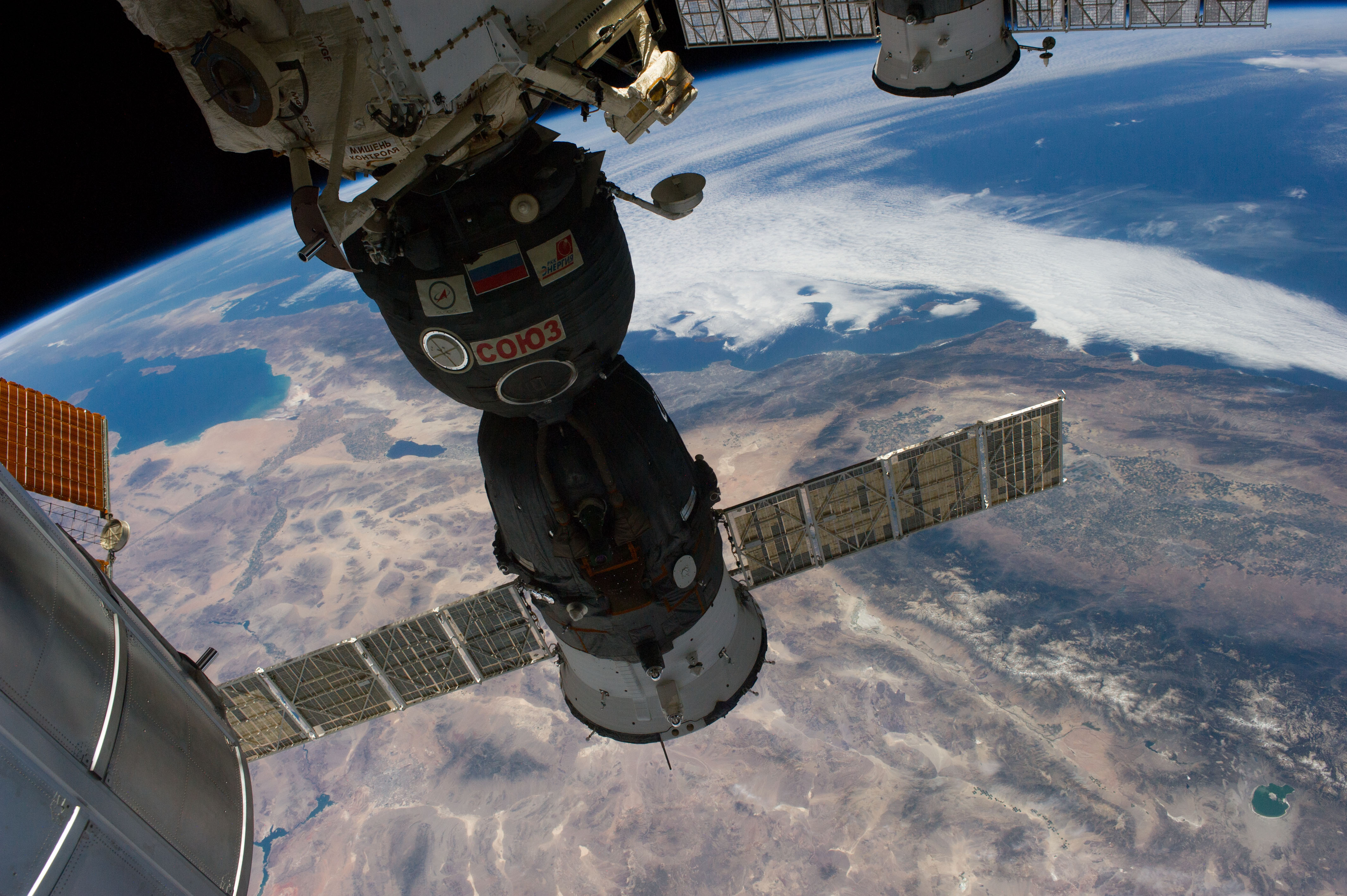
Image Caption: ISS040-E-017377 (23 June 2014) --- One of the Expedition 40 crew members aboard the International Space Station recorded this image showing several states in the USA and
a small part of Mexico, including Baja California, on June 23, 2014. Parts of Nevada are visible in the bottom of the frame. The area in the Mojave Desert where many space shuttle missions successfully ended is visible near the scene's center. The Gulf of Cortez and several hundred miles of the Pacific coast line of Mexico and California are visible in the top portion of the photo. The heavily populated Los Angeles Basin is just above the Mojave site of shuttle landings, with the San Diego area partially obscured by the docked Russian Soyuz vehicle in the foreground. The Salton Sea is just above left center frame.
a small part of Mexico, including Baja California, on June 23, 2014. Parts of Nevada are visible in the bottom of the frame. The area in the Mojave Desert where many space shuttle missions successfully ended is visible near the scene's center. The Gulf of Cortez and several hundred miles of the Pacific coast line of Mexico and California are visible in the top portion of the photo. The heavily populated Los Angeles Basin is just above the Mojave site of shuttle landings, with the San Diego area partially obscured by the docked Russian Soyuz vehicle in the foreground. The Salton Sea is just above left center frame.
