ISS040-E-017264
| NASA Photo ID | ISS040-E-017264 |
| Focal Length | 80mm |
| Date taken | 2014.06.23 |
| Time taken | 09:55:25 GMT |
Resolutions offered for this image:
1000 x 665 pixels 540 x 359 pixels 2128 x 1416 pixels 720 x 480 pixels 4256 x 2832 pixels 640 x 426 pixels
1000 x 665 pixels 540 x 359 pixels 2128 x 1416 pixels 720 x 480 pixels 4256 x 2832 pixels 640 x 426 pixels


Cloud masks available for this image:
Spacecraft nadir point: 38.1° N, 46.5° E
Photo center point: 37.5° N, 45.5° E
Photo center point by machine learning:
Photo center point: 37.5° N, 45.5° E
Photo center point by machine learning:
Nadir to Photo Center: Southwest
Spacecraft Altitude: 220 nautical miles (407km)
Country or Geographic Name: | IRAN |
Features: | LAKE URMIA, URMIA, MIANDOAB |
| Features Found Using Machine Learning: | |
Cloud Cover Percentage: | 10 (1-10)% |
Sun Elevation Angle: | 71° |
Sun Azimuth: | 225° |
Camera: | Nikon D3S Electronic Still Camera |
Focal Length: | 80mm |
Camera Tilt: | 18 degrees |
Format: | 4256E: 4256 x 2832 pixel CMOS sensor, 36.0mm x 23.9mm, total pixels: 12.87 million, Nikon FX format |
Film Exposure: | |
| Additional Information | |
| Width | Height | Annotated | Cropped | Purpose | Links |
|---|---|---|---|---|---|
| 1000 pixels | 665 pixels | No | No | Earth From Space collection | Download Image |
| 540 pixels | 359 pixels | Yes | No | Earth From Space collection | Download Image |
| 2128 pixels | 1416 pixels | No | No | NASA's Earth Observatory web site | Download Image |
| 720 pixels | 480 pixels | Yes | No | NASA's Earth Observatory web site | Download Image |
| 4256 pixels | 2832 pixels | No | No | Download Image | |
| 640 pixels | 426 pixels | No | No | Download Image |
Download Packaged File
Download a Google Earth KML for this Image
View photo footprint information
Download a GeoTIFF for this photo
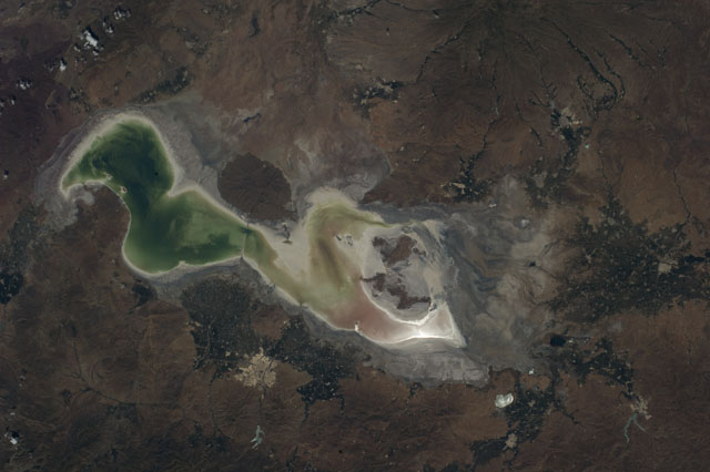
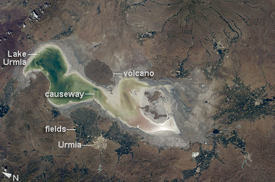
Image Caption: Lake Urmia, Iran
Green and tan shades show the extent of the water surface of Lake Urmia (also Orumiyeh, Orumieh) in westernmost Iran. The lake is highly saline and only a few tens of meters deep even at high water. The shoreline appears as a white margin of salt. Rivers that flow into the lake appear as narrow green lines (especially on the southeastern lake margin; image top right), and these form deltas where soft soils and a nearby water supply allow farming, areas marked by clusters of green agricultural fields. The lake and its wetlands have been declared a UNESCO Biosphere Reserve. The lake is one of the largest in the Middle East, measuring 130 km from the northern shoreline to the vegetated delta image right.
The city of Urmia stands out as a distinct gray patch surrounded by fields at image lower left. On the opposite shore from the city an extinct volcano appears as an oval shape. A causeway and bridge connect the opposite shorelines at this point. More detailed images of the causeway can be seen here.
The lake is experiencing a drastic loss of water, and now holds only approximately 5% of its known high-stage volume. The drying is vividly illustrated by the fact that the volcano used to be entirely surrounded by the lake. The cause of the drop in water levels is related to extraction of water for farming and a long-term decrease in rainfall.
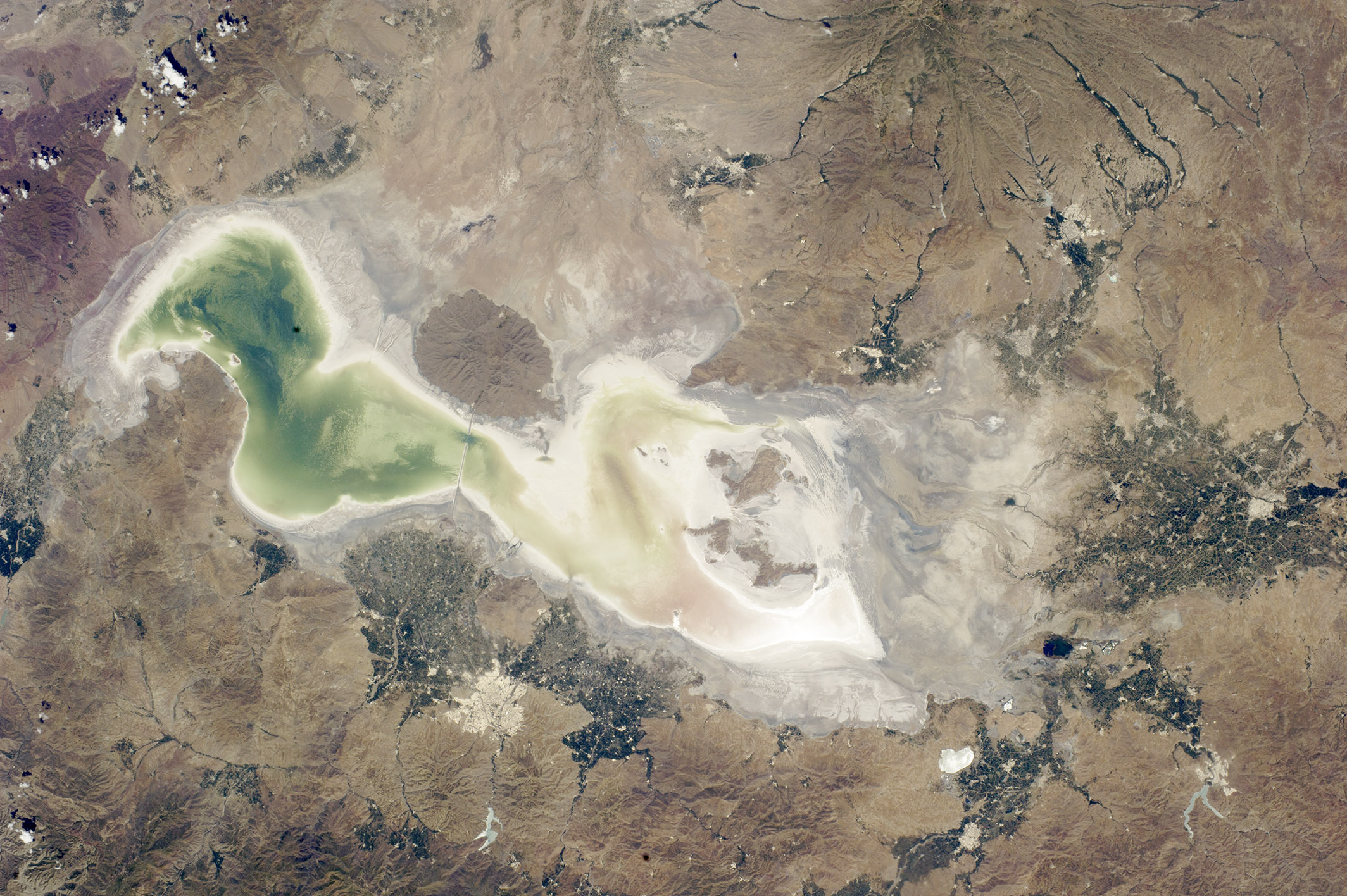
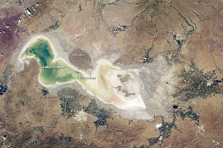
