ISS040-E-011996
| NASA Photo ID | ISS040-E-011996 |
| Focal Length | 80mm |
| Date taken | 2014.06.14 |
| Time taken | 17:07:38 GMT |
Cloud masks available for this image:
Spacecraft nadir point: 37.1° N, 11.5° W
Photo center point:
Photo center point by machine learning:
Photo center point:
Photo center point by machine learning:
Nadir to Photo Center:
Spacecraft Altitude: 220 nautical miles (407km)
Country or Geographic Name: | |
Features: | |
| Features Found Using Machine Learning: | |
Cloud Cover Percentage: | 4 (1-10)% |
Sun Elevation Angle: | 33° |
Sun Azimuth: | 276° |
Camera: | NIKON D3S S/N: 2007945 |
Focal Length: | 80mm |
Camera Tilt: | |
Format: | |
Film Exposure: | |
| Additional Information | |
| Width | Height | Annotated | Cropped | Purpose | Links |
|---|---|---|---|---|---|
| 4256 pixels | 2832 pixels | No | No | Download Image | |
| 640 pixels | 426 pixels | No | No | Download Image |
Download Packaged File
Download a Google Earth KML for this Image
View photo footprint information
Download a GeoTIFF for this photo
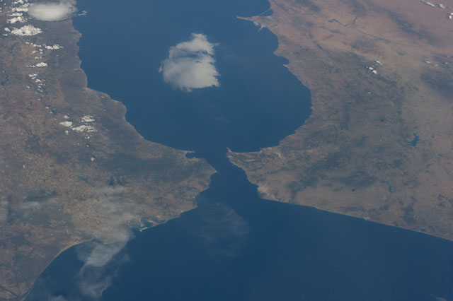
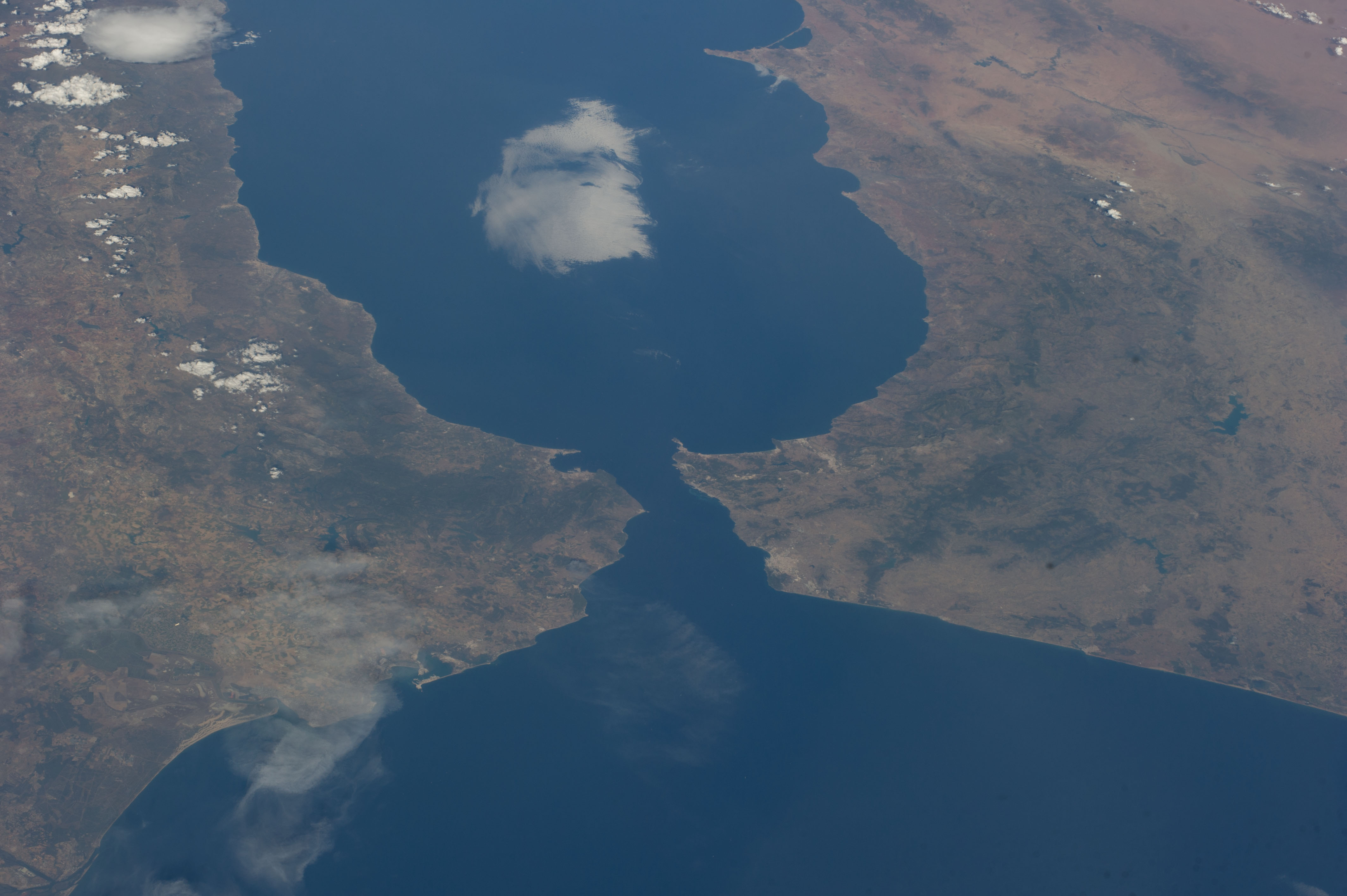
Image Caption: ISS040-E-011996 (14 June 2014) --- One of the Expedition 40 crew members aboard the Earth-orbiting International Space Station recorded this image of the Strait of Gibraltar, showing parts of Morocco and Spain, on June 14, 2014.
