ISS039-E-003841
| NASA Photo ID | ISS039-E-003841 |
| Focal Length | 800mm |
| Date taken | 2014.03.21 |
| Time taken | 21:34:10 GMT |
Resolutions offered for this image:
1000 x 665 pixels 540 x 359 pixels 1440 x 960 pixels 720 x 480 pixels 4256 x 2832 pixels 640 x 426 pixels
1000 x 665 pixels 540 x 359 pixels 1440 x 960 pixels 720 x 480 pixels 4256 x 2832 pixels 640 x 426 pixels


Cloud masks available for this image:
Spacecraft nadir point: 47.1° N, 151.6° E
Photo center point: 42.5° N, 143.4° E
Photo center point by machine learning:
Photo center point: 42.5° N, 143.4° E
Photo center point by machine learning:
Nadir to Photo Center: Southwest
Spacecraft Altitude: 221 nautical miles (409km)
Country or Geographic Name: | JAPAN |
Features: | COASTLINE, AGR. UNDER SNOW, TOKACHI R. |
| Features Found Using Machine Learning: | |
Cloud Cover Percentage: | 10 (1-10)% |
Sun Elevation Angle: | 16° |
Sun Azimuth: | 107° |
Camera: | Nikon D3S Electronic Still Camera |
Focal Length: | 800mm |
Camera Tilt: | High Oblique |
Format: | 4256E: 4256 x 2832 pixel CMOS sensor, 36.0mm x 23.9mm, total pixels: 12.87 million, Nikon FX format |
Film Exposure: | |
| Additional Information | |
| Width | Height | Annotated | Cropped | Purpose | Links |
|---|---|---|---|---|---|
| 1000 pixels | 665 pixels | No | No | Earth From Space collection | Download Image |
| 540 pixels | 359 pixels | Yes | No | Earth From Space collection | Download Image |
| 1440 pixels | 960 pixels | No | No | NASA's Earth Observatory web site | Download Image |
| 720 pixels | 480 pixels | Yes | No | NASA's Earth Observatory web site | Download Image |
| 4256 pixels | 2832 pixels | No | No | Download Image | |
| 640 pixels | 426 pixels | No | No | Download Image |
Download Packaged File
Download a Google Earth KML for this Image
View photo footprint information
Download a GeoTIFF for this photo
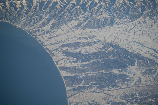
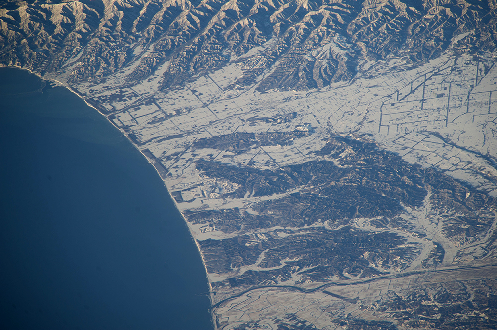
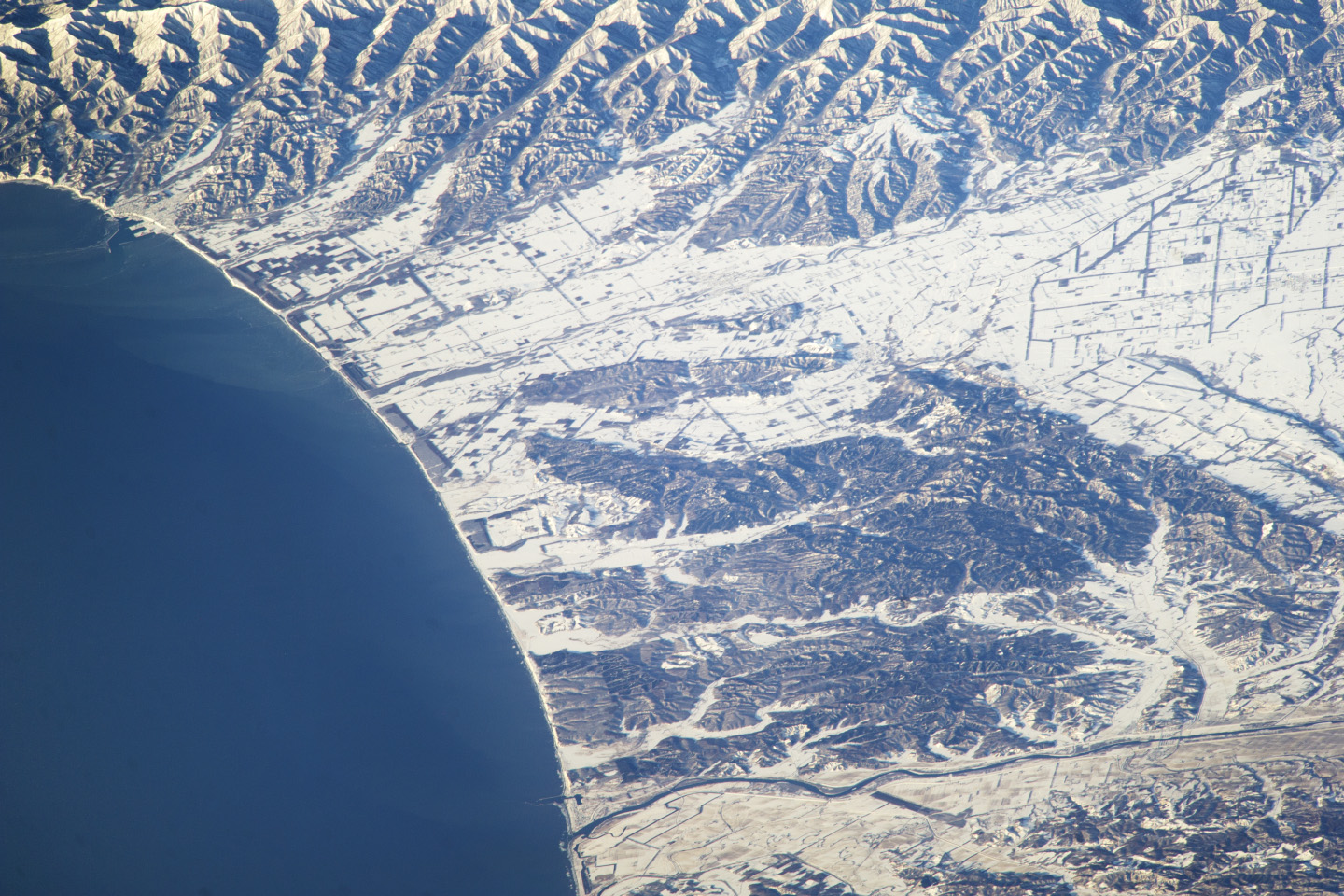
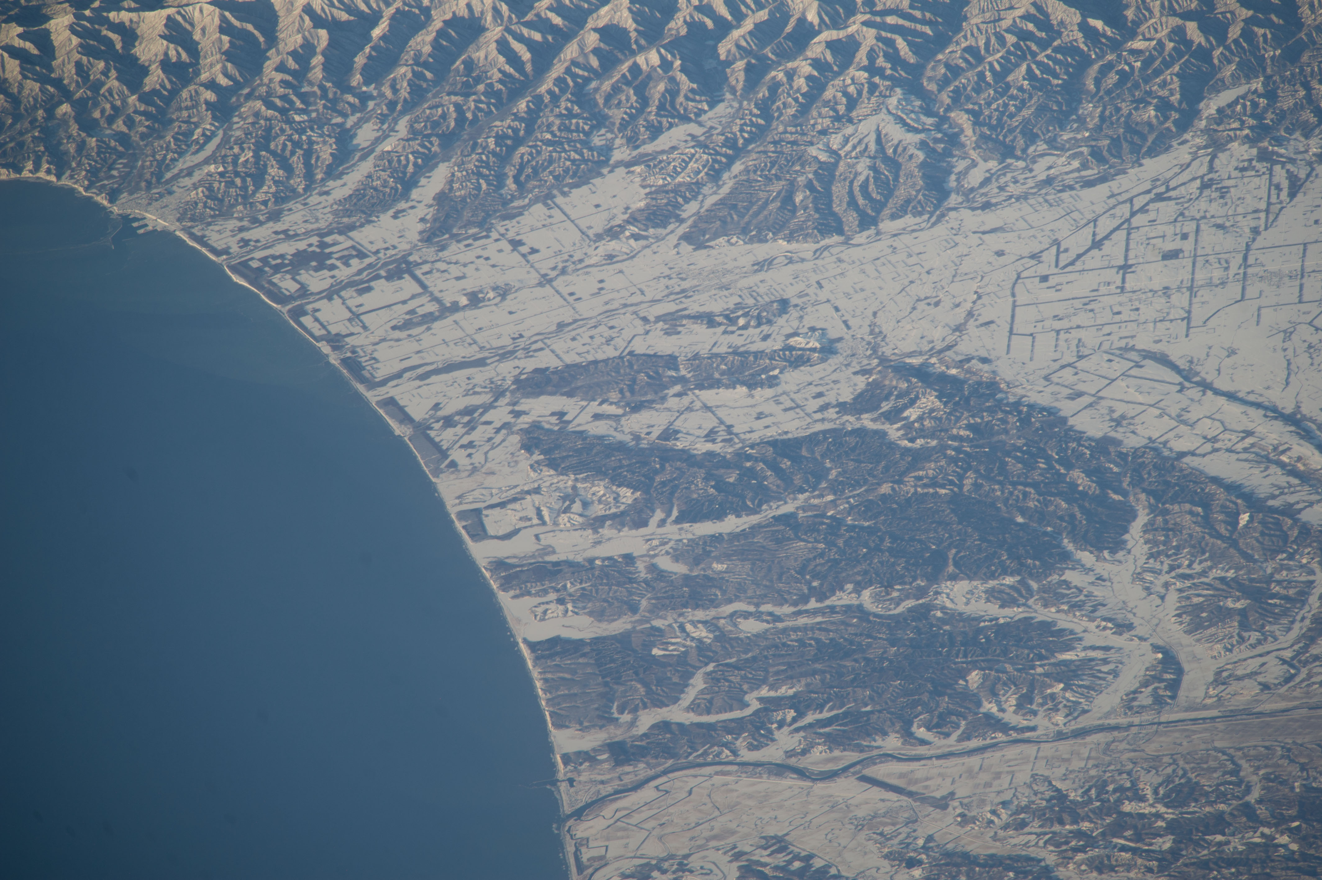
Image Caption: Hokkaido agriculture, Northern Japan
Unusually heavy snows fell on northern Japan this winter. Snow highlights the flat, fenced landscape used for agriculture in this image taken from the International Space Station. The large Tokachi River reaches the arc of the Pacific Ocean on Hokkaido's east coast. Forests on steeper hillsides mask the snow and appear dark (upper image margin and image center).
This detailed view taken with a long lens from more than 800 km (500 mi) away, shows the narrow greenbelt forests that line the coast. Planted in Japan for at least the last four centuries, greenbelts protect coastlines from storms and sand movement, and are increasingly providing recreation areas. Greenbelts also reduce tsunami wave energy, protecting houses and roads from floating debris. Greenbelt forests reduced the destructive effects of the 2011 tsunami at Sendai by "catching" entire seagoing vessels, preventing them from being washed inland.
