ISS039-E-000707
| NASA Photo ID | ISS039-E-000707 |
| Focal Length | 800mm |
| Date taken | 2014.03.12 |
| Time taken | 19:38:42 GMT |
Cloud masks available for this image:
Spacecraft nadir point: 27.6° N, 92.1° W
Photo center point:
Photo center point by machine learning:
Photo center point:
Photo center point by machine learning:
Nadir to Photo Center:
Spacecraft Altitude: 221 nautical miles (409km)
Country or Geographic Name: | |
Features: | |
| Features Found Using Machine Learning: | |
Cloud Cover Percentage: | 1 (1-10)% |
Sun Elevation Angle: | 54° |
Sun Azimuth: | 216° |
Camera: | NIKON D3S S/N: 2053892 |
Focal Length: | 800mm |
Camera Tilt: | |
Format: | |
Film Exposure: | |
| Additional Information | |
| Width | Height | Annotated | Cropped | Purpose | Links |
|---|---|---|---|---|---|
| 4256 pixels | 2832 pixels | No | No | Download Image | |
| 640 pixels | 426 pixels | No | No | Download Image |
Download Packaged File
Download a Google Earth KML for this Image
View photo footprint information
Download a GeoTIFF for this photo
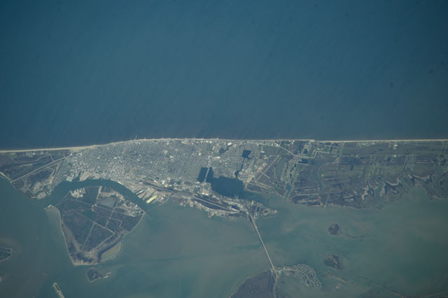
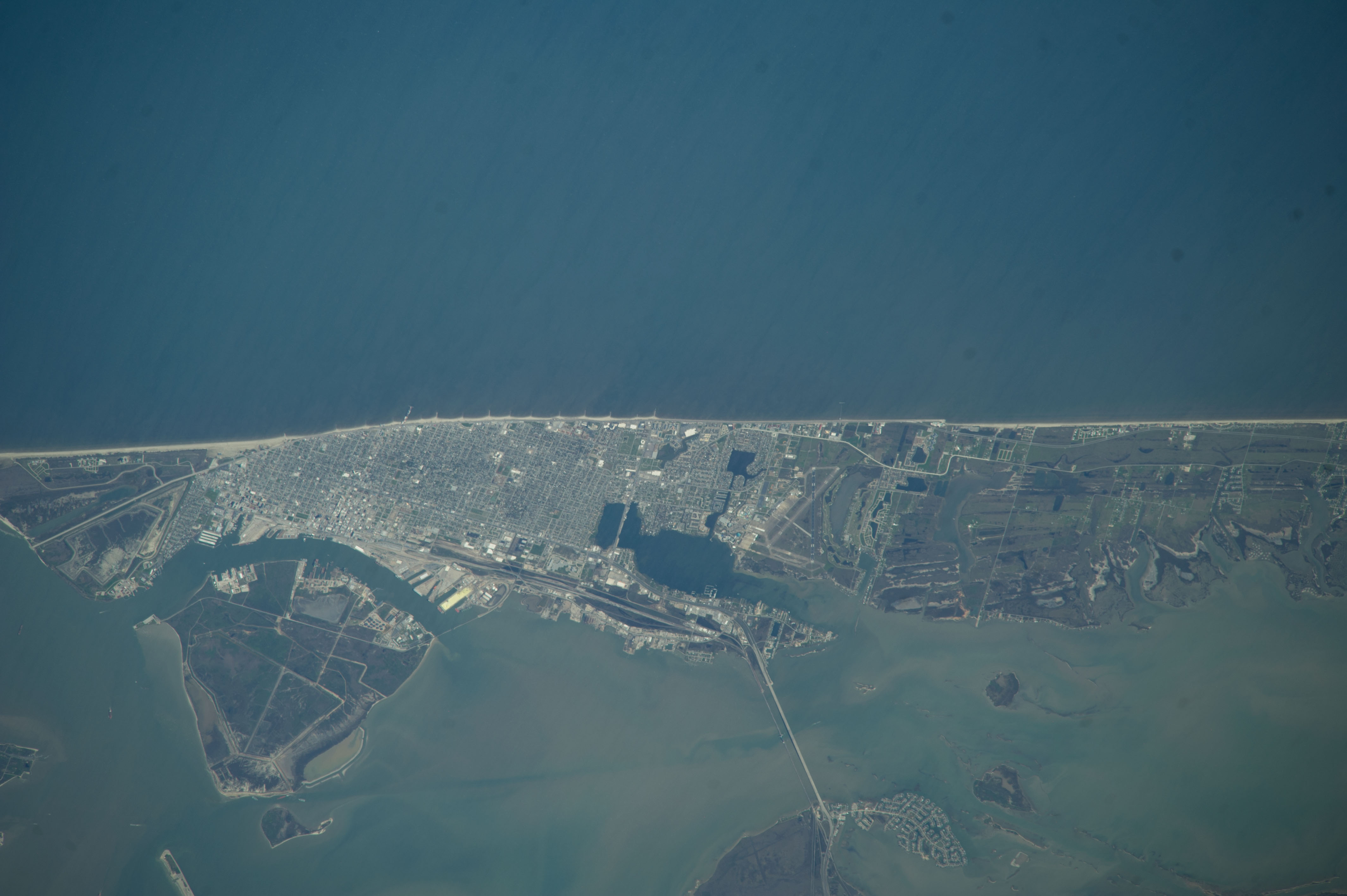
Image Caption: ISS039-E-000707 (12 March 2014) --- This nadir picture of Galveston Island and its coastline on the Gulf of Mexico was taken by one of the Expedition 39 crew members aboard the International Space Station on March 12. It was among the first batch of Earth photographs downlinked near the beginning of the Expedition 38 mission. The clear weather and the 800mm focal length used to record the photo allow for very detailed "bird's eye" viewing of the storied city. The Interstate 45 causeway can be seen at bottom center, and Scholes International Airport is seen nearby.
The Bolivar Island ferry landing is just out of frame at bottom left.
The Bolivar Island ferry landing is just out of frame at bottom left.
