ISS038-E-057979
| NASA Photo ID | ISS038-E-057979 |
| Focal Length | 1000mm |
| Date taken | 2014.02.22 |
| Time taken | 19:53:14 GMT |
Resolutions offered for this image:
1000 x 667 pixels 540 x 360 pixels 1440 x 960 pixels 720 x 480 pixels 6048 x 4032 pixels 640 x 427 pixels
1000 x 667 pixels 540 x 360 pixels 1440 x 960 pixels 720 x 480 pixels 6048 x 4032 pixels 640 x 427 pixels


Cloud masks available for this image:
Spacecraft nadir point: 46.8° N, 87.6° W
Photo center point: 44.5° N, 88.0° W
Photo center point by machine learning: 44.52° N, 88.00° W
Photo center point: 44.5° N, 88.0° W
Photo center point by machine learning: 44.52° N, 88.00° W
Nadir to Photo Center: South
Spacecraft Altitude: 221 nautical miles (409km)
Camera: | Nikon D3X Electronic Still Camera |
Focal Length: | 1000mm |
Camera Tilt: | 32 degrees |
Format: | 6048E: 6048 x 4032 pixel CMOS sensor, 35.9mm x 24.0mm, total pixels: 25.72 million, Nikon FX format |
Film Exposure: | |
| Additional Information | |
| Width | Height | Annotated | Cropped | Purpose | Links |
|---|---|---|---|---|---|
| 1000 pixels | 667 pixels | No | No | Earth From Space collection | Download Image |
| 540 pixels | 360 pixels | Yes | No | Earth From Space collection | Download Image |
| 1440 pixels | 960 pixels | No | No | NASA's Earth Observatory web site | Download Image |
| 720 pixels | 480 pixels | Yes | Yes | NASA's Earth Observatory web site | Download Image |
| 6048 pixels | 4032 pixels | No | No | Download Image | |
| 640 pixels | 427 pixels | No | No | Download Image |
Download Packaged File
Download a Google Earth KML for this Image
View photo footprint information
Download a GeoTIFF for this photo
Image Caption: Green Bay, Wisconsin, USA
Note: This caption refers to the image versions labeled "NASA's Earth Observatory web site".
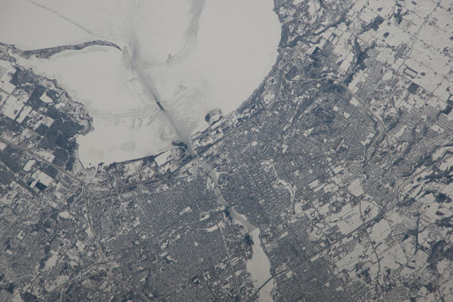
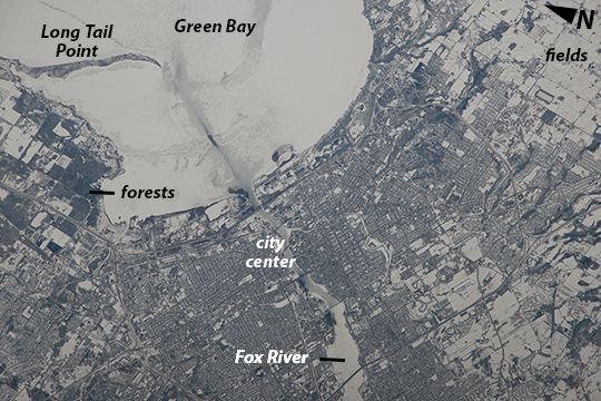
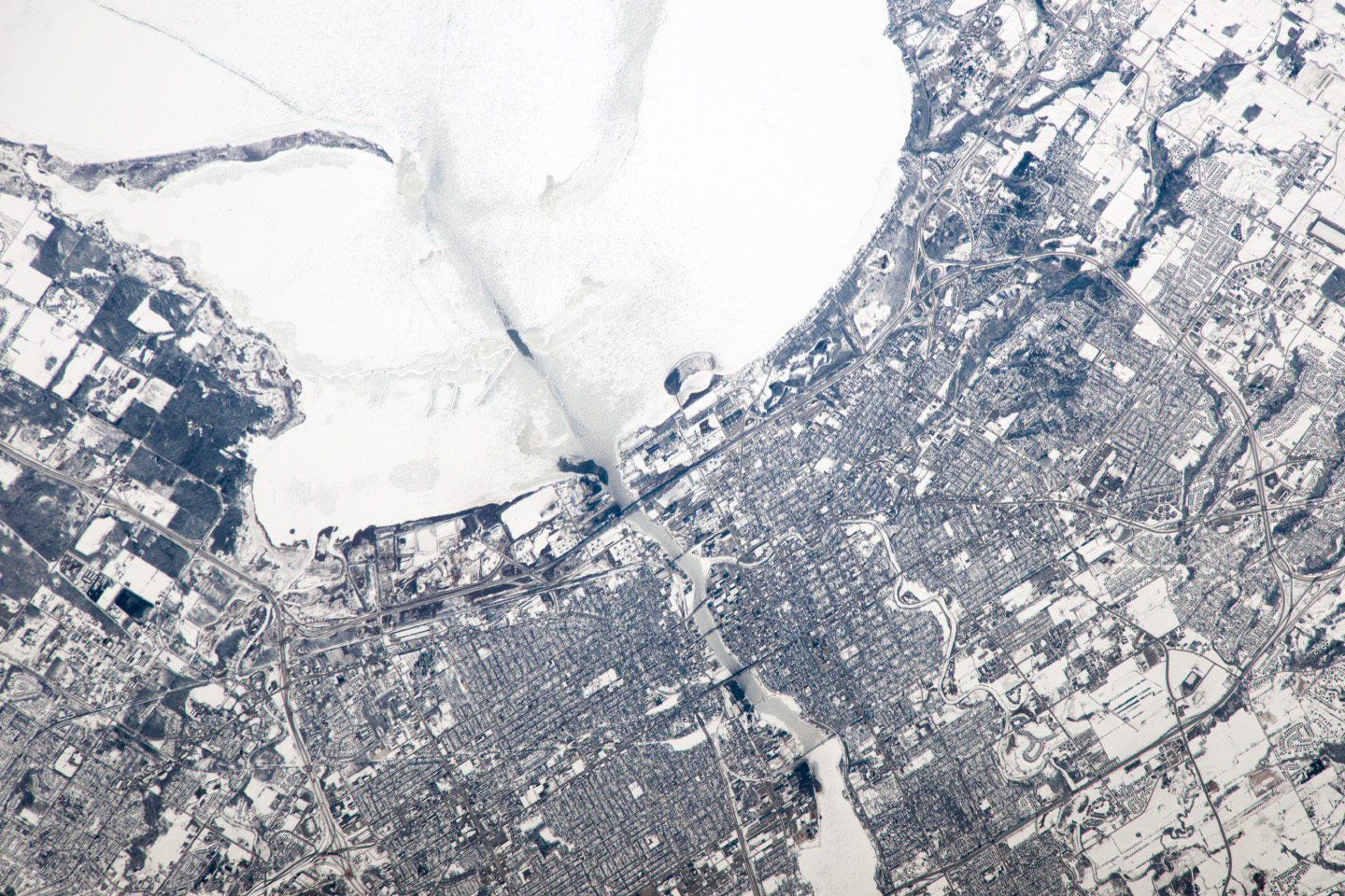
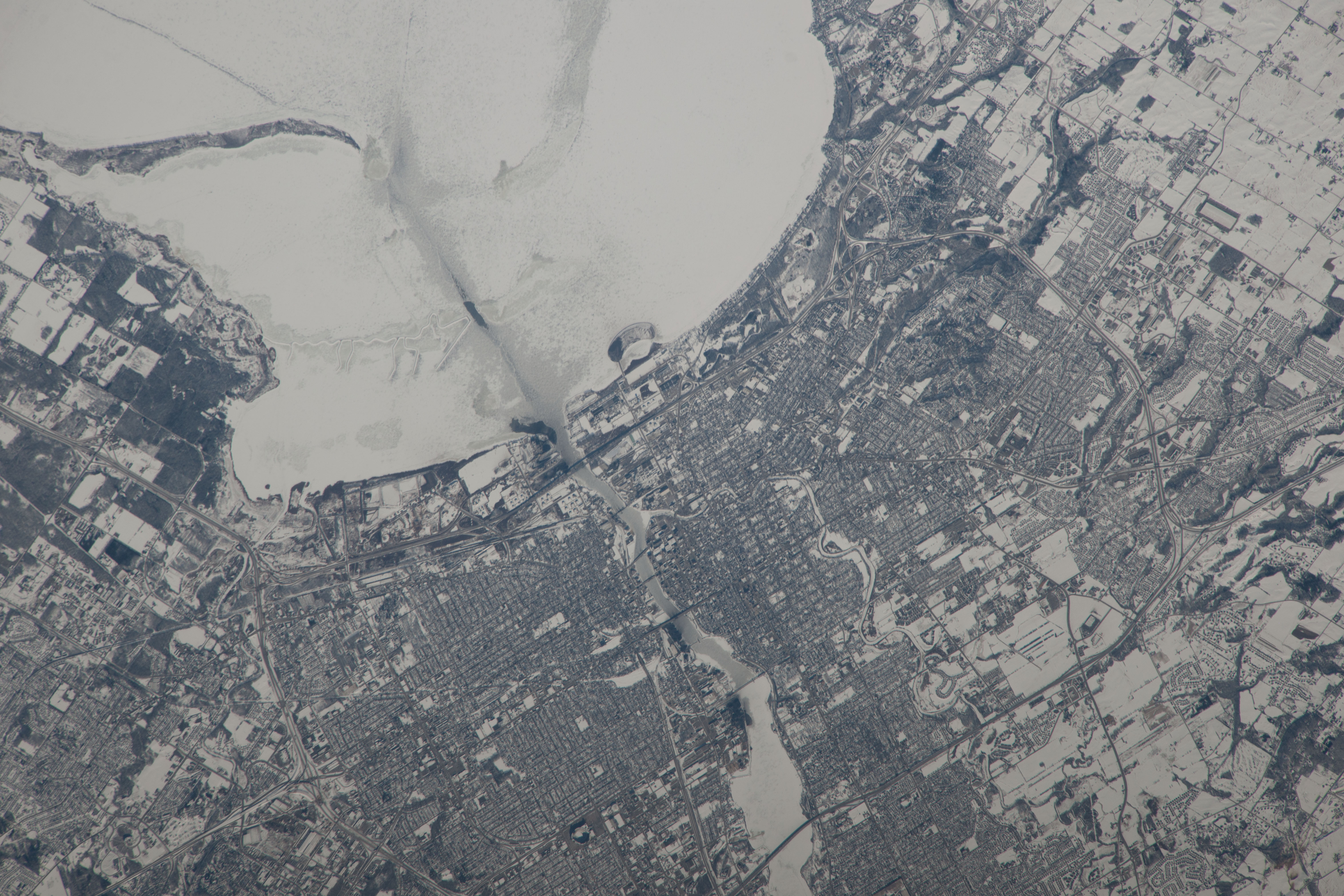
This image taken from the International Space Station shows the city of Green Bay at the southern end of icebound Green Bay, Wisconsin. This arm of Lake Michigan is six miles wide as seen in this view. The heavy snowfalls of the winter of 2014 cover the landscape. Combined with low sun illumination of a winter's day, all surfaces appear shades of gray. Fields appear brighter (top right, lower right), the cityscape (lower half of the image) appears as a checkerboard of grays, and forests (top left) appear dark.
The center of the city lies on the Fox River, one of the few larger rivers in the United States that flows north. Open water appears as dark patches at the mouth of the river where a power station emits warm water. Thinner (grayer) ice can be detected where slightly warmer water extends from the river mouth towards Long Tail Point, an ancient shoreline of the bay. Crews aboard the ISS do not usually take such detailed photographs because of the difficulty of getting sharp images with long lenses (in this case a 1000 mm lens). Streets and bridges crossing the Fox River appear quite clearly.
Note: This caption refers to the image versions labeled "NASA's Earth Observatory web site".
This image taken from the International Space Station shows the city of Green Bay at the southern end of icebound Green Bay, Wisconsin. This arm of Lake Michigan is six miles wide as seen in this view. The heavy snowfalls of the winter of 2014 cover the landscape. Combined with low sun illumination of a winter's day, all surfaces appear shades of gray. Fields appear brighter (top right, lower right), the cityscape (lower half of the image) appears as a checkerboard of grays, and forests (top left) appear dark.
The center of the city lies on the Fox River, one of the few larger rivers in the United States that flows north. Open water appears as dark patches at the mouth of the river where a power station emits warm water. Thinner (grayer) ice can be detected where slightly warmer water extends from the river mouth towards Long Tail Point, an ancient shoreline of the bay. Crews aboard the ISS do not usually take such detailed photographs because of the difficulty of getting sharp images with long lenses (in this case a 1000 mm lens). Streets and bridges crossing the Fox River appear quite clearly.
