ISS036-E-38117
| NASA Photo ID | ISS036-E-38117 |
| Focal Length | 400mm |
| Date taken | 2013.08.29 |
| Time taken | 19:10:09 GMT |


Spacecraft nadir point: 38.5° N, 123.4° W
Photo center point:
Photo center point by machine learning:
Photo center point:
Photo center point by machine learning:
Nadir to Photo Center:
Spacecraft Altitude: 220 nautical miles (407km)
Country or Geographic Name: | |
Features: | |
| Features Found Using Machine Learning: | |
Cloud Cover Percentage: | 67 (51-75)% |
Sun Elevation Angle: | 57° |
Sun Azimuth: | 150° |
Camera: | NIKON D3S S/N: 2008337 |
Focal Length: | 400mm |
Camera Tilt: | |
Format: | |
Film Exposure: | |
| Additional Information | |
| Width | Height | Annotated | Cropped | Purpose | Links |
|---|---|---|---|---|---|
| 4256 pixels | 2832 pixels | No | No | Download Image | |
| 640 pixels | 426 pixels | No | No | Download Image |
Download Packaged File
Download a Google Earth KML for this Image
View photo footprint information
Download a GeoTIFF for this photo
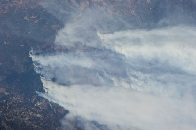
Image Caption: ISS036-E-038117 (29 Aug. 2013) --- One of the Expedition 36 crew members aboard the Earth-orbiting International Space Station photographed massive smoke plumes from the California wildfires. When this image was exposed on Aug. 29, the orbital outpost was approximately 220 miles above a point located at 38.6 degrees north latitude and 123.2 degrees west longitude.
