ISS036-E-36611
| NASA Photo ID | ISS036-E-36611 |
| Focal Length | 50mm |
| Date taken | 2013.08.23 |
| Time taken | 13:05:46 GMT |
Spacecraft nadir point: 33.8° N, 2.1° W
Photo center point:
Photo center point by machine learning:
Photo center point:
Photo center point by machine learning:
Nadir to Photo Center:
Spacecraft Altitude: 221 nautical miles (409km)
Country or Geographic Name: | |
Features: | |
| Features Found Using Machine Learning: | |
Cloud Cover Percentage: | 2 (1-10)% |
Sun Elevation Angle: | 64° |
Sun Azimuth: | 213° |
Camera: | NIKON D3S S/N: 2007945 |
Focal Length: | 50mm |
Camera Tilt: | |
Format: | |
Film Exposure: | |
| Additional Information | |
| Width | Height | Annotated | Cropped | Purpose | Links |
|---|---|---|---|---|---|
| 4256 pixels | 2832 pixels | No | No | Download Image | |
| 640 pixels | 426 pixels | No | No | Download Image |
Download Packaged File
Download a Google Earth KML for this Image
View photo footprint information
Download a GeoTIFF for this photo
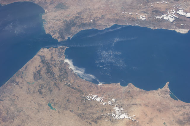
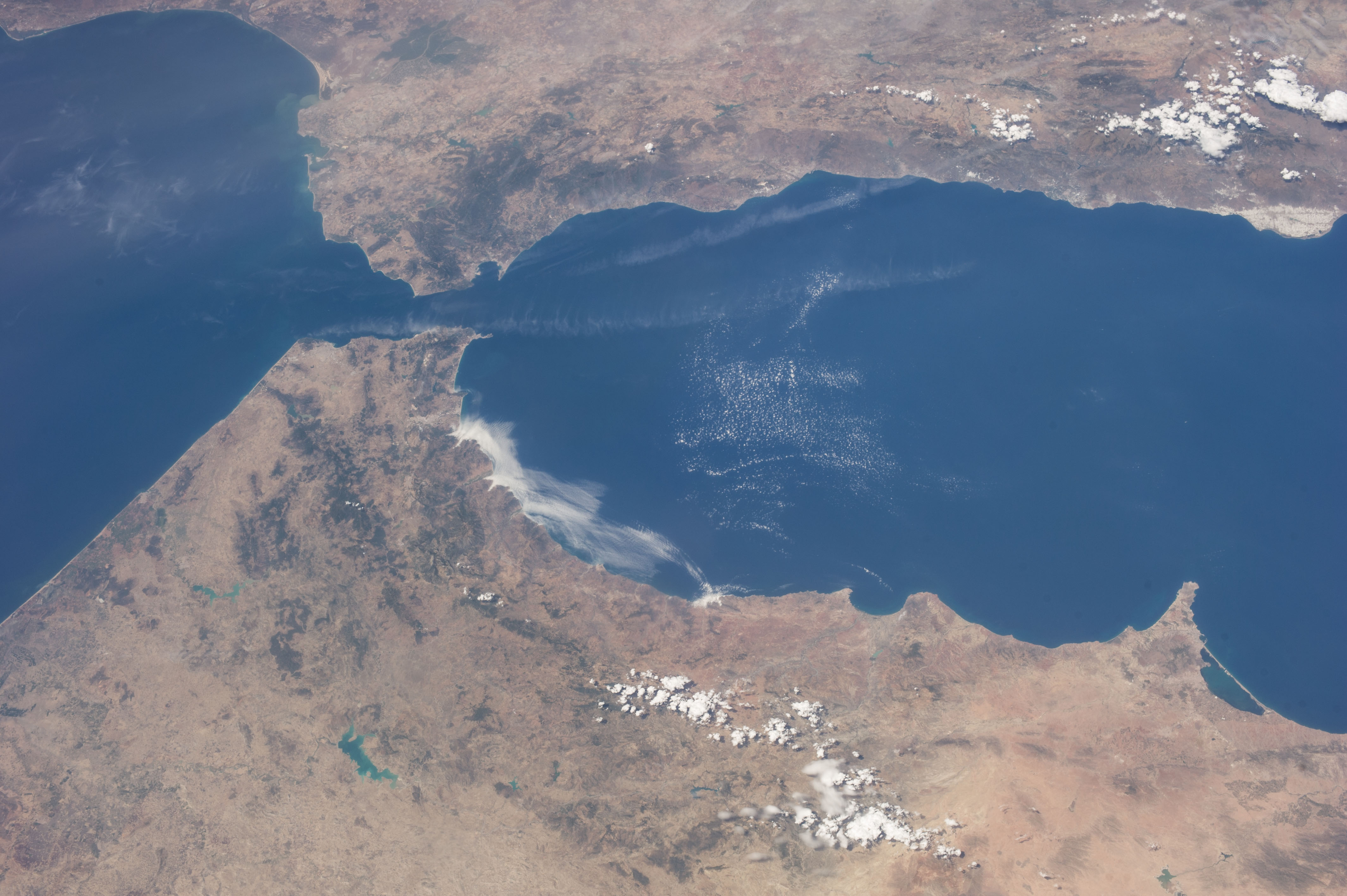
Image Caption: ISS036-E-036611 (23 Aug. 2013) --- One of the Expedition 36 crew members aboard the International Space Station on Aug. 23 exposed this image of the Strait of Gibraltar, where Europe and Africa meet and where the Atlantic Ocean waters flow through the strait into the Mediterranean Sea. A popular photographic target of astronauts has always been the Strait of Gibraltar, easily spotted at left center in this wide photograph, shot from the International Space Station. Spain is to the north (top) and Morocco to the south. The strait is 36 miles (58 kilometers) long and slims down to 8 miles (13 kilometers) at it's most narrow point. The British colony of Gibraltar is north of the strait.
