ISS036-E-35663

| NASA Photo ID | ISS036-E-35663 |
| Focal Length | 50mm |
| Date taken | 2013.08.24 |
| Time taken | 19:59:58 GMT |

Spacecraft nadir point: 28.2° N, 120.1° W
Photo center point:
Photo center point by machine learning:
Photo center point:
Photo center point by machine learning:
Nadir to Photo Center:
Spacecraft Altitude: 221 nautical miles (409km)
Country or Geographic Name: | |
Features: | |
| Features Found Using Machine Learning: | |
Cloud Cover Percentage: | 90 (76-100)% |
Sun Elevation Angle: | 73° |
Sun Azimuth: | 178° |
Camera: | NIKON D3S S/N: 2007945 |
Focal Length: | 50mm |
Camera Tilt: | |
Format: | |
Film Exposure: | |
| Additional Information | |
| Width | Height | Annotated | Cropped | Purpose | Links |
|---|---|---|---|---|---|
| 4256 pixels | 2832 pixels | No | No | Download Image | |
| 640 pixels | 426 pixels | No | No | Download Image |
Download Packaged File
Download a Google Earth KML for this Image
View photo footprint information
Download a GeoTIFF for this photo
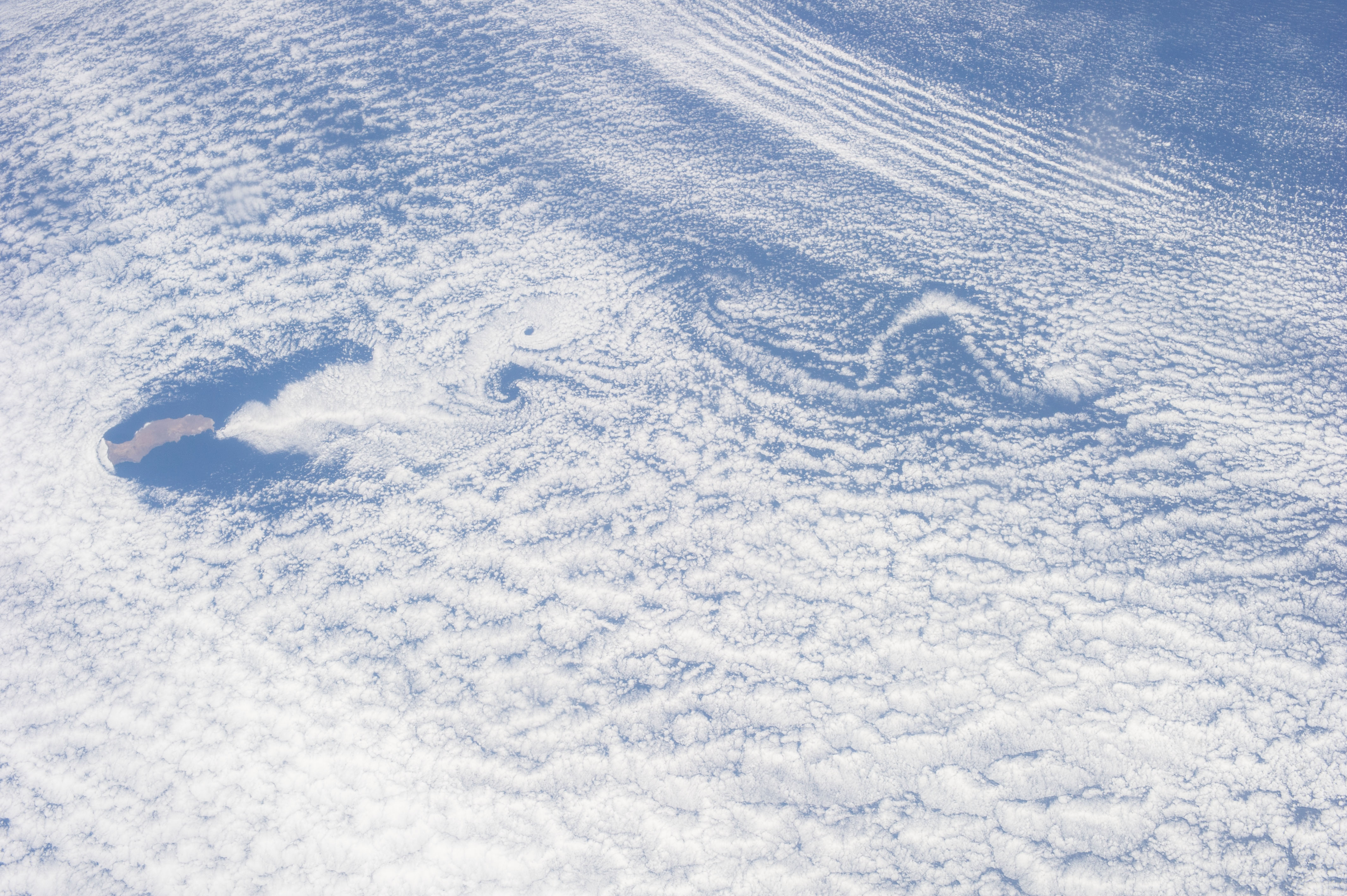
Image Caption: ISS036-E-035663 (24 Aug. 2013) --- One of the Expedition 36 crew members aboard the International Space Station recorded this still image of unusual cloud patterns surrounding Guadalupe Island in the Pacific Ocean (left center). These are the result of a ubiquitous occurrence in the motion of fluids-a vortex street, which is a linear chain of spiral eddies called von Karman vortices. Von Karman vortices are named after Theodore von Karman, a co-founder of NASA's Jet Propulsion Laboratory. who first described the phenomenon in the atmosphere. Guadalupe Island or Isla Guadalupe is a volcanic island located 241 kilometers (150 statute miles) off the west coast of Mexico's Baja California peninsula.
