ISS036-E-17943
| NASA Photo ID | ISS036-E-17943 |
| Focal Length | 50mm |
| Date taken | 2013.07.11 |
| Time taken | 18:33:58 GMT |
Cloud masks available for this image:
Spacecraft nadir point: 42.9° S, 5.2° E
Photo center point:
Photo center point by machine learning:
Photo center point:
Photo center point by machine learning:
Nadir to Photo Center:
Spacecraft Altitude: 227 nautical miles (420km)
Country or Geographic Name: | |
Features: | |
| Features Found Using Machine Learning: | PAN- |
Cloud Cover Percentage: | 57 (51-75)% |
Sun Elevation Angle: | -24° |
Sun Azimuth: | 279° |
Camera: | NIKON D3S S/N: 2007945 |
Focal Length: | 50mm |
Camera Tilt: | |
Format: | |
Film Exposure: | |
| Additional Information | |
| Width | Height | Annotated | Cropped | Purpose | Links |
|---|---|---|---|---|---|
| 4256 pixels | 2832 pixels | No | No | Download Image | |
| 640 pixels | 426 pixels | No | No | Download Image |
Download Packaged File
Download a Google Earth KML for this Image
View photo footprint information
Download a GeoTIFF for this photo
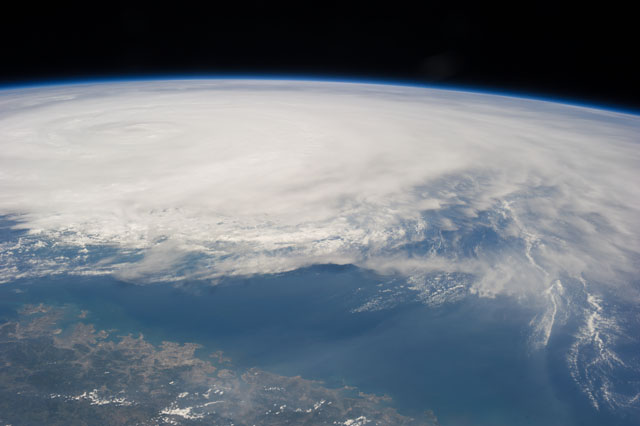
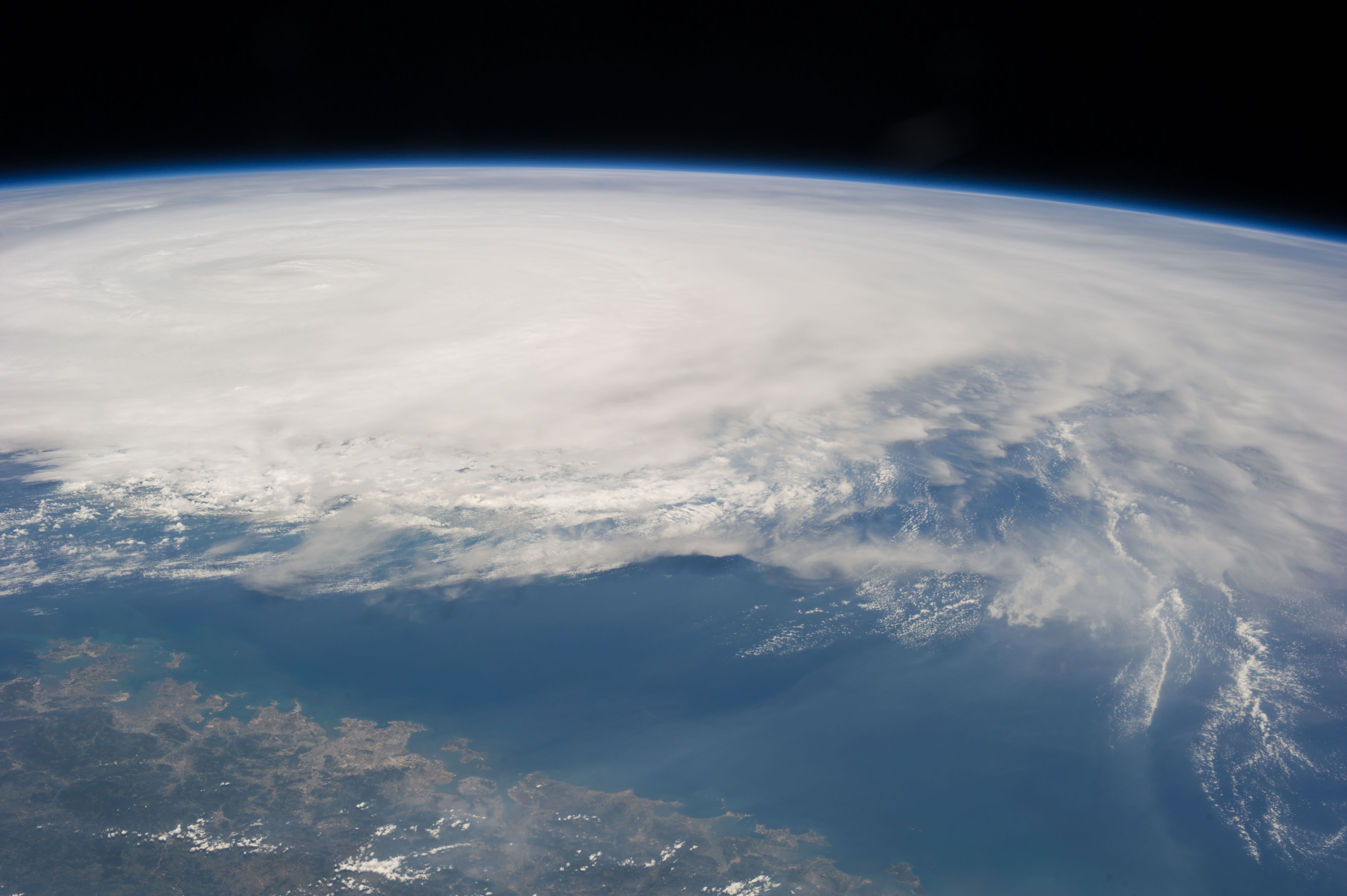
Image Caption: ISS036-E-017943 (11 July 2013) --- One of the Expedition 36 crew members aboard the International Space Station photographed this image of Typhoon Soulik just east of northern Taiwan The city of Guangzhou can be seen along the coast. [Editor's update: Thousands of people were evacuated in Taiwan; and the entire island was declared an "alert zone," as Typhoon Soulik made landfall early on July 13 (local time), pounding the country with powerful winds and heavy rain].
