ISS036-E-17925
| NASA Photo ID | ISS036-E-17925 |
| Focal Length | 50mm |
| Date taken | 2013.07.11 |
| Time taken | 06:05:23 GMT |


Spacecraft nadir point: 28.8° S, 174.0° E
Photo center point:
Photo center point by machine learning:
Photo center point:
Photo center point by machine learning:
Nadir to Photo Center:
Spacecraft Altitude: 226 nautical miles (419km)
Country or Geographic Name: | |
Features: | |
| Features Found Using Machine Learning: | PAN- |
Cloud Cover Percentage: | 48 (26-50)% |
Sun Elevation Angle: | -5° |
Sun Azimuth: | 292° |
Camera: | NIKON D3S S/N: 2007945 |
Focal Length: | 50mm |
Camera Tilt: | |
Format: | |
Film Exposure: | |
| Additional Information | |
| Width | Height | Annotated | Cropped | Purpose | Links |
|---|---|---|---|---|---|
| 4256 pixels | 2832 pixels | No | No | Download Image | |
| 640 pixels | 426 pixels | No | No | Download Image |
Download Packaged File
Download a Google Earth KML for this Image
View photo footprint information
Download a GeoTIFF for this photo
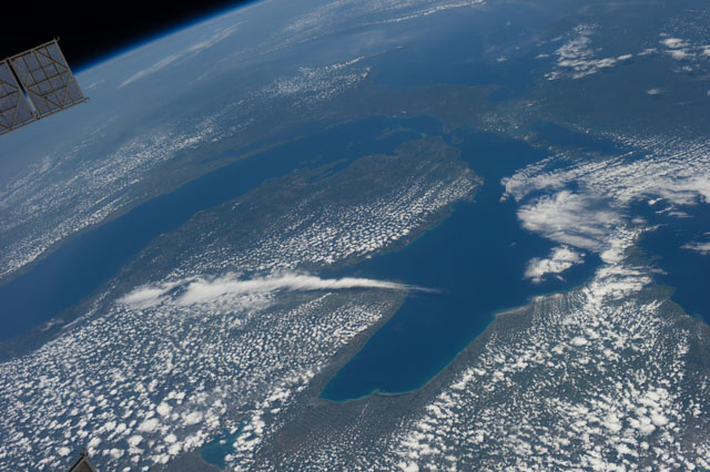
Image Caption: ISS036-E-017925 (11 July 2013) --- One of the Expedition 36 crew members aboard the Earth-orbiting International Space Station on July 11 captured this high oblique view of Lake Michigan (left) and Lake Huron and much of the state of Michigan in between.
