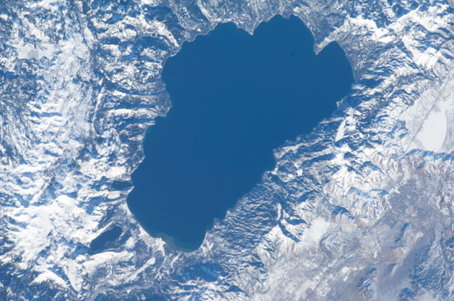
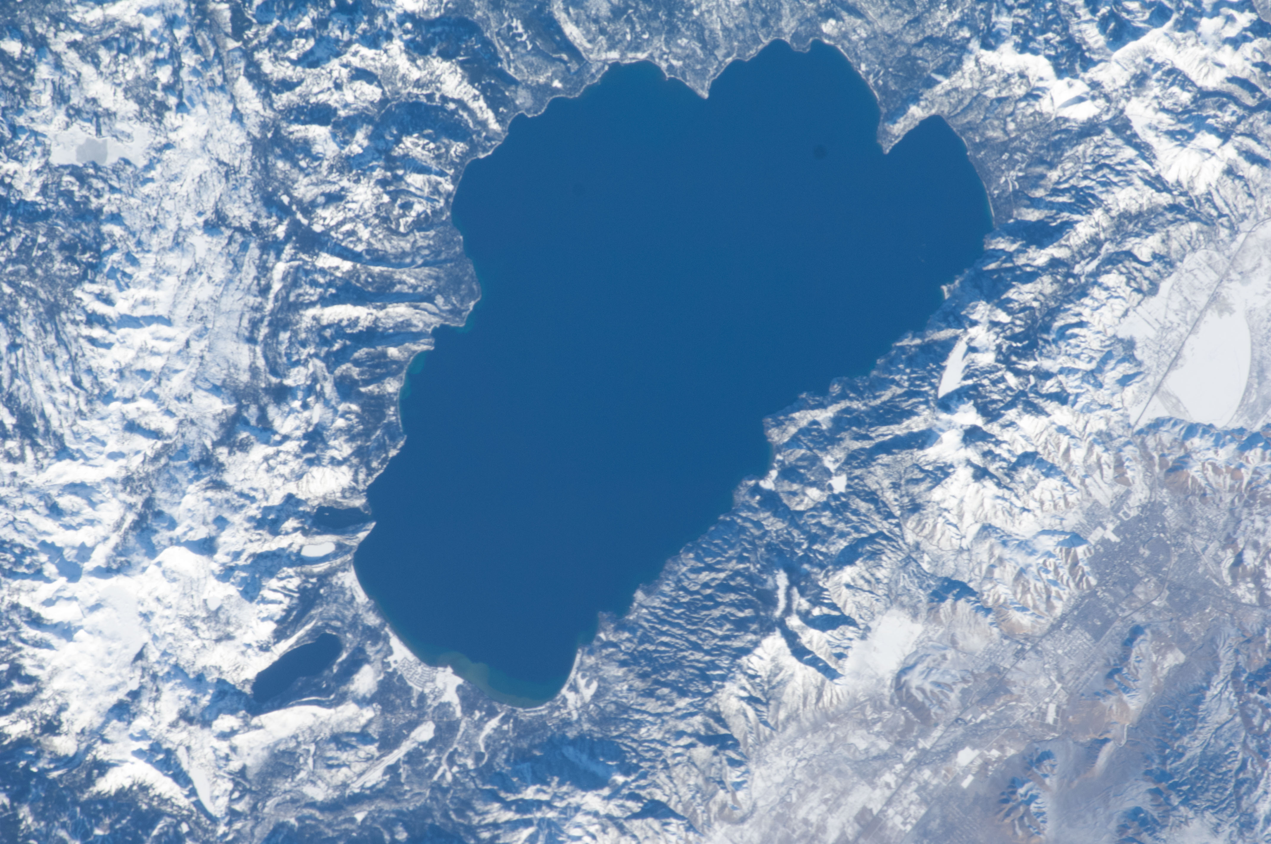
ISS034-E-32083
| NASA Photo ID | ISS034-E-32083 |
| Focal Length | 180mm |
| Date taken | 2013.01.20 |
| Time taken | 17:34:11 GMT |
Cloud masks available for this image:
Spacecraft nadir point: 37.0° N, 119.4° W
Photo center point:
Photo center point by machine learning:
Photo center point:
Photo center point by machine learning:
Nadir to Photo Center:
Spacecraft Altitude: 216 nautical miles (400km)
Country or Geographic Name: | |
Features: | |
| Features Found Using Machine Learning: | |
Cloud Cover Percentage: | 69 (51-75)% |
Sun Elevation Angle: | 22° |
Sun Azimuth: | 141° |
Camera: | NIKON D2Xs S/N: 6027269 |
Focal Length: | 180mm |
Camera Tilt: | |
Format: | |
Film Exposure: | |
| Additional Information | |
| Width | Height | Annotated | Cropped | Purpose | Links |
|---|---|---|---|---|---|
| 4288 pixels | 2848 pixels | No | No | Download Image | |
| 640 pixels | 425 pixels | No | No | Download Image |
Download Packaged File
Download a Google Earth KML for this Image
View photo footprint information
Download a GeoTIFF for this photo
Image Caption: ISS034-E-032083 (20 Jan. 2013) --- One of the Expedition 34 crew members aboard the International Space Station used a 180-mm lens to photograph this day time nadir image of Lake Tahoe, on the border of California and Nevada, from approximately 240 miles above Earth.
