ISS032-E-25610

| NASA Photo ID | ISS032-E-25610 |
| Focal Length | 24mm |
| Date taken | 2012.09.09 |
| Time taken | 18:29:05 GMT |
Cloud masks available for this image:
Spacecraft nadir point: 30.1° N, 52.9° W
Photo center point: 33.5° N, 62.0° W
Photo center point by machine learning:
Photo center point: 33.5° N, 62.0° W
Photo center point by machine learning:
Nadir to Photo Center: West
Spacecraft Altitude: 222 nautical miles (411km)
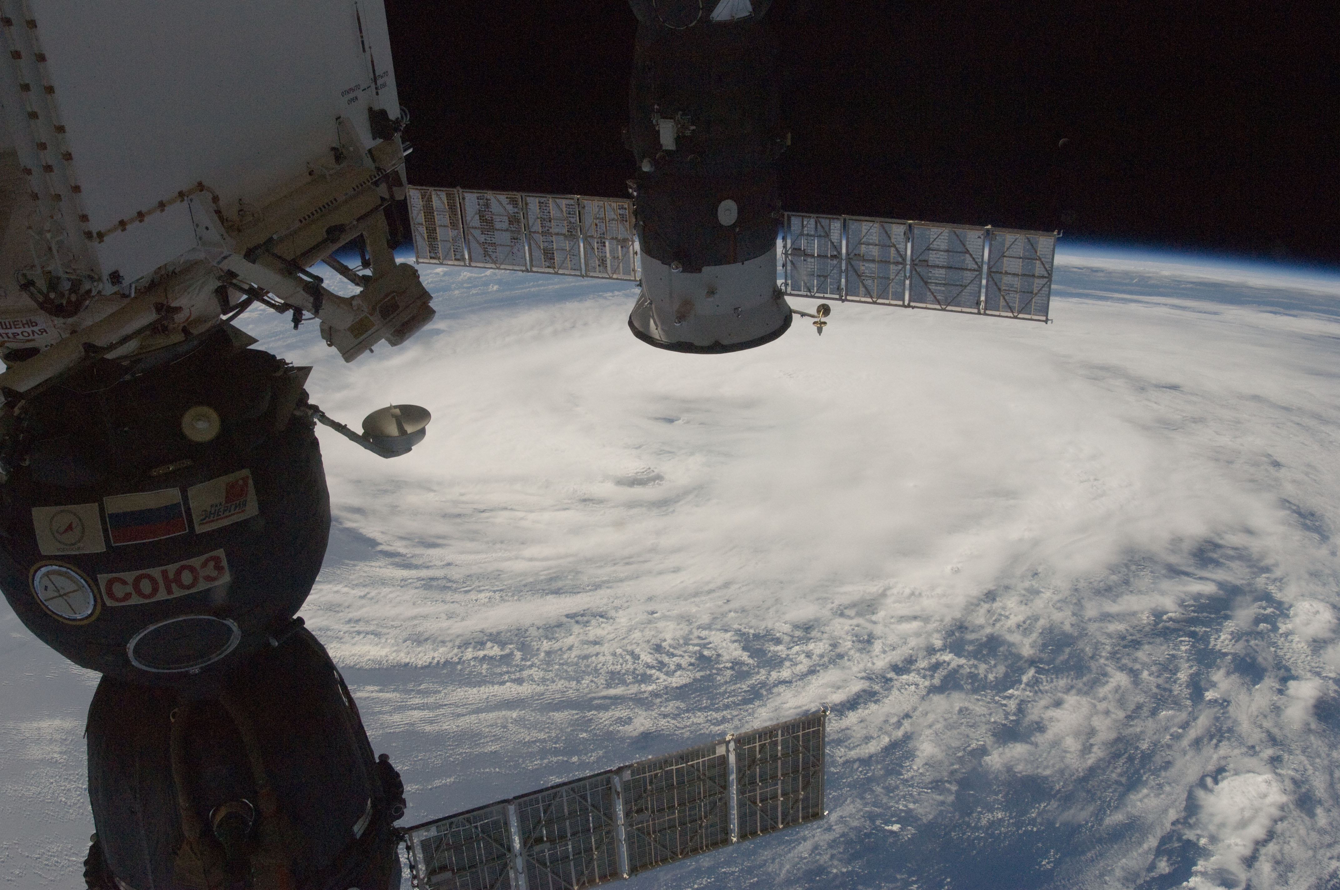
Country or Geographic Name: | ATLANTIC OCEAN |
Features: | PAN-TROPICAL STORM LESLIE, ISS |
| Features Found Using Machine Learning: | PAN- |
Cloud Cover Percentage: | 100 (76-100)% |
Sun Elevation Angle: | 41° |
Sun Azimuth: | 249° |
Camera: | Nikon D2Xs Electronic Still Camera |
Focal Length: | 24mm |
Camera Tilt: | High Oblique |
Format: | 4288E: 4288 x 2848 pixel CMOS sensor, RGBG imager color filter |
Film Exposure: | |
| Additional Information | |
| Width | Height | Annotated | Cropped | Purpose | Links |
|---|---|---|---|---|---|
| 4288 pixels | 2848 pixels | No | No | Download Image | |
| 640 pixels | 425 pixels | No | No | Download Image |
Download Packaged File
Download a Google Earth KML for this Image
View photo footprint information
Download a GeoTIFF for this photo
Image Caption: ISS032-E-025610 (9 Sept. 2012) --- Partially obstructed by two Russian spacecraft in the foreground, Tropical Storm Leslie is clearly seen in the Atlantic Ocean on Sept. 9, 2012, as photographed by one of the Expedition 32 crew members aboard the International Space Station. At the time of the photo, Leslie was centered near 33.4 degrees north latitude and 62.1 degrees west longitude (approximately 175 miles east-northeast of Bermuda) moving northward at 14 miles per hour with winds of 60 miles per hour.
