ISS032-E-23646

| NASA Photo ID | ISS032-E-23646 |
| Focal Length | 200mm |
| Date taken | 2012.08.15 |
| Time taken | 21:37:39 GMT |
Cloud masks available for this image:
Spacecraft nadir point: 29.1° N, 49.1° E
Photo center point: 29.3° N, 48.0° E
Photo center point by machine learning:
Photo center point: 29.3° N, 48.0° E
Photo center point by machine learning:
Nadir to Photo Center: West
Spacecraft Altitude: 215 nautical miles (398km)
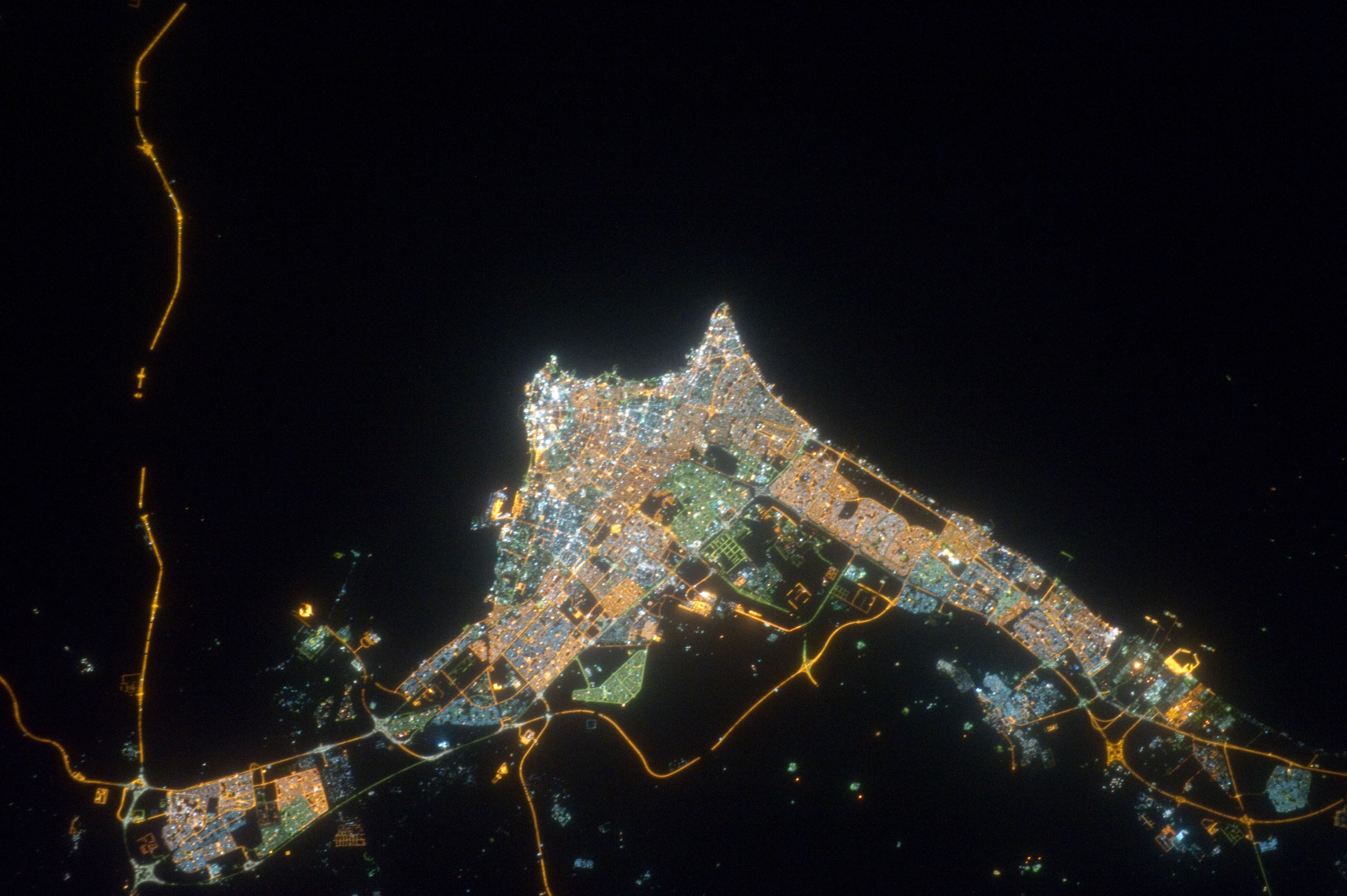
Country or Geographic Name: | KUWAIT |
Features: | KUWAIT CITY AT NIGHT, ROADS, SHIP PORTS |
| Features Found Using Machine Learning: | |
Cloud Cover Percentage: | 10 (1-10)% |
Sun Elevation Angle: | -46° |
Sun Azimuth: | 17° |
Camera: | Nikon D3S Electronic Still Camera |
Focal Length: | 200mm |
Camera Tilt: | 17 degrees |
Format: | 4256E: 4256 x 2832 pixel CMOS sensor, 36.0mm x 23.9mm, total pixels: 12.87 million, Nikon FX format |
Film Exposure: | |
| Additional Information | |
| Width | Height | Annotated | Cropped | Purpose | Links |
|---|---|---|---|---|---|
| 4256 pixels | 2832 pixels | No | No | Download Image | |
| 640 pixels | 426 pixels | No | No | Download Image |
Download Packaged File
Download a Google Earth KML for this Image
View photo footprint information
Download a GeoTIFF for this photo
Image Caption: ISS032-E-023646 (15 Aug. 2012) --- This nighttime nadir view of Kuwait City, the coastal city which serves as Kuwait's political and economic capital, was photographed by one of the Expedition 32 crew members from the International Space Station. The metropolitan area has a population approaching two and a half million. A 200-mm lens was used to record the image.
