ISS031-E-10712
| NASA Photo ID | ISS031-E-10712 |
| Focal Length | 24mm |
| Date taken | 2012.04.30 |
| Time taken | 13:42:16 GMT |
Resolutions offered for this image:
1000 x 667 pixels 720 x 480 pixels 4256 x 2832 pixels 640 x 426 pixels
1000 x 667 pixels 720 x 480 pixels 4256 x 2832 pixels 640 x 426 pixels


Cloud masks available for this image:
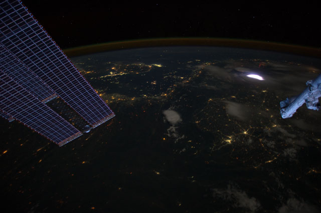
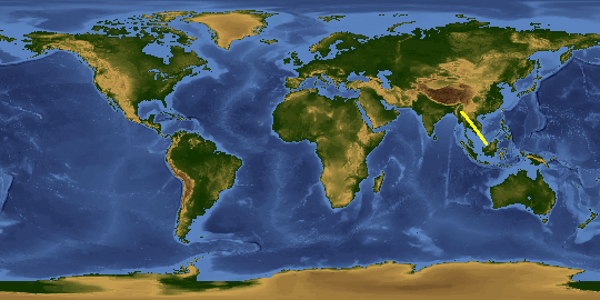
Spacecraft nadir point: 19.6° N, 99.8° E
Photo center point: 19.0° N, 104.0° E
Photo center point by machine learning:
Photo center point: 19.0° N, 104.0° E
Photo center point by machine learning:
Nadir to Photo Center: East
Spacecraft Altitude: 215 nautical miles (398km)
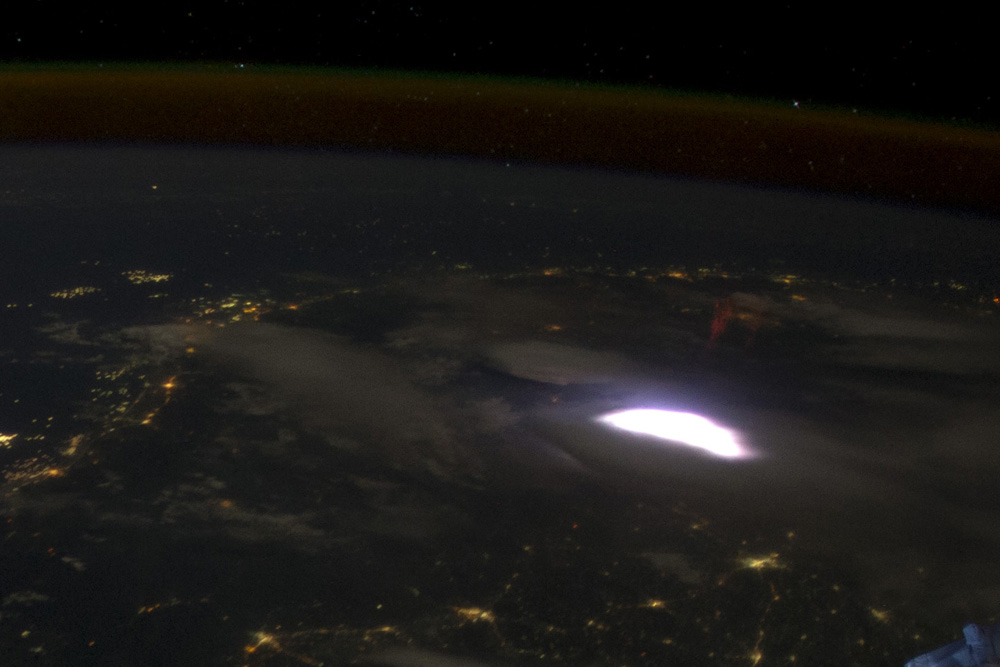
Country or Geographic Name: | LAOS |
Features: | VIENTIANE AT NIGHT, SPRITE, LIGHTNING FLASH, GULF OF TONKIN |
| Features Found Using Machine Learning: | LIGHTNING, PAN- |
Cloud Cover Percentage: | 10 (1-10)% |
Sun Elevation Angle: | -27° |
Sun Azimuth: | 299° |
Camera: | Nikon D3S Electronic Still Camera |
Focal Length: | 24mm |
Camera Tilt: | 50 degrees |
Format: | 4256E: 4256 x 2832 pixel CMOS sensor, 36.0mm x 23.9mm, total pixels: 12.87 million, Nikon FX format |
Film Exposure: | |
| Additional Information | |
This photo is one of the photos used to create this time-lapse video:
| Width | Height | Annotated | Cropped | Purpose | Links |
|---|---|---|---|---|---|
| 1000 pixels | 667 pixels | No | Yes | NASA's Earth Observatory web site | Download Image |
| 720 pixels | 480 pixels | Yes | Yes | NASA's Earth Observatory web site | Download Image |
| 4256 pixels | 2832 pixels | No | No | Download Image | |
| 640 pixels | 426 pixels | No | No | Download Image |
Download Packaged File
Download a Google Earth KML for this Image
View photo footprint information
Download a GeoTIFF for this photo
Image Caption: none
