ISS013-E-13549
| NASA Photo ID | ISS013-E-13549 |
| Focal Length | 800mm |
| Date taken | 2006.05.02 |
| Time taken | 21:18:23 GMT |
1000 x 706 pixels 540 x 381 pixels 540 x 405 pixels 1520 x 1008 pixels 639 x 435 pixels
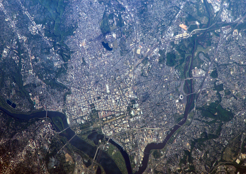
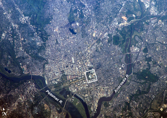
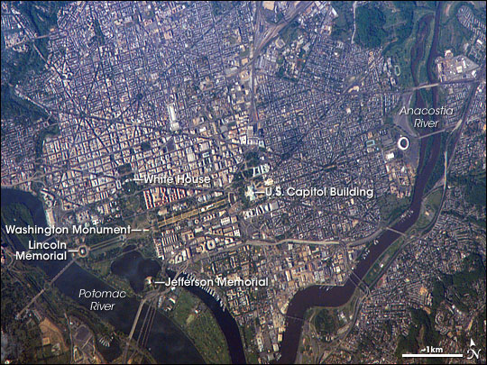
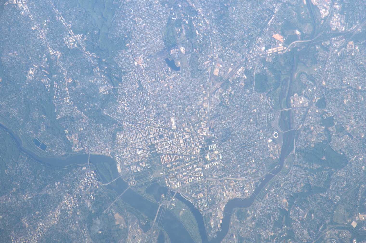
Photo center point: 38.9° N, 77.0° W
Photo center point by machine learning:
Country or Geographic Name: | USA-DC |
Features: | WASHINGTON METRO AREA |
| Features Found Using Machine Learning: | WASHINGTON DC |
Cloud Cover Percentage: | 10 (1-10)% |
Sun Elevation Angle: | 32° |
Sun Azimuth: | 264° |
Camera: | Kodak DCS760c Electronic Still Camera |
Focal Length: | 800mm |
Camera Tilt: | 41 degrees |
Format: | 3060E: 3060 x 2036 pixel CCD, RGBG array |
Film Exposure: | |
| Additional Information | |
| Width | Height | Annotated | Cropped | Purpose | Links |
|---|---|---|---|---|---|
| 1000 pixels | 706 pixels | No | Yes | Earth From Space collection | Download Image |
| 540 pixels | 381 pixels | Yes | Yes | Earth From Space collection | Download Image |
| 540 pixels | 405 pixels | Yes | Yes | NASA's Earth Observatory web site | Download Image |
| 1520 pixels | 1008 pixels | No | No | Not enhanced | Download Image |
| 639 pixels | 435 pixels | No | No | Download Image |
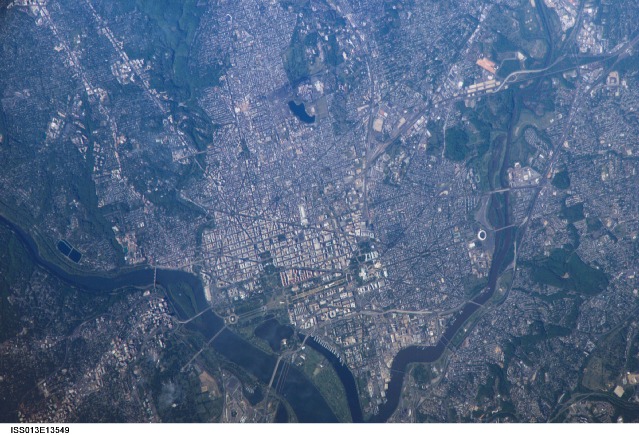
George Washington not only served as the namesake for the capital city of the United States, he also chose its location, perhaps envisioning the transportation possibilities that the Potomac River flowing past the site would provide. Early on, the city saw conflict; in the War of 1812, British forces invaded and burned several public buildings. The Civil War marked the beginning of the city's transformation from a provincial town to a world center of culture, history, and political energy during the 20th century. According to the Census Bureau, the District of Columbia, which comprises the city of Washington, supported a population of more than half a million inhabitants in 2003.
This picture was taken as the International Space Station passed over the western border of Maryland and West Virginia. The resolution and spatial coverage of this image are similar to the 15-meter-per-pixel data obtained by sensors onboard the Landsat 7 and Terra satellites. Recognizable in this image are the Capitol Building, the Washington Monument (and its shadow), and the Lincoln Memorial, along the northeast bank of the Potomac River.
