ISS011-E-13889
| NASA Photo ID | ISS011-E-13889 |
| Focal Length | 800mm |
| Date taken | 2005.09.30 |
| Time taken | 21:13:27 GMT |
1000 x 660 pixels 540 x 356 pixels 540 x 405 pixels 3032 x 2008 pixels 639 x 435 pixels
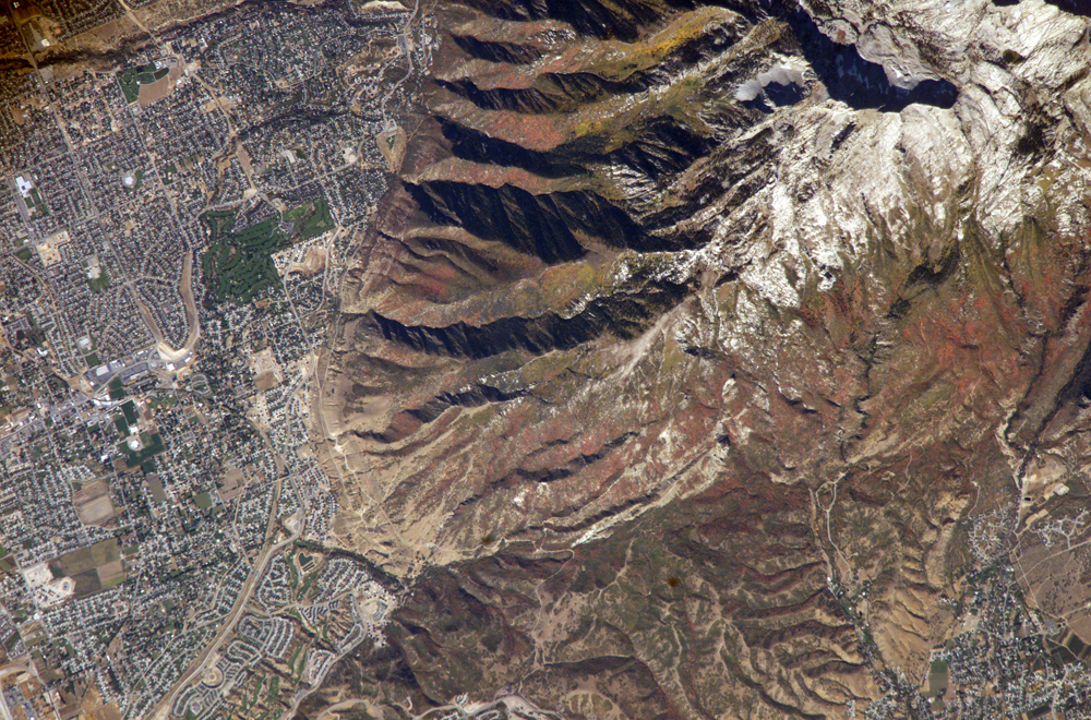
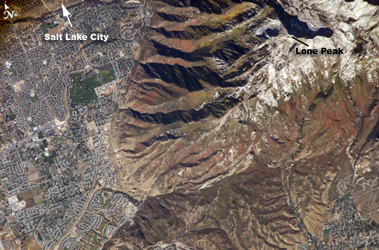
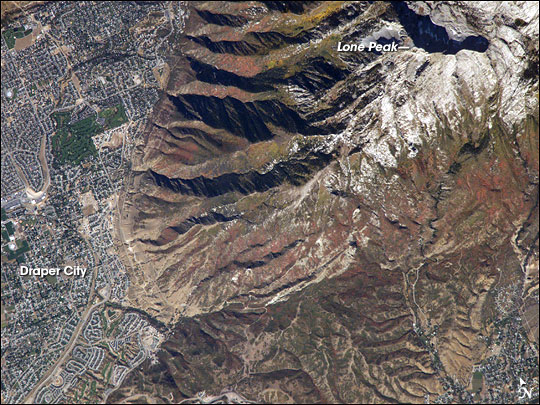
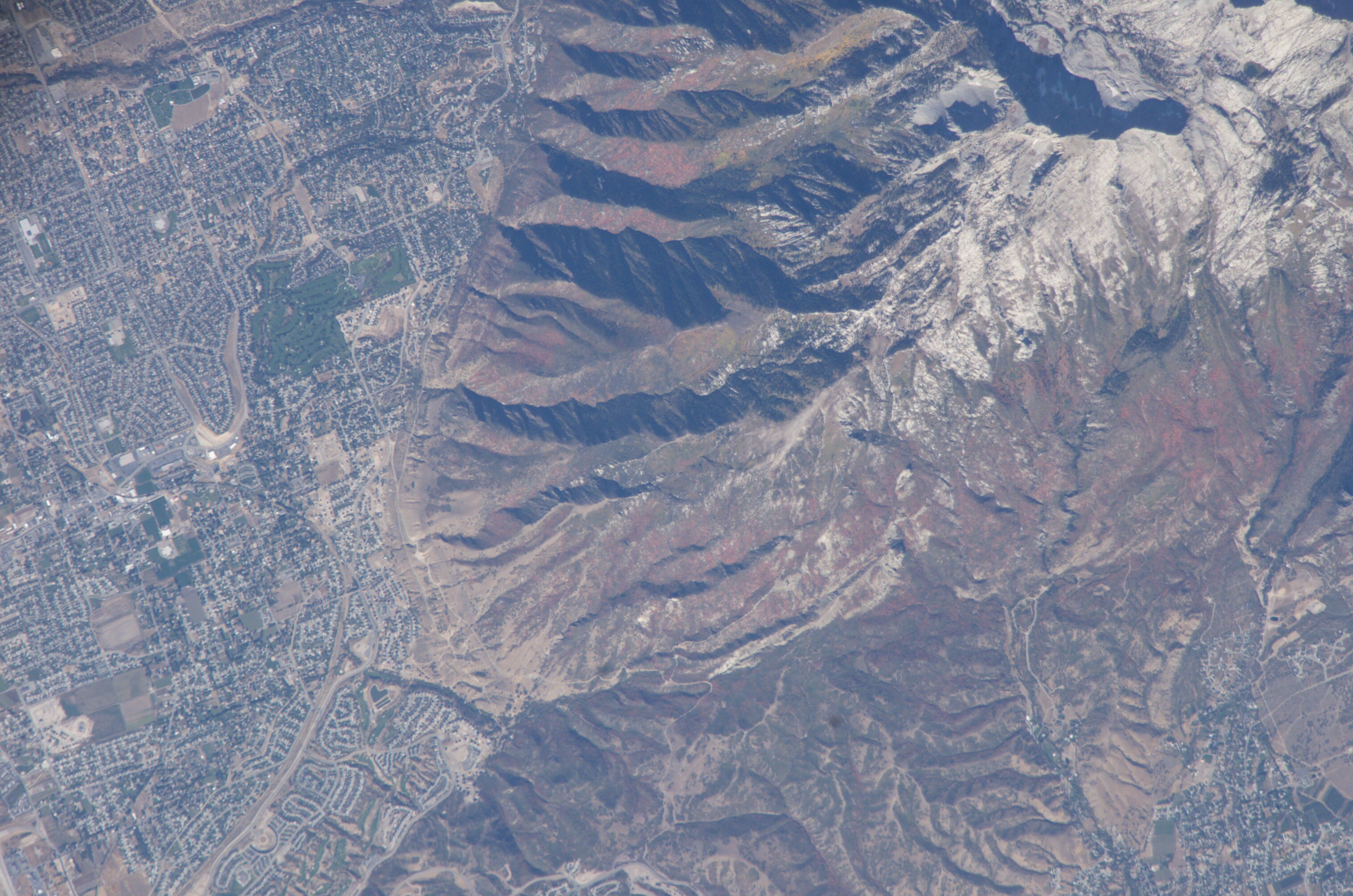
Photo center point: 40.5° N, 111.8° W
Photo center point by machine learning:
Camera: | Kodak DCS760c Electronic Still Camera |
Focal Length: | 800mm |
Camera Tilt: | 9 degrees |
Format: | 3060E: 3060 x 2036 pixel CCD, RGBG array |
Film Exposure: | |
| Additional Information | |
| Width | Height | Annotated | Cropped | Purpose | Links |
|---|---|---|---|---|---|
| 1000 pixels | 660 pixels | No | Yes | Earth From Space collection | Download Image |
| 540 pixels | 356 pixels | Yes | Yes | Earth From Space collection | Download Image |
| 540 pixels | 405 pixels | Yes | Yes | NASA's Earth Observatory web site | Download Image |
| 3032 pixels | 2008 pixels | No | No | Not enhanced | Download Image |
| 639 pixels | 435 pixels | No | No | Download Image |
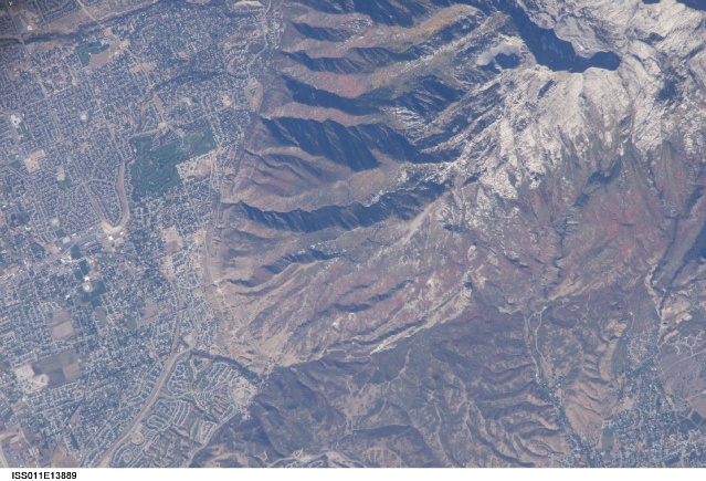
The Wasatch Range forms an impressive backdrop to the Salt Lake City metropolitan area, and it is a frequent destination for hikers, backpackers, and skiers. The range is considered to be the westernmost part of the Rocky Mountains, and rises to elevations of approximately 3,600 meters (12,000 feet) above sea level. The abundance of streams and building materials (timber and stone) encouraged the earliest Mormon settlers to establish themselves along the western front of the Wasatch Range. Development of the region still occurs mainly along the western mountain front.
The cooling days of autumn find the Wasatch Range clothed in the leaves of deciduous trees turning color. This astronaut photograph, taken at the end of September, captures red- (maple trees) and gold-mantled (aspen trees) hill slopes along the western mountain front to the south of Salt Lake City. Other common tree species at these elevations include pine, fir, spruce, willow, birch, and oak. A portion of Draper City is visible in the left half of the image. The elevation of Lone Peak, visible at upper right, is approximately 3,410 meters (11,253 feet).
