ISS010-E-20813
| NASA Photo ID | ISS010-E-20813 |
| Focal Length | 180mm |
| Date taken | 2005.03.22 |
| Time taken | 19:52:42 GMT |
Resolutions offered for this image:
1000 x 1122 pixels 540 x 605 pixels 540 x 353 pixels 3032 x 2064 pixels 639 x 435 pixels
1000 x 1122 pixels 540 x 605 pixels 540 x 353 pixels 3032 x 2064 pixels 639 x 435 pixels
Cloud masks available for this image:
Spacecraft nadir point: 46.0° N, 81.3° W
Photo center point:
Photo center point by machine learning:
Photo center point:
Photo center point by machine learning:
Nadir to Photo Center:
Spacecraft Altitude: 190 nautical miles (352km)
Country or Geographic Name: | |
Features: | |
| Features Found Using Machine Learning: | |
Cloud Cover Percentage: | |
Sun Elevation Angle: | 35° |
Sun Azimuth: | 225° |
Camera: | K760C-05160 |
Focal Length: | 180mm |
Camera Tilt: | |
Format: | |
Film Exposure: | |
| Additional Information | |
| Width | Height | Annotated | Cropped | Purpose | Links |
|---|---|---|---|---|---|
| 1000 pixels | 1122 pixels | No | Yes | Earth From Space collection | Download Image |
| 540 pixels | 605 pixels | Yes | Yes | Earth From Space collection | Download Image |
| 540 pixels | 353 pixels | Yes | Yes | NASA's Earth Observatory web site | Download Image |
| 3032 pixels | 2064 pixels | No | No | Download Image | |
| 639 pixels | 435 pixels | No | No | Download Image |
Download Packaged File
Download a Google Earth KML for this Image
View photo footprint information
Download a GeoTIFF for this photo
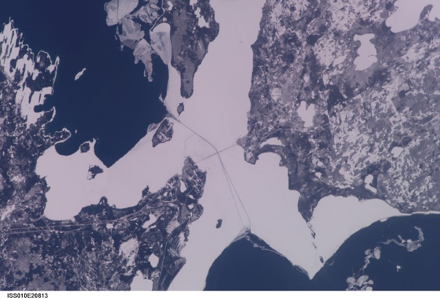
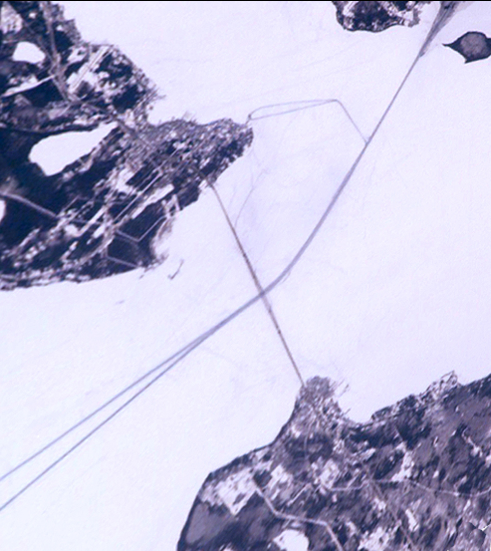
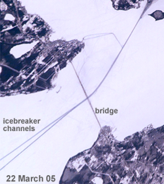
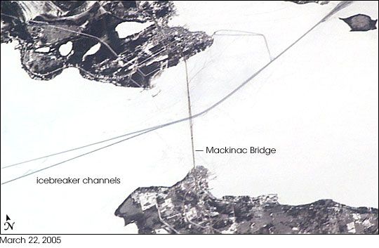
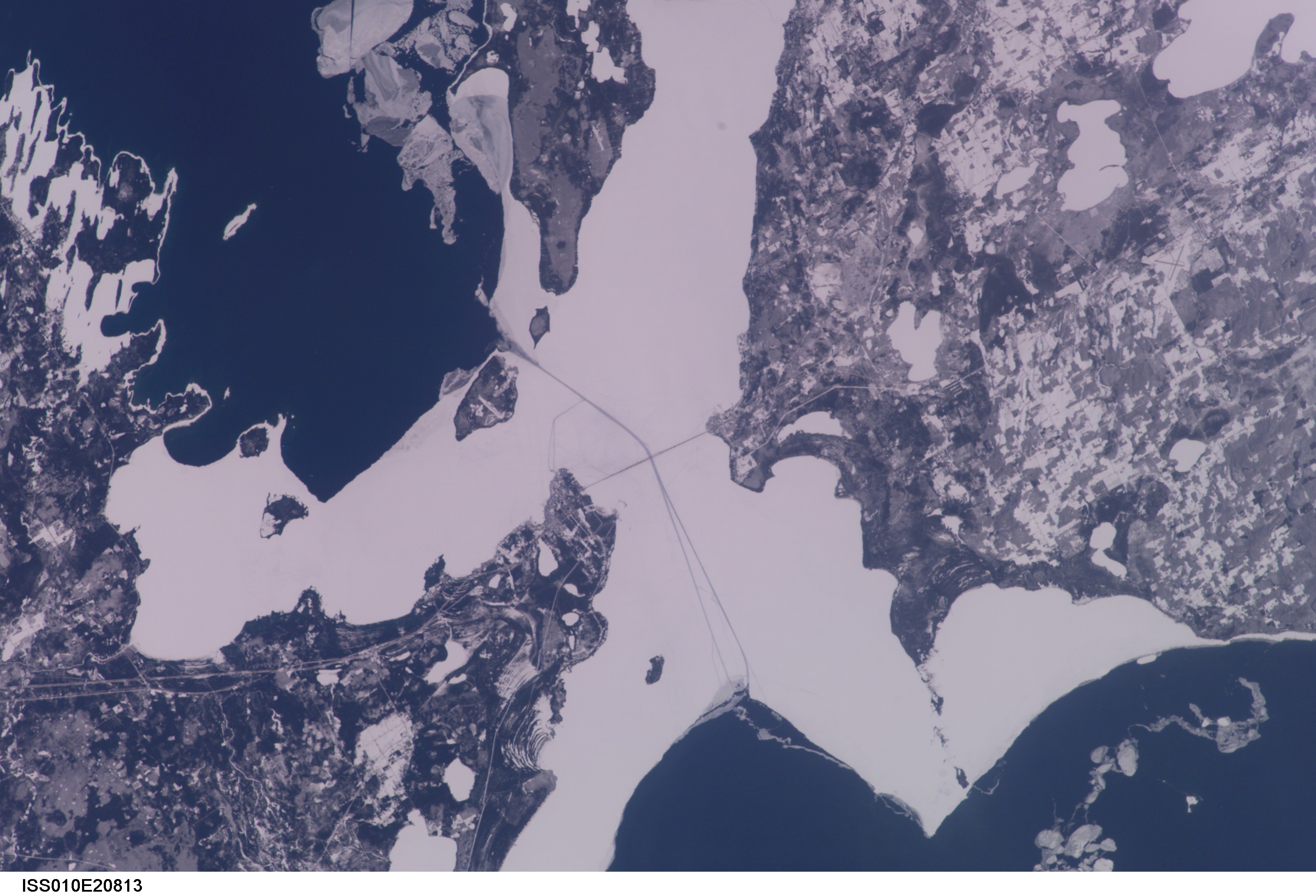
Image Caption: ISS010-E-20813 (22 March 2005) --- The Straits of Mackinac are featured in this image photographed by an Expedition 10 crewmember on the International Space Station (ISS). The Mackinac Bridge spans a stretch of water five miles wide between Michigan's lower and upper peninsulas. The strait connects Lakes Michigan (left) and Huron (right). The bridge is a combination of pier-supported spans with a high, central suspension sector that allows passage of lake steamers. The suspension sector is the longest in the Americas (8614 feet or 1.6 miles). Prior to construction of the bridge, the only passage across the straits was by ferryboat. This view shows shipping lanes opened by ice breakers. A narrow passage leads to the small town of St. Ignace at the north end of the bridge (Mackinaw City appears at the south end). The shipping channel is maintained even through remnants of the ice mass, but the ice ridges can be hazardous to shipping during ice break-up.
