ISS010-E-05070
| NASA Photo ID | ISS010-E-05070 |
| Focal Length | 800mm |
| Date taken | 2004.10.25 |
| Time taken | 16:37:01 GMT |
540 x 816 pixels 1000 x 1511 pixels 540 x 720 pixels 3032 x 2064 pixels 639 x 435 pixels

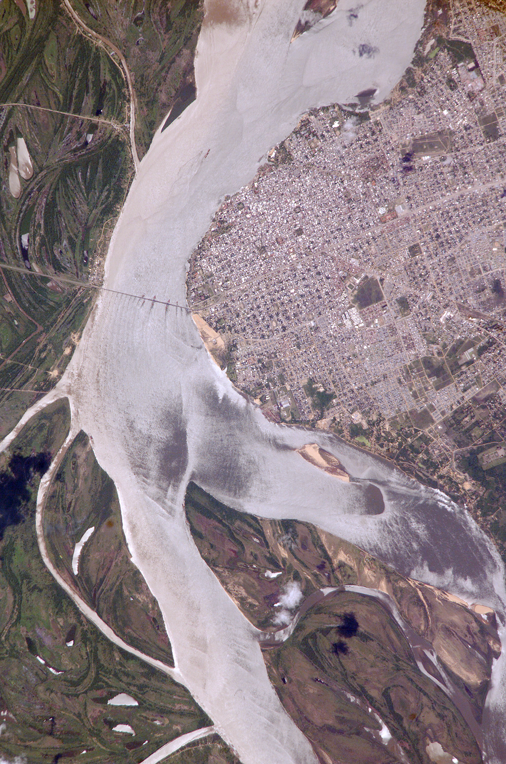
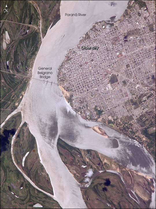

Photo center point: 27.5° S, 58.8° W
Photo center point by machine learning: 27.49° S, 58.86° W
Country or Geographic Name: | ARGENTINA |
Features: | CORRIENTES, PARANA R., GLINT |
| Features Found Using Machine Learning: | |
Cloud Cover Percentage: | 10 (1-10)% |
Sun Elevation Angle: | 69° |
Sun Azimuth: | 316° |
Camera: | Kodak DCS760c Electronic Still Camera |
Focal Length: | 800mm |
Camera Tilt: | 12 degrees |
Format: | 3060E: 3060 x 2036 pixel CCD, RGBG array |
Film Exposure: | |
| Additional Information | |
| Width | Height | Annotated | Cropped | Purpose | Links |
|---|---|---|---|---|---|
| 540 pixels | 816 pixels | Yes | Yes | Earth From Space collection | Download Image |
| 1000 pixels | 1511 pixels | No | Yes | NASA's Earth Observatory web site | Download Image |
| 540 pixels | 720 pixels | Yes | Yes | NASA's Earth Observatory web site | Download Image |
| 3032 pixels | 2064 pixels | No | No | Download Image | |
| 639 pixels | 435 pixels | No | No | Download Image |
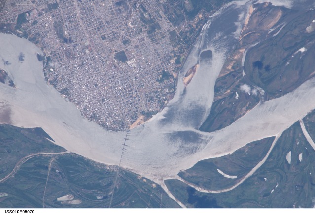
Corrientes, Argentina (population 347,000), sits on the east bank of the Parana River, South America's third largest river (after the Negro and Amazon Rivers). From its headwaters in southeastern Brazil, the river flows southwestward around southern Paraguay, and then into Argentina. Corrientes is located just inside Argentina, across the river from the southwestern tip of Paraguay.
The bridge over the Parana, built in the 1970s, connects Corrientes to its sister city, Resistencia, (beyond the left edge of image) on the western bank of the river. Sun glint on the river gives it a silvery glow and emphasizes channel islands in the river, side channels, and meander scars on the floodplain opposite the city, and even reveals the pattern of disturbed flow downstream of the bridge pylons.
Although it lies 500 miles from the sea, Corrientes is a major port city. Barge traffic from Corrientes supplies landlocked Paraguay and Bolivia and interior parts of Brazil. Local manufactures and farm products are sent downstream to Buenos Aires, where the Parana empties into the Atlantic Ocean through the Rio de la Plata Estuary. Founded in 1588, the city's name is an abbreviated version of the historic one, "San Juan de Vera de las Siete Corrientes" (San Juan de Vera of the Seven Currents), which honored the city's founder and the complex behavior of the river in that location. The sun glint on the river highlights the different currents.
The old part of the city appears as a zone of smaller, more densely clustered city blocks along the river to the north of a major highway, which runs through Corrientes from the General Belgrano Bridge to the northeast (upper right of image). Larger blocks of the younger cityscape, with more green space, surround these core neighborhoods.
