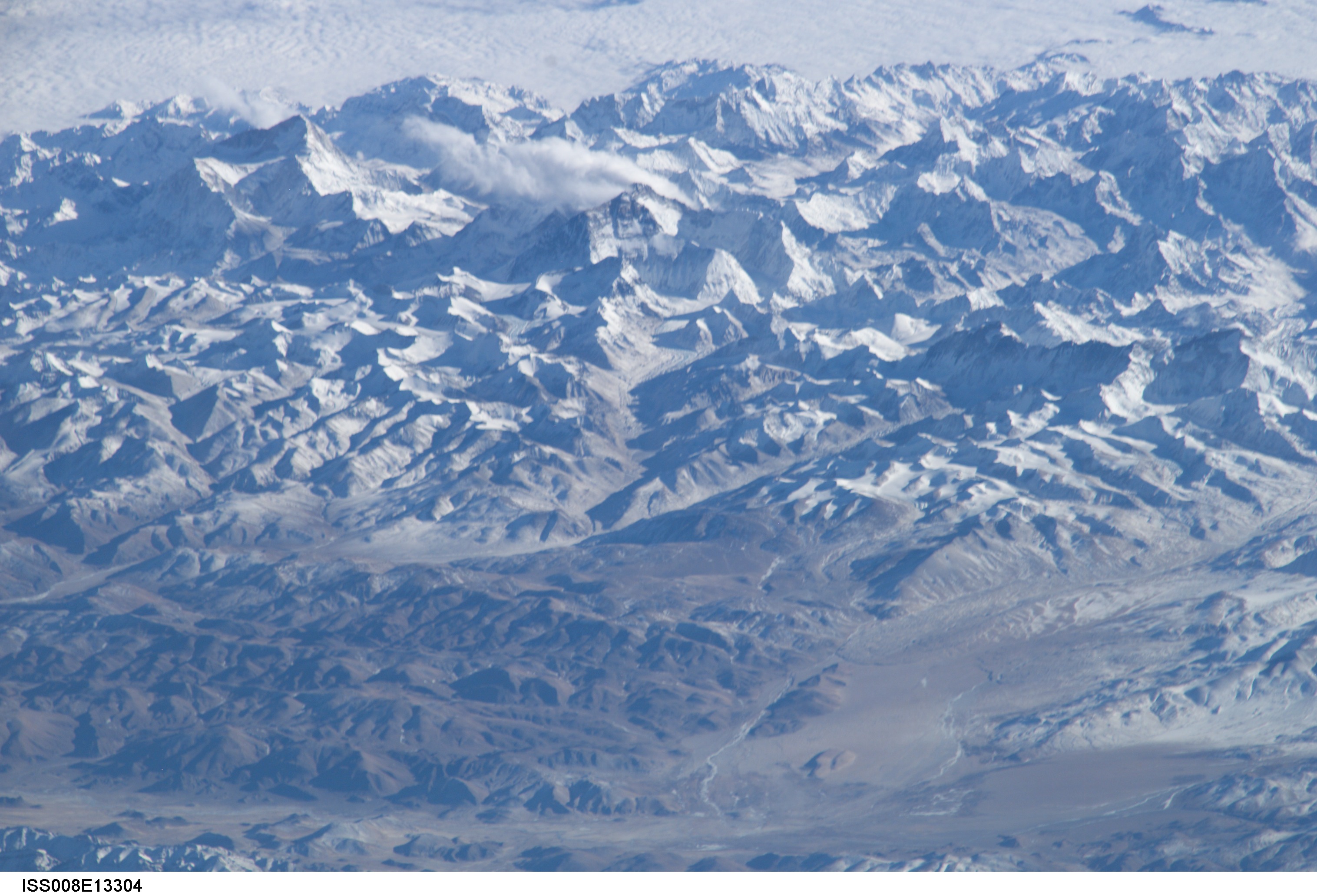
ISS008-E-13304

| NASA Photo ID | ISS008-E-13304 |
| Focal Length | 800mm |
| Date taken | 2004.01.28 |
| Time taken | 10:01:59 GMT |
Resolutions offered for this image:
3032 x 1998 pixels 1000 x 662 pixels 540 x 334 pixels 3032 x 2064 pixels 639 x 435 pixels
3032 x 1998 pixels 1000 x 662 pixels 540 x 334 pixels 3032 x 2064 pixels 639 x 435 pixels
Cloud masks available for this image:
Spacecraft nadir point: 38.0° N, 82.7° E
Photo center point: 28.0° N, 87.0° E
Photo center point by machine learning:
Photo center point: 28.0° N, 87.0° E
Photo center point by machine learning:
Nadir to Photo Center: South
Spacecraft Altitude: 194 nautical miles (359km)
Country or Geographic Name: | CHINA |
Features: | HIMALAYA RANGE, MT. EVEREST |
| Features Found Using Machine Learning: | |
Cloud Cover Percentage: | 25 (11-25)% |
Sun Elevation Angle: | 17° |
Sun Azimuth: | 229° |
Camera: | Kodak DCS760c Electronic Still Camera |
Focal Length: | 800mm |
Camera Tilt: | High Oblique |
Format: | 3060E: 3060 x 2036 pixel CCD, RGBG array |
Film Exposure: | |
| Additional Information | |
| Width | Height | Annotated | Cropped | Purpose | Links |
|---|---|---|---|---|---|
| 3032 pixels | 1998 pixels | No | No | NASA's Earth Observatory web site | Download Image |
| 1000 pixels | 662 pixels | No | No | NASA's Earth Observatory web site | Download Image |
| 540 pixels | 334 pixels | No | Yes | NASA's Earth Observatory web site | Download Image |
| 3032 pixels | 2064 pixels | No | No | Download Image | |
| 639 pixels | 435 pixels | No | No | Download Image |
Download Packaged File
Download a Google Earth KML for this Image
View photo footprint information
Download a GeoTIFF for this photo
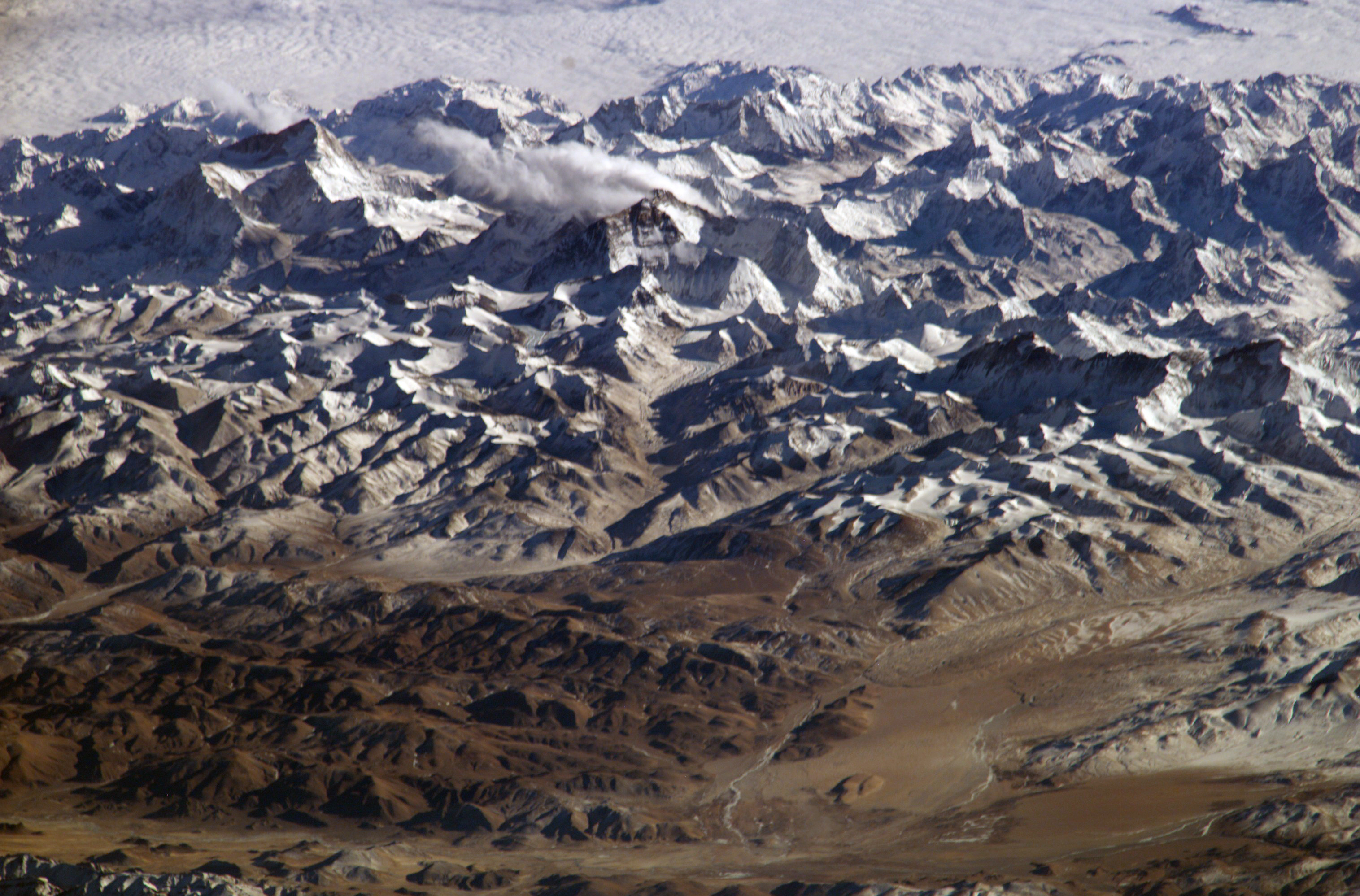
Image Caption: This image is part of a mosaic of the Himalayas (using ISS008-E-13302 through 13307).
On Top of the World: Everest and Makalu:
Astronauts on board the International Space Station (ISS) have a unique view of the world because of their position in a low orbit (200 nautical miles, 360 km) relative to satellites and their ability to look at any angle out the windows of the spacecraft. ISS crewmembers recently took advantage of their vantage point to photograph a series of oblique views of the Himalayas looking south from over the Tibetan Plateau. At first glance, one might think that the image looks like a picture taken from an airplane, until you remember that the summits of Makalu [left (8,462 meters; 27,765 feet)] and Everest [right (8,850 meters; 29,035 feet)] are at the heights typically flown by commercial aircraft. The image is part of a larger panorama mosaic of the Himalayas. The full mosaic covers over 130 kilometers (80 miles) of the Himalayan front, and could never be seen this way from an airplane.
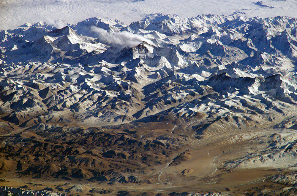
