[Skip to Content]
Earth From Space
Earth from Space logo  9 Matches Search ResultsEarth from Space logo

Image: gray corner Image: gray corner
View Image Information
Image: Geographic Location
Image: gray corner Image: gray corner

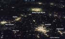
Photo #: ISS010-E-24596 Technical Info
All Available Images Lo-Resolution 0k
Features: SUNGLINT, DALLAS, TRINITY R., RES., GLINT, FORT WORTH, FLOODING, BRYAN, LAKE
Geographic Region: USA-TEXAS


Image: gray corner Image: gray corner
View Image Information
Image: Geographic Location
Image: gray corner Image: gray corner

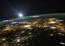
Photo #: ISS013-E-19323 Technical Info
All Available Images Lo-Resolution 0k
Features: DALLAS, YORK, ISLAND, MANHATTAN, AIRPORT, FORT WORTH, DALLAS-FORT WORTH AIRPORT, LAKE
Geographic Region: USA-TEXAS


Image: gray corner Image: gray corner
View Image Information
Image: Geographic Location
Image: gray corner Image: gray corner

Photo #: ISS033-E-21663 Technical Info
All Available Images Lo-Resolution 0k
Features: AIRPORT, DALLAS AT NIGHT, CARROLLTON AT NIGHT, URBAN AREA, DALLAS, ARLINGTON, FORT WORTH, RICHARDSON AT NIGHT
Geographic Region: USA-TEXAS


Image: gray corner Image: gray corner
View Image Information
Image: Geographic Location
Image: gray corner Image: gray corner

Photo #: ISS036-E-9405 Technical Info
All Available Images Lo-Resolution 0k
Features: SAN ANTONIO AT NIGHT, BEAUMONT, FORT WORTH, THUNDERSTORM, HOUSTON AT NIGHT, STORMS, AUSTIN, DALLAS, HOUSTON, AUSTIN AT NIGHT, PLAIN, ARLINGTON, BAYTOWN
Geographic Region: USA-TEXAS


Image: gray corner Image: gray corner
View Image Information
Image: Geographic Location
Image: gray corner Image: gray corner

Photo #: ISS044-E-45553 Technical Info
All Available Images Lo-Resolution 0k
Features: DALLAS, SPRITE, MOON, PAN TEXAS & N. MEXICO AT NIGHT, THUNDERSTORM
Geographic Region: USA-TEXAS


Image: gray corner Image: gray corner
View Image Information
Image: Geographic Location
Image: gray corner Image: gray corner

Photo #: STS039-85-33 Technical Info
All Available Images Lo-Resolution 0k
Features: RANGE, DAM, LAKE, RESERVOIR, HIGHWAY, PLAIN, RESERVOIRS, AIRPORT, NO. DALLAS, URBAN AREA
Geographic Region: USA-TEXAS


Image: gray corner Image: gray corner
View Image Information
Image: Geographic Location
Image: gray corner Image: gray corner

Photo #: STS039-151-172 Technical Info
All Available Images Lo-Resolution 0k
Features: AIRPORT, URBAN AREA, DALLAS, RIVER, RESERVOIR, FORT WORTH, AGRICULTURE, DALLAS-FORT WORTH AREA, LAKE, DAM, PLAIN
Geographic Region: USA-TEXAS


Image: gray corner Image: gray corner
View Image Information
Image: Geographic Location
Image: gray corner Image: gray corner

Photo #: STS068-174-169 Technical Info
All Available Images Lo-Resolution 0k
Features: L. TEXOMA TO N DALLAS, PLAIN, RANGE, RESERVOIR, RIVER
Geographic Region: USA-TEXAS


Image: gray corner Image: gray corner
View Image Information
Image: Geographic Location
Image: gray corner Image: gray corner

Photo #: STS071-745-65 Technical Info
All Available Images Lo-Resolution 0k
Features: DALLAS-FT. WORTH, AIRPORT, PART. FRM, PLAIN, HIGHWAY, RESERVOIR, RANGE
Geographic Region: USA-TEXAS


NASA
Home Page
JSC
Home Page
JSC Digital
Image Collection
Earth Science &
Remote Sensing
NASA meatball logo
This service is provided by the International Space Station program and the JSC Earth Science & Remote Sensing Unit, ARES Division, Exploration Integration Science Directorate.
ESRS logo