Geographic Region: USA-LOUISIANA
Feature: AGR.,CY.,LAKES, RED R.
|
Geographic Region: USA-LOUISIANA Feature: AGR.,CY.,LAKES, RED R. |
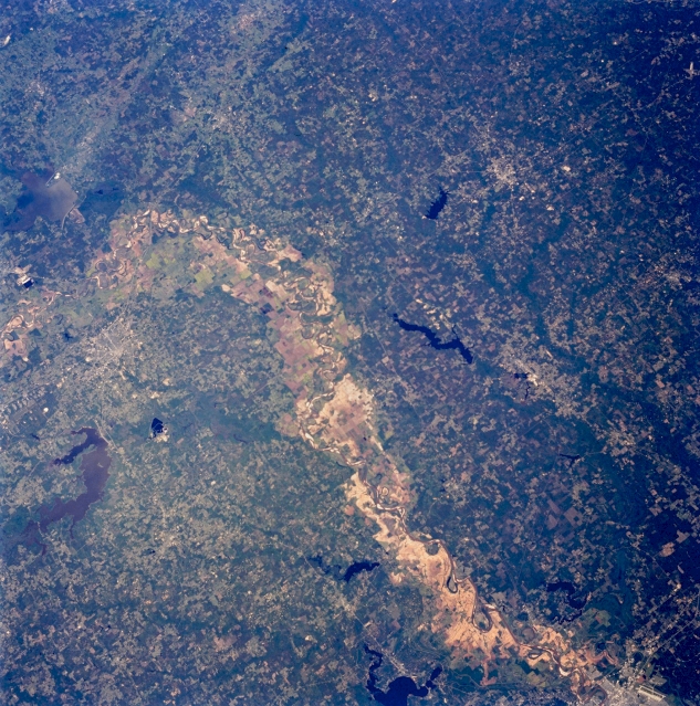 |
| STS059-222-055 Northeast Texas, Texas, U.S.A. April 1994 Parts of northeast Texas, southwest Arkansas, and northwest Louisiana are included in this oblique, northeast-looking photograph. The broad floodplain scar of the meandering Red River is impressive as the river makes a 90-degree east-to-south turn immediately northeast of Texarkana (barely discernible). Much of the broad floodplain is used for agriculture. Several reservoirs identifiable in the three-state area--Wright Patman Lake in Texas and U-shaped Caddo Lake, which straddles the Texas-Louisiana border; Black Bayou Lake in the northwest corner of Louisiana; and Millwood Lake and, to its southeast, elongated Lake Erling in Arkansas. Dark areas denote dense vegetation and woodlands; lighter terrain shows cultivated fields and pastureland. Visible are a section of Shreveport and the runway and apron of Barksdale Air Force Base (lower right corner). |
| Images: | Images: | NO IMAGES YET | |||
| Mission: | STS059 |
||||
| Roll - Frame: | 222 - 55 |
||||
| Geographical Name: | USA-LOUISIANA |
||||
| Features: | AGR.,CY.,LAKES, RED R. |
||||
| Center Lat x Lon: | 32.0N x 93.5W |
||||
| Film Exposure: | N | N=Normal exposure, U=Under exposed, O=Over exposed, F=out of Focus |
|||
| Percentage of Cloud Cover-CLDP: | 0 |
||||
| Camera:: | HB |
||||
| Camera Tilt: | 21 | LO=Low Oblique, HO=High Oblique, NV=Near Vertical |
|||
| Camera Focal Length: | 100 |
||||
| Nadir to Photo Center Direction: | SE | The direction from the nadir to the center point, N=North, S=South, E=East, W=West |
|||
| Stereo?: | N | Y=Yes there is an adjacent picture of the same area, N=No there isn't |
|||
| Orbit Number: | 135 |
||||
| Date: | 19940417 | YYYYMMDD |
|||
| Time: | 175140 | GMT HHMMSS |
|||
| Nadir Lat: | 32.5N |
Latitude of suborbital point of spacecraft | |||
| Nadir Lon: | 94W |
Longitude of suborbital point of spacecraft | |||
| Sun Azimuth: | 164 | Clockwise angle in degrees from north to the sun measured at the nadir point |
|||
| Space Craft Altitude: | 113 | nautical miles |
|||
| Sun Elevation: | 68 | Angle in degrees between the horizon and the sun, measured at the nadir point |
|||
| Land Views: | PLAIN, HILL, RANGE |
||||
| Water Views: | RIVER, RESERVOIR, LAKE |
||||
| Atmosphere Views: | |
||||
| Man Made Views: | AIRPORT |
||||
| City Views: | |
||||
Photo is not associated with any sequences | |||||
| NASA Home Page |
JSC Home Page |
JSC Digital Image Collection |
Earth Science & Remote Sensing |
|
This service is provided by the International Space Station program and the JSC Earth Science & Remote Sensing Unit, ARES Division, Exploration Integration Science Directorate.

|