STS61C-46-10
| NASA Photo ID | STS61C-46-10 |
| Focal Length | 250mm |
| Date taken | 1986.01.13 |
| Time taken | 01:49:08 GMT |
Resolutions offered for this image:
5265 x 5265 pixels 639 x 639 pixels 5700 x 5900 pixels 500 x 518 pixels 640 x 480 pixels 5290 x 5600 pixels
5265 x 5265 pixels 639 x 639 pixels 5700 x 5900 pixels 500 x 518 pixels 640 x 480 pixels 5290 x 5600 pixels
Cloud masks available for this image:
Spacecraft nadir point: 20.1° N, 116.2° E
Photo center point: 20.5° N, 117.0° E
Photo center point by machine learning:
Photo center point: 20.5° N, 117.0° E
Photo center point by machine learning:
Nadir to Photo Center: Northeast
Spacecraft Altitude: 181 nautical miles (335km)
Country or Geographic Name: | CHINA |
Features: | PRATAS ISLAND |
| Features Found Using Machine Learning: | |
Cloud Cover Percentage: | 20 (11-25)% |
Sun Elevation Angle: | 33° |
Sun Azimuth: | 135° |
Camera: | Hasselblad |
Focal Length: | 250mm |
Camera Tilt: | 17 degrees |
Format: | 5017: Kodak, natural color positive, Ektachrome, X Professional, ASA 64, standard base |
Film Exposure: | Normal |
| Additional Information | |
| Width | Height | Annotated | Cropped | Purpose | Links |
|---|---|---|---|---|---|
| 5265 pixels | 5265 pixels | No | No | Earth From Space collection | Download Image |
| 639 pixels | 639 pixels | No | No | Earth From Space collection | Download Image |
| 5700 pixels | 5900 pixels | No | No | Download Image | |
| 500 pixels | 518 pixels | No | No | Download Image | |
| 640 pixels | 480 pixels | No | No | Download Image | |
| 5290 pixels | 5600 pixels | ReefBase pilot | Download Image |
Download Packaged File
Download a Google Earth KML for this Image
View photo footprint information
Download a GeoTIFF for this photo
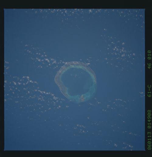
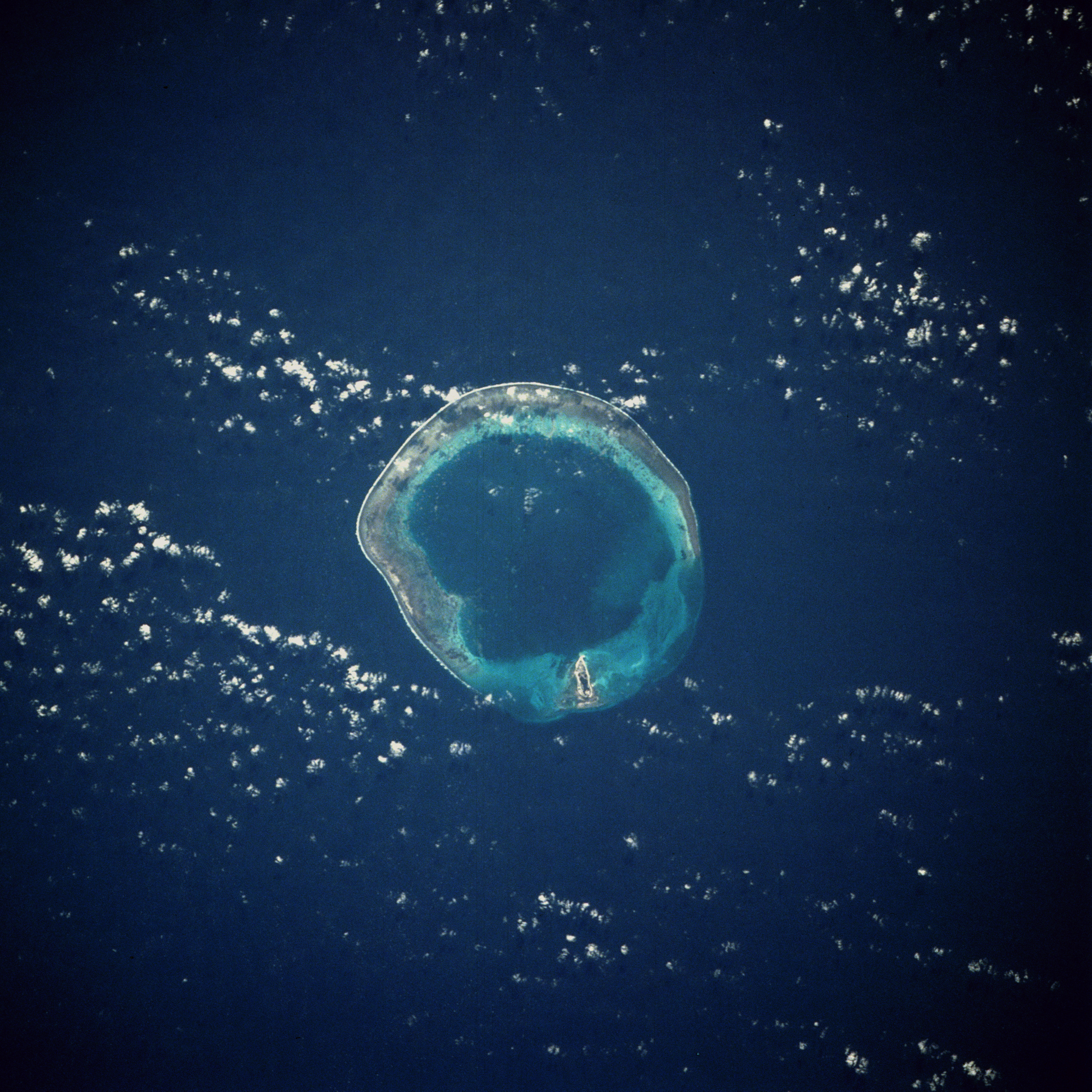
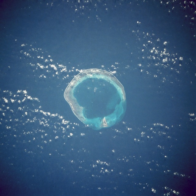
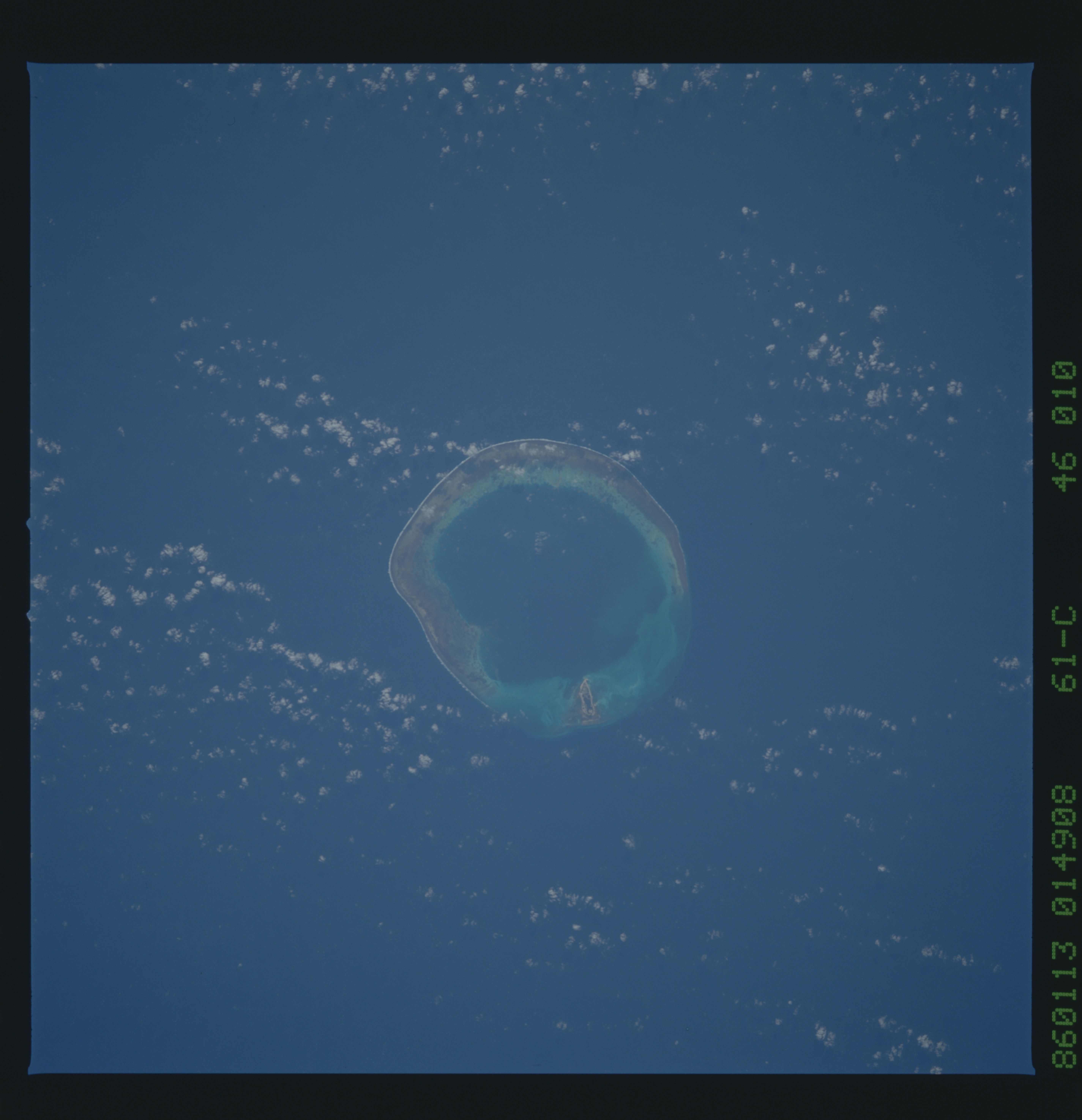
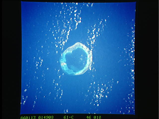
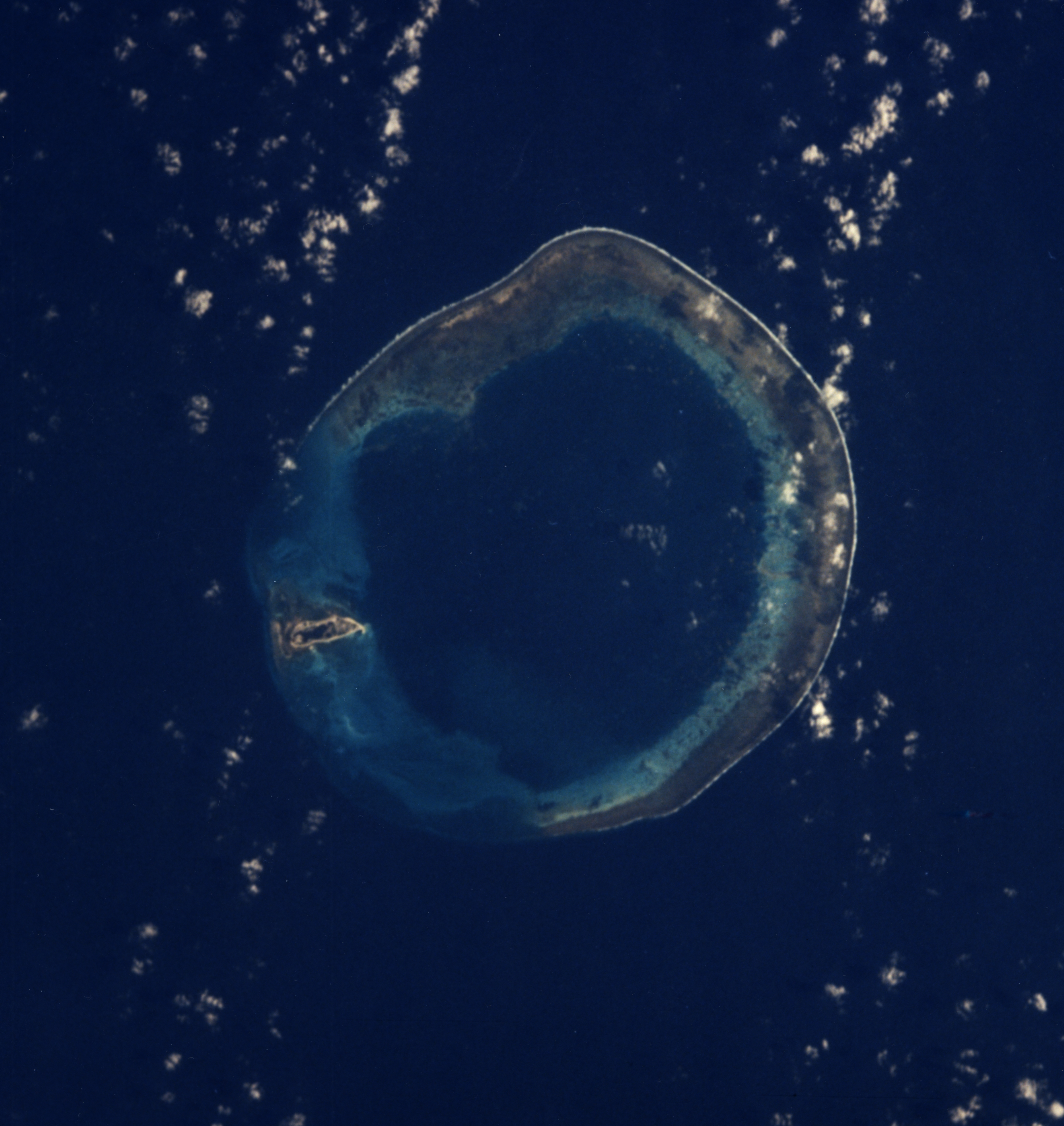
Image Caption: STS61C-46-0010 Pratas (Dongsha) Island, South China Sea January 1986
Pratas Island, its lagoon, and its horseshoe-shaped coral reef are the centerpiece in this southeast-looking, low-oblique photograph. Named Dongsha Island (East Sand Island) by the Chinese, Pratas is approximately 200 miles (322 kilometers) southeast of Hong Kong in the northern South China Sea. The island and its reef are the remains of coral skeletons on a submerged sea terrace now 984 feet (300 meters) below the sea surface. The island is a sanctuary for many tropical birds. The phosphorous-rich lime soils of the island mix with the abundant bird guano deposits to make excellent fertilizer that is transported by the Chinese to the mainland for agricultural use.
Pratas Island, its lagoon, and its horseshoe-shaped coral reef are the centerpiece in this southeast-looking, low-oblique photograph. Named Dongsha Island (East Sand Island) by the Chinese, Pratas is approximately 200 miles (322 kilometers) southeast of Hong Kong in the northern South China Sea. The island and its reef are the remains of coral skeletons on a submerged sea terrace now 984 feet (300 meters) below the sea surface. The island is a sanctuary for many tropical birds. The phosphorous-rich lime soils of the island mix with the abundant bird guano deposits to make excellent fertilizer that is transported by the Chinese to the mainland for agricultural use.
