STS61C-40-96

| NASA Photo ID | STS61C-40-96 |
| Focal Length | 250mm |
| Date taken | 1986.01.12 |
| Time taken | 18:39:34 GMT |
Resolutions offered for this image:
5248 x 5196 pixels 640 x 633 pixels 5700 x 5900 pixels 500 x 518 pixels 640 x 480 pixels
5248 x 5196 pixels 640 x 633 pixels 5700 x 5900 pixels 500 x 518 pixels 640 x 480 pixels
Cloud masks available for this image:
Spacecraft nadir point: 22.8° S, 40.9° W
Photo center point: 21.5° S, 41.0° W
Photo center point by machine learning:
Photo center point: 21.5° S, 41.0° W
Photo center point by machine learning:
Nadir to Photo Center: North
Spacecraft Altitude: 176 nautical miles (326km)
Country or Geographic Name: | BRAZIL |
Features: | COAST, R. PARAIBA DO SUL |
| Features Found Using Machine Learning: | |
Cloud Cover Percentage: | 15 (11-25)% |
Sun Elevation Angle: | 37° |
Sun Azimuth: | 259° |
Camera: | Hasselblad |
Focal Length: | 250mm |
Camera Tilt: | 24 degrees |
Format: | 5017: Kodak, natural color positive, Ektachrome, X Professional, ASA 64, standard base |
Film Exposure: | Normal |
| Additional Information | |
| Width | Height | Annotated | Cropped | Purpose | Links |
|---|---|---|---|---|---|
| 5248 pixels | 5196 pixels | No | No | Earth From Space collection | Download Image |
| 640 pixels | 633 pixels | No | No | Earth From Space collection | Download Image |
| 5700 pixels | 5900 pixels | No | No | Download Image | |
| 500 pixels | 518 pixels | No | No | Download Image | |
| 640 pixels | 480 pixels | No | No | Download Image |
Download Packaged File
Download a Google Earth KML for this Image
View photo footprint information
Download a GeoTIFF for this photo
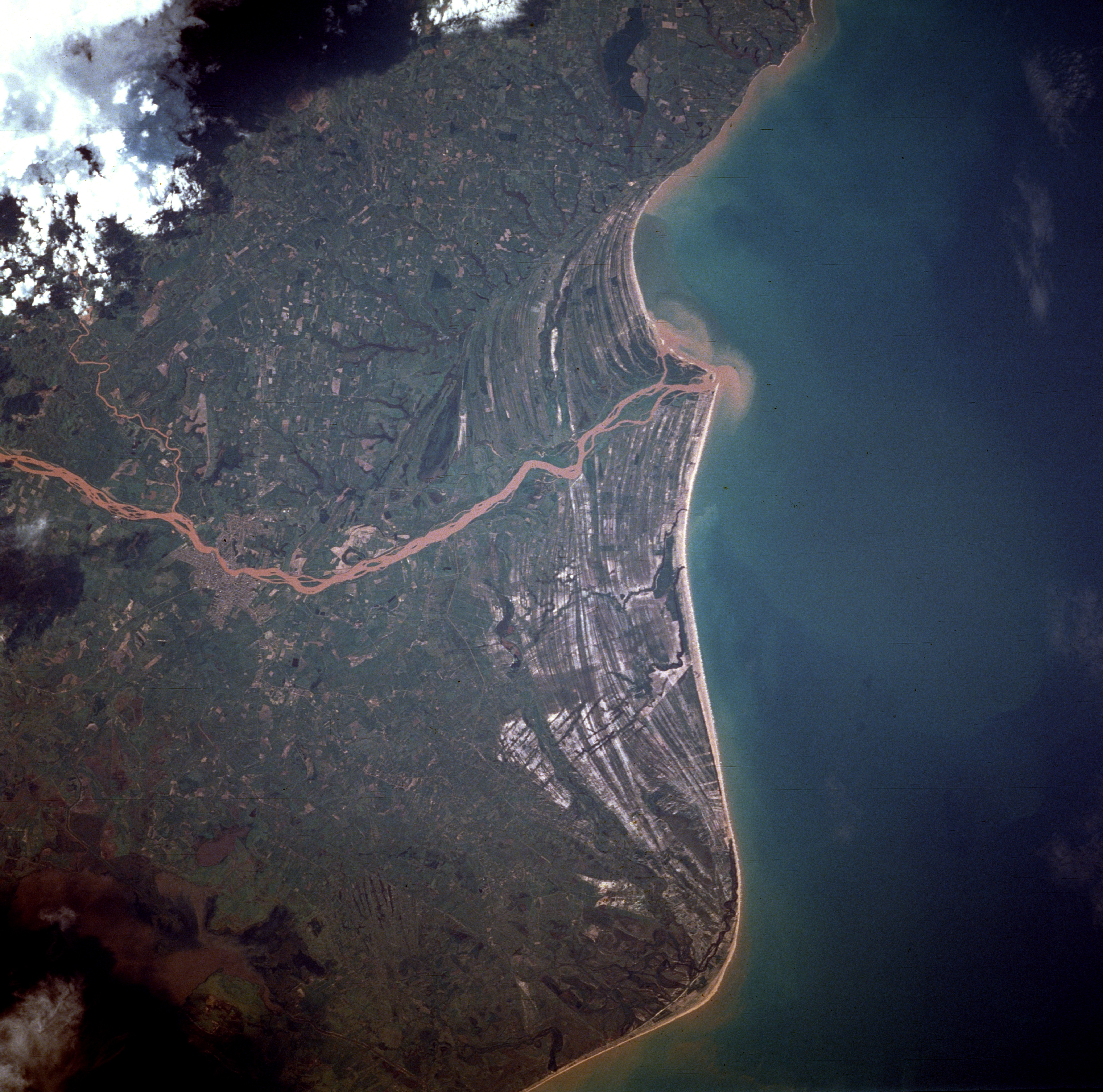
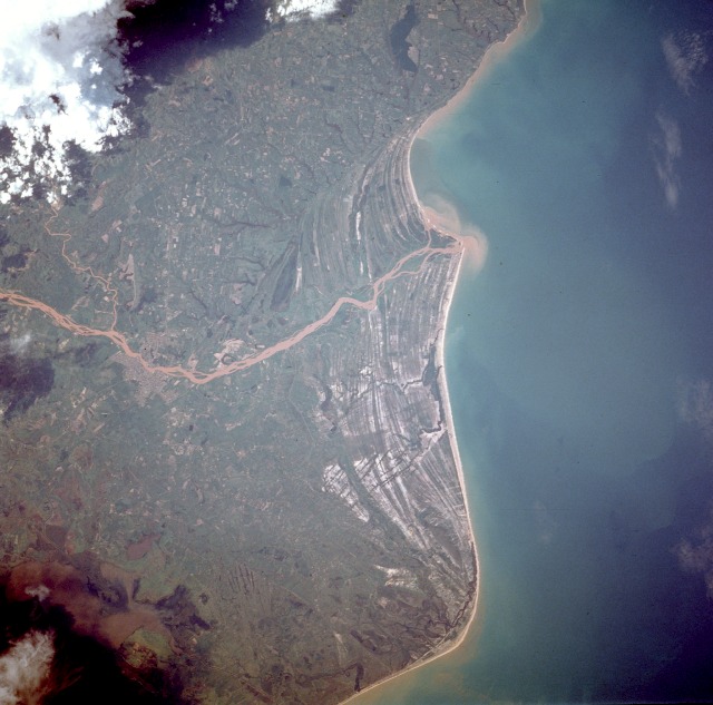
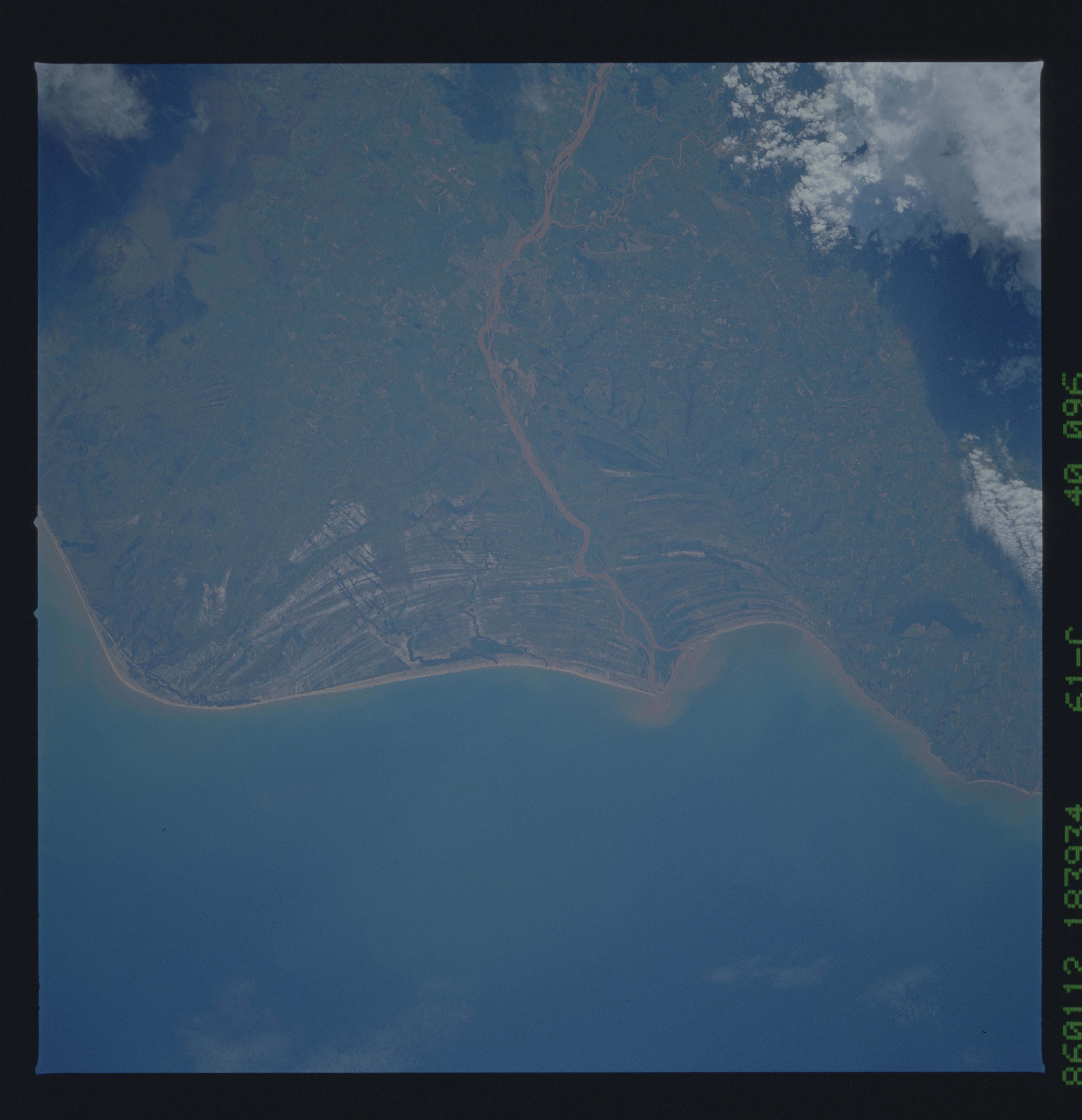
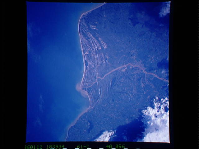
Image Caption: STS61C-40-0096 Rio Paraiba do Sul, Brazil January 1986
The sediment-laden Rio Paraiba do Sul is observed as it flows eastward and empties into the Atlantic Ocean. The delta and floodplain created by this river provide ample pastureland for raising cattle on the open savanna along the coast. The faint outline of Campos, a city of nearly 500 000 people, can be seen along the Rio Paraiba do Sul 35 miles (55 kilometers) from the river's mouth. Campos is the hub of both the cattle industry and an agricultural region known for its sugar production. In colonial times, Campos was one of the major gateways to the interior of Brazil. One of the most striking features in this nearly vertical photograph is the numerous striated beach terraces that generally parallel the coastline. The curving coastline near the southern edge of the photograph is Cabo de Sao Tome; the murky, grayish feature in the southwest corner of the photograph is part of Lake Feia.
The sediment-laden Rio Paraiba do Sul is observed as it flows eastward and empties into the Atlantic Ocean. The delta and floodplain created by this river provide ample pastureland for raising cattle on the open savanna along the coast. The faint outline of Campos, a city of nearly 500 000 people, can be seen along the Rio Paraiba do Sul 35 miles (55 kilometers) from the river's mouth. Campos is the hub of both the cattle industry and an agricultural region known for its sugar production. In colonial times, Campos was one of the major gateways to the interior of Brazil. One of the most striking features in this nearly vertical photograph is the numerous striated beach terraces that generally parallel the coastline. The curving coastline near the southern edge of the photograph is Cabo de Sao Tome; the murky, grayish feature in the southwest corner of the photograph is part of Lake Feia.
