STS61A-50-80

| NASA Photo ID | STS61A-50-80 |
| Focal Length | 250mm |
| Date taken | 1985.11.01 |
| Time taken | 21:52:05 GMT |
Resolutions offered for this image:
3936 x 3904 pixels 639 x 634 pixels 5700 x 5900 pixels 500 x 518 pixels 640 x 480 pixels
3936 x 3904 pixels 639 x 634 pixels 5700 x 5900 pixels 500 x 518 pixels 640 x 480 pixels
Cloud masks available for this image:
Spacecraft nadir point: 33.1° S, 150.0° E
Photo center point: 34.0° S, 150.0° E
Photo center point by machine learning:
Photo center point: 34.0° S, 150.0° E
Photo center point by machine learning:
Nadir to Photo Center: South
Spacecraft Altitude: 179 nautical miles (332km)
Country or Geographic Name: | AUSTRALIA-NSW |
Features: | LAKE BURRAGORANG |
| Features Found Using Machine Learning: | |
Cloud Cover Percentage: | 5 (1-10)% |
Sun Elevation Angle: | 34° |
Sun Azimuth: | 85° |
Camera: | Hasselblad |
Focal Length: | 250mm |
Camera Tilt: | 17 degrees |
Format: | 5017: Kodak, natural color positive, Ektachrome, X Professional, ASA 64, standard base |
Film Exposure: | Normal |
| Additional Information | |
| Width | Height | Annotated | Cropped | Purpose | Links |
|---|---|---|---|---|---|
| 3936 pixels | 3904 pixels | No | No | Earth From Space collection | Download Image |
| 639 pixels | 634 pixels | No | No | Earth From Space collection | Download Image |
| 5700 pixels | 5900 pixels | No | No | Download Image | |
| 500 pixels | 518 pixels | No | No | Download Image | |
| 640 pixels | 480 pixels | No | No | Download Image |
Download Packaged File
Download a Google Earth KML for this Image
View photo footprint information
Download a GeoTIFF for this photo
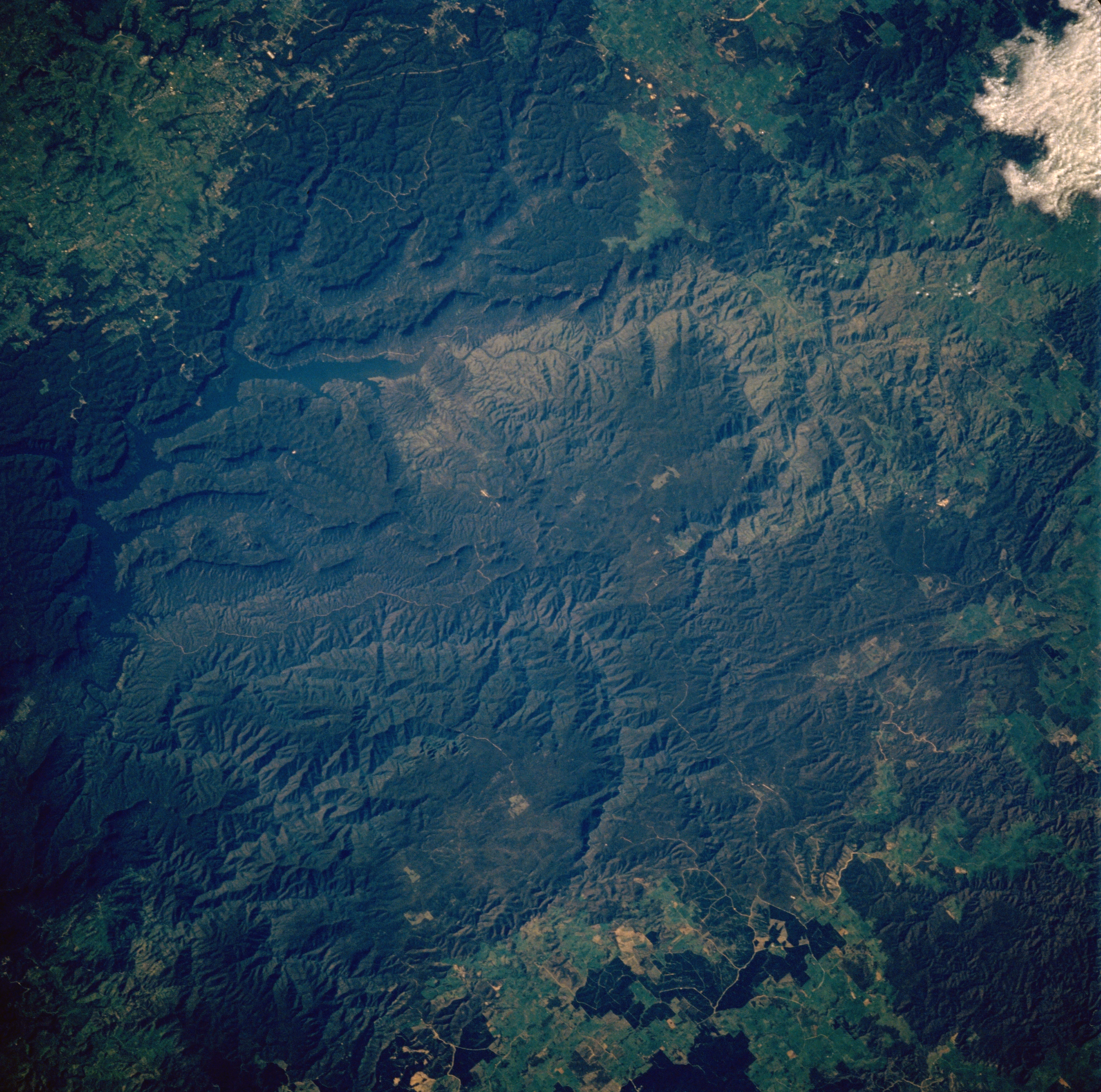
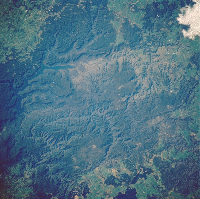
Image Caption: STS61A-50-0080 Lake Burragorang, New South Wales, Australia November 1985
The reservoir, Lake Burragorang (linear, dark blue feature) is a little difficult to distinguish from the dark, surrounding woodlands. Located on the outskirts of Sydney (southwest of urban area) Burragorang is a major water supply for the largest city in Australia. While the surface area of this lake is just 34 square miles (88 square kilometers) it has an average depth of 76 feet (23 meters). Both the Wollondilly and the Coxs Rivers flow into a dammed gorge to create this reservoir. The extensive dark landscape that is visible throughout much of this scene is heavily wooded sections of the Great Dividing Range. STS61A-50-081 provides overlapping coverage of the Great Dividing Range and the extreme western suburbs of Sydney.
The reservoir, Lake Burragorang (linear, dark blue feature) is a little difficult to distinguish from the dark, surrounding woodlands. Located on the outskirts of Sydney (southwest of urban area) Burragorang is a major water supply for the largest city in Australia. While the surface area of this lake is just 34 square miles (88 square kilometers) it has an average depth of 76 feet (23 meters). Both the Wollondilly and the Coxs Rivers flow into a dammed gorge to create this reservoir. The extensive dark landscape that is visible throughout much of this scene is heavily wooded sections of the Great Dividing Range. STS61A-50-081 provides overlapping coverage of the Great Dividing Range and the extreme western suburbs of Sydney.
