STS61A-489-12
| NASA Photo ID | STS61A-489-12 |
| Focal Length | 100mm |
| Date taken | 1985.__.__ |
| Time taken | GMT |
Resolutions offered for this image:
5218 x 5218 pixels 640 x 640 pixels 5700 x 5900 pixels 500 x 518 pixels 640 x 480 pixels
5218 x 5218 pixels 640 x 640 pixels 5700 x 5900 pixels 500 x 518 pixels 640 x 480 pixels

Cloud masks available for this image:
Spacecraft nadir point:
Photo center point: 7.5° N, 62.5° W
Photo center point by machine learning:
Photo center point: 7.5° N, 62.5° W
Photo center point by machine learning:
Nadir to Photo Center:
Spacecraft Altitude: nautical miles (0km)
Country or Geographic Name: | VENEZUELA |
Features: | RIO CARONI-RES, ORINOCO R |
| Features Found Using Machine Learning: | |
Cloud Cover Percentage: | 40 (26-50)% |
Sun Elevation Angle: | ° |
Sun Azimuth: | ° |
Camera: | Hasselblad |
Focal Length: | 100mm |
Camera Tilt: | Low Oblique |
Format: | UNKN: unknown |
Film Exposure: | Normal |
| Additional Information | |
| Width | Height | Annotated | Cropped | Purpose | Links |
|---|---|---|---|---|---|
| 5218 pixels | 5218 pixels | No | No | Earth From Space collection | Download Image |
| 640 pixels | 640 pixels | No | No | Earth From Space collection | Download Image |
| 5700 pixels | 5900 pixels | No | No | Download Image | |
| 500 pixels | 518 pixels | No | No | Download Image | |
| 640 pixels | 480 pixels | No | No | Download Image |
Download Packaged File
Download a Google Earth KML for this Image
View photo footprint information
Download a GeoTIFF for this photo
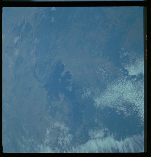
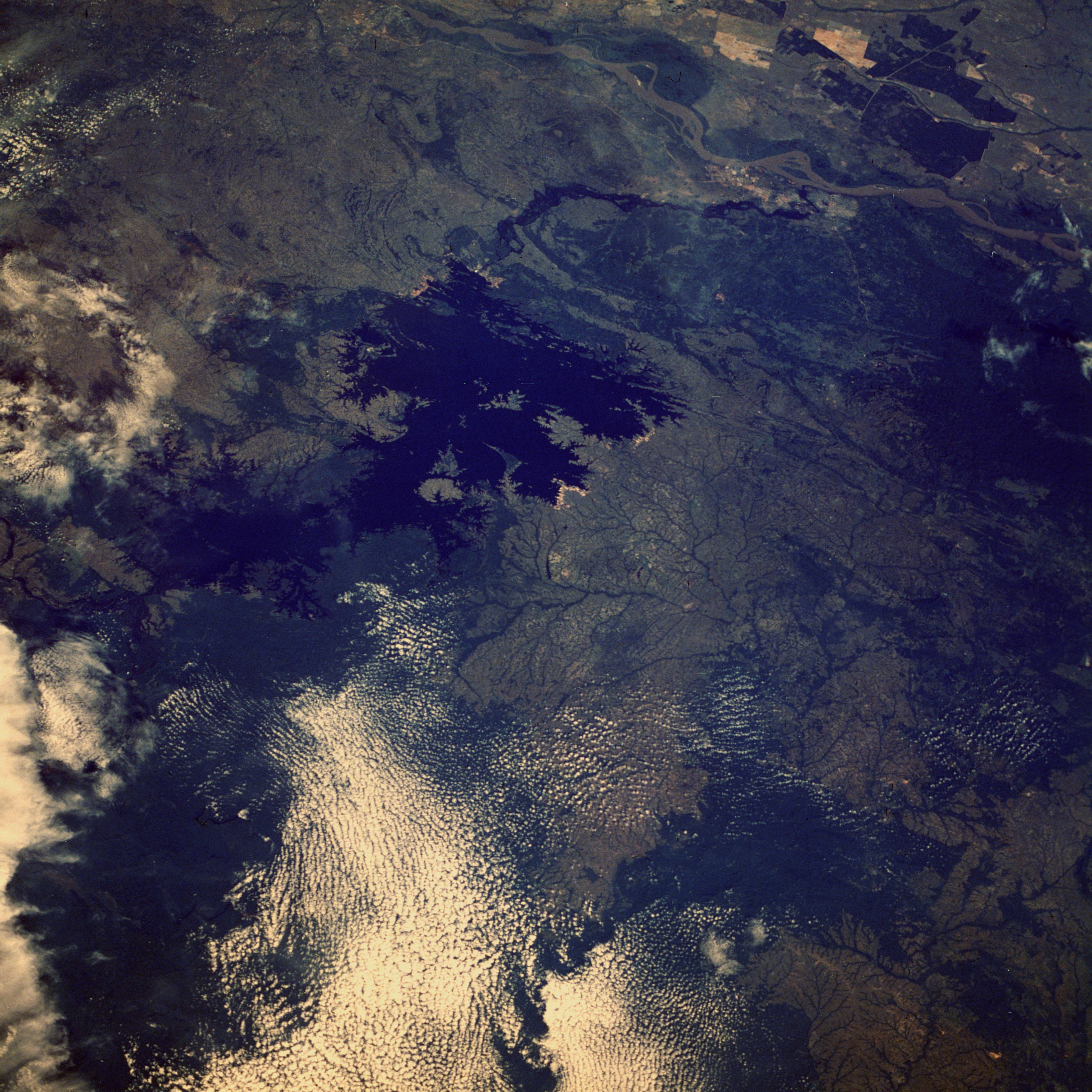
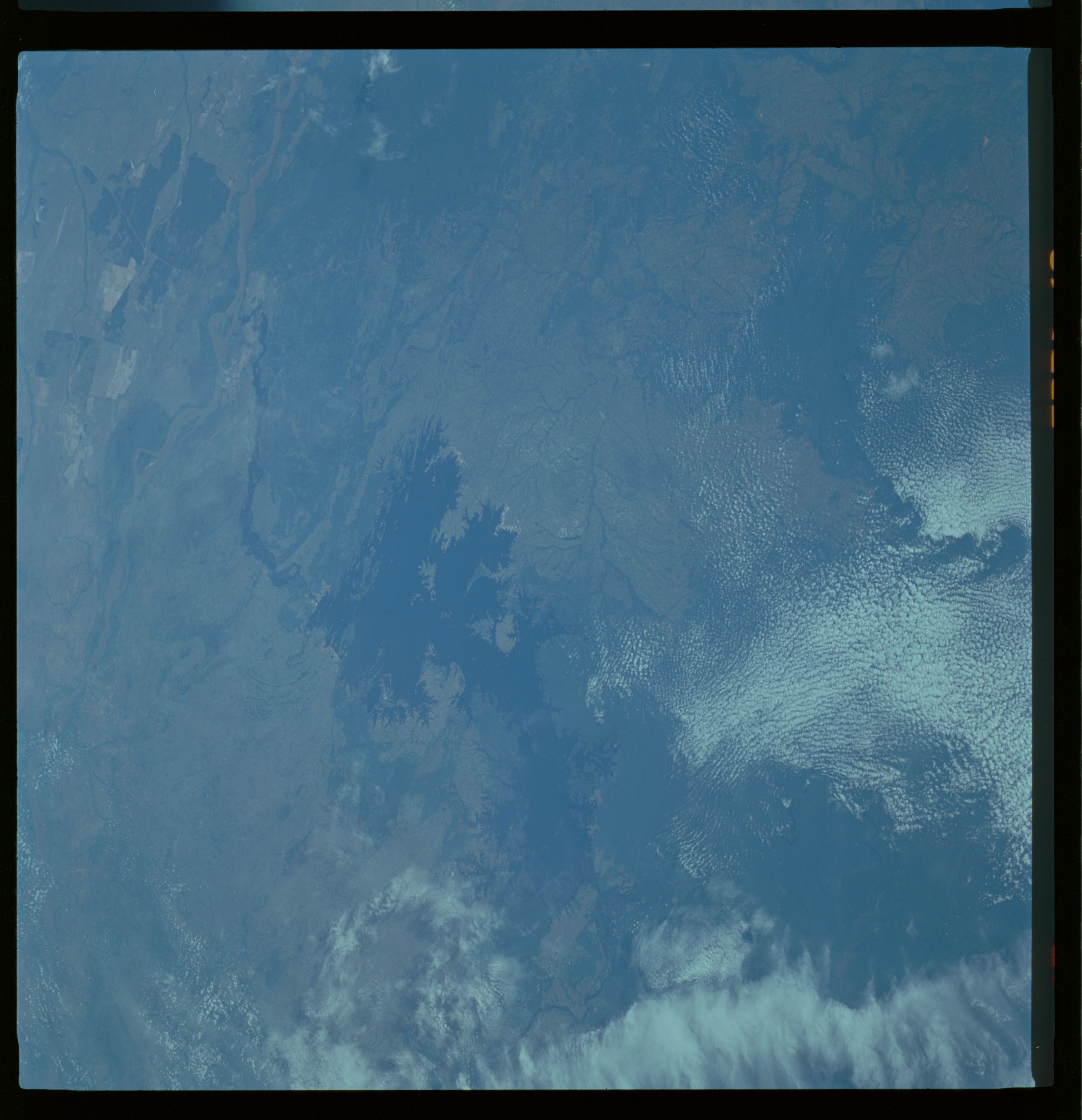
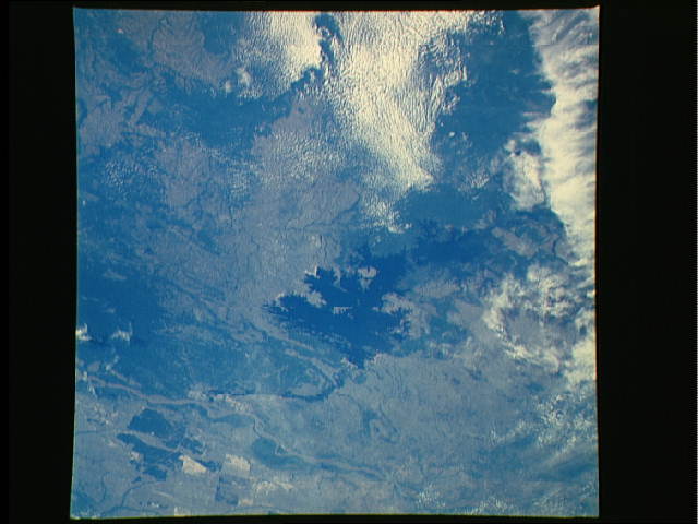
Image Caption: STS61A-489-0012 Caroni River and Guri Reservoir, Venezuela October 1985
The dark blue waters of the Guri Reservoir in southeastern Venezuela are visible in the center of this northwest-looking, low-oblique photograph. The Guri Reservoir, built on the Caroni River in the early 1980s, provides water and electricity for steel plants and other industries around Guayana and irrigation projects along the Caroni River. Upon its completion in mid-1986, the dam produced more than 10 gigawatts of electricity, the first in the world to do so. The Caroni River, which originates in southeastern Venezuela near the border with Guyana, flows northward 550 miles (885 kilometers) and joins the sediment-filled Orinoco River near the city of Guayana (not easily discernible in the photograph). Before this photograph was taken, much forest (dark green) had been cleared south of the Orinoco River; subsequently, much land near the southern end of the reservoir and upstream of the Caroni River has been deforested, leading to silting problems within the reservoir.
The dark blue waters of the Guri Reservoir in southeastern Venezuela are visible in the center of this northwest-looking, low-oblique photograph. The Guri Reservoir, built on the Caroni River in the early 1980s, provides water and electricity for steel plants and other industries around Guayana and irrigation projects along the Caroni River. Upon its completion in mid-1986, the dam produced more than 10 gigawatts of electricity, the first in the world to do so. The Caroni River, which originates in southeastern Venezuela near the border with Guyana, flows northward 550 miles (885 kilometers) and joins the sediment-filled Orinoco River near the city of Guayana (not easily discernible in the photograph). Before this photograph was taken, much forest (dark green) had been cleared south of the Orinoco River; subsequently, much land near the southern end of the reservoir and upstream of the Caroni River has been deforested, leading to silting problems within the reservoir.
