STS61A-48-71
| NASA Photo ID | STS61A-48-71 |
| Focal Length | 250mm |
| Date taken | 1985.11.03 |
| Time taken | 16:40:24 GMT |
Resolutions offered for this image:
5266 x 5266 pixels 639 x 639 pixels 5700 x 5900 pixels 500 x 518 pixels 640 x 480 pixels
5266 x 5266 pixels 639 x 639 pixels 5700 x 5900 pixels 500 x 518 pixels 640 x 480 pixels

Cloud masks available for this image:
Spacecraft nadir point: 29.0° N, 96.0° W
Photo center point: 28.5° N, 96.0° W
Photo center point by machine learning:
Photo center point: 28.5° N, 96.0° W
Photo center point by machine learning:
Nadir to Photo Center: South
Spacecraft Altitude: 177 nautical miles (328km)
Country or Geographic Name: | USA-TEXAS |
Features: | MATAGORDA BAY |
| Features Found Using Machine Learning: | |
Cloud Cover Percentage: | 0 (no clouds present) |
Sun Elevation Angle: | 41° |
Sun Azimuth: | 151° |
Camera: | Hasselblad |
Focal Length: | 250mm |
Camera Tilt: | 10 degrees |
Format: | 5017: Kodak, natural color positive, Ektachrome, X Professional, ASA 64, standard base |
Film Exposure: | Normal |
| Additional Information | |
| Width | Height | Annotated | Cropped | Purpose | Links |
|---|---|---|---|---|---|
| 5266 pixels | 5266 pixels | No | No | Earth From Space collection | Download Image |
| 639 pixels | 639 pixels | No | No | Earth From Space collection | Download Image |
| 5700 pixels | 5900 pixels | No | No | Download Image | |
| 500 pixels | 518 pixels | No | No | Download Image | |
| 640 pixels | 480 pixels | No | No | Download Image |
Download Packaged File
Download a Google Earth KML for this Image
View photo footprint information
Download a GeoTIFF for this photo
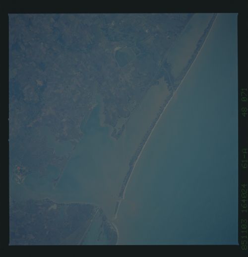
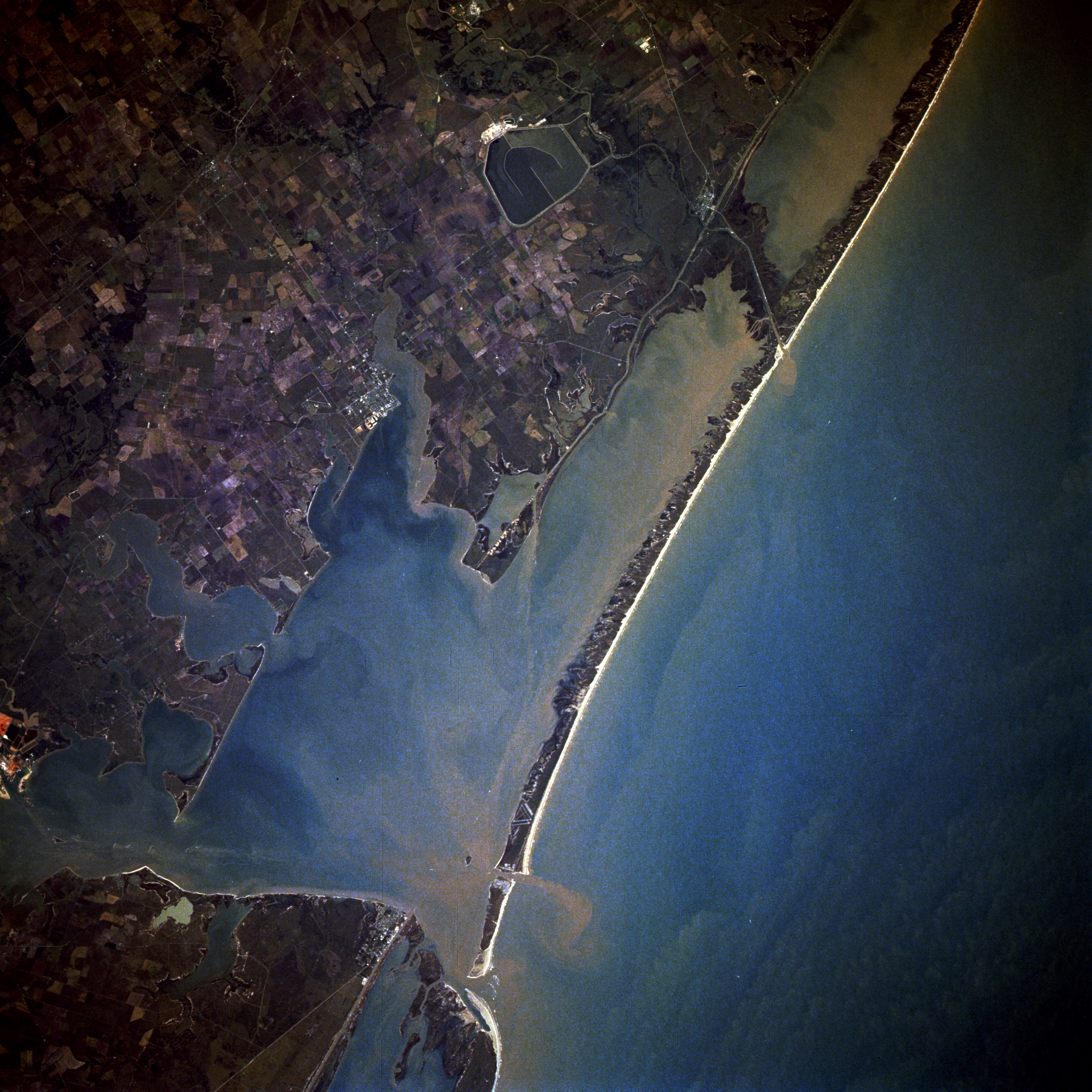
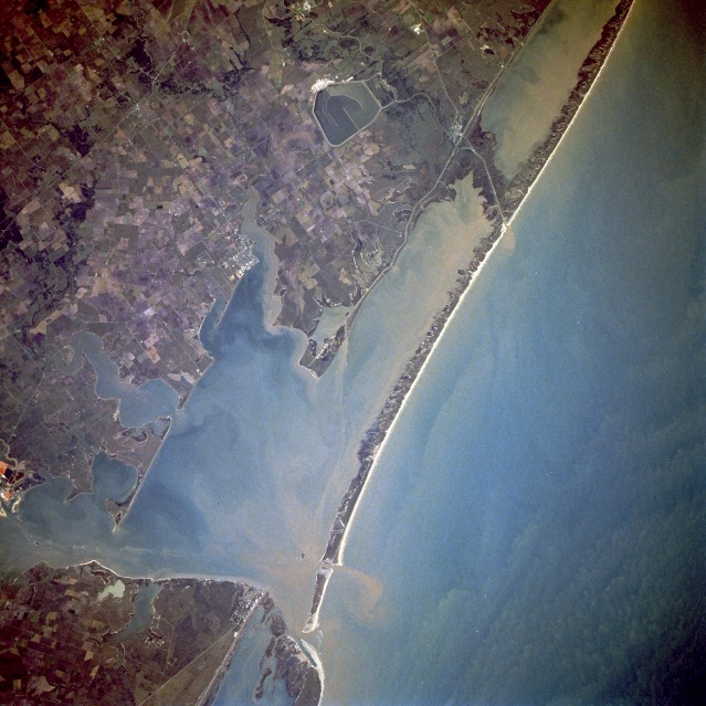
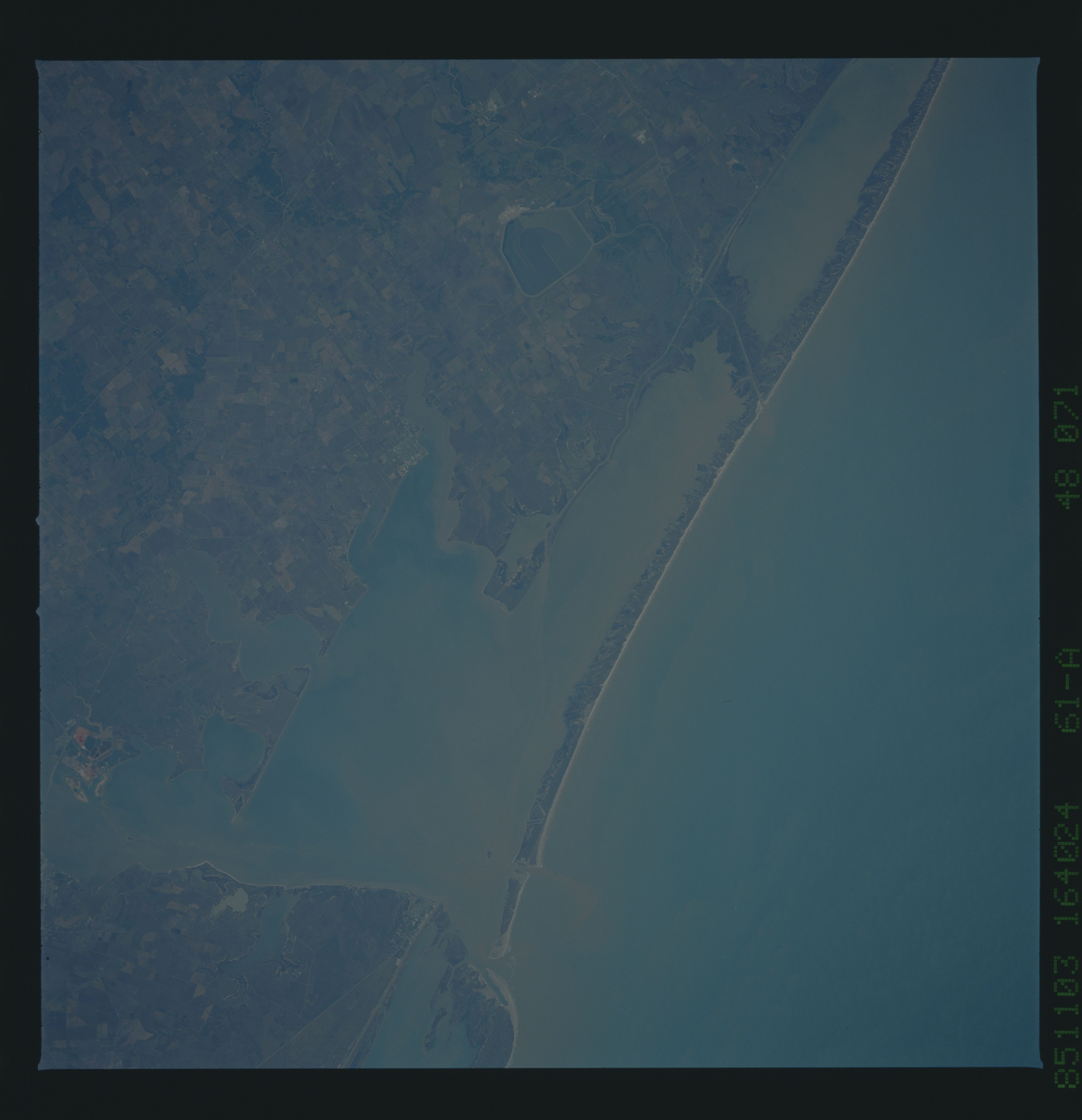
Image Caption: STS61A-48-0071 Matagorda Bay, Texas, U.S.A. November 1985
Sediment-filled Matagorda Bay and its arm, Lavaca Bay, to the northwest, comprise the centerpiece of this near-vertical photograph. Matagorda Bay, an inlet of the Gulf of Mexico, was first visited in 1685 by French explorer Robert LaSalle on his last expedition. Although the region is often hit with tropical storms and hurricanes, the bay, 50 miles (80 kilometers) long and 3 to 12 miles (5 to 19 kilometers) wide, is generally protected from the gulf by Matagorda Peninsula, a long sandspit, at the west end of which is the entrance to Matagorda Bay through Cavallo Pass; farther west and mostly out of the photograph is Matagorda Island, a sandbar on which Matagorda State Park is located. The small city of Port O'Connor, north of Cavallo Pass, is also discernible. At the east end of the bay is the small delta of the Colorado River, which is 900 miles (1448 kilometers) long and rises in the Staked Plains of northwest Texas. North of the delta, a large holding pond for a nuclear power plant can be seen. Although mostly a cattle-raising region, agriculture (rice, cotton, grain, corn, truck crops, fruit, dairy products, livestock, and poultry) is prevalent. The region around the bay is also noted for its fishing industries.
Sediment-filled Matagorda Bay and its arm, Lavaca Bay, to the northwest, comprise the centerpiece of this near-vertical photograph. Matagorda Bay, an inlet of the Gulf of Mexico, was first visited in 1685 by French explorer Robert LaSalle on his last expedition. Although the region is often hit with tropical storms and hurricanes, the bay, 50 miles (80 kilometers) long and 3 to 12 miles (5 to 19 kilometers) wide, is generally protected from the gulf by Matagorda Peninsula, a long sandspit, at the west end of which is the entrance to Matagorda Bay through Cavallo Pass; farther west and mostly out of the photograph is Matagorda Island, a sandbar on which Matagorda State Park is located. The small city of Port O'Connor, north of Cavallo Pass, is also discernible. At the east end of the bay is the small delta of the Colorado River, which is 900 miles (1448 kilometers) long and rises in the Staked Plains of northwest Texas. North of the delta, a large holding pond for a nuclear power plant can be seen. Although mostly a cattle-raising region, agriculture (rice, cotton, grain, corn, truck crops, fruit, dairy products, livestock, and poultry) is prevalent. The region around the bay is also noted for its fishing industries.
