STS61A-44-53
| NASA Photo ID | STS61A-44-53 |
| Focal Length | 250mm |
| Date taken | 1985.11.02 |
| Time taken | 22:08:11 GMT |
Resolutions offered for this image:
3907 x 3904 pixels 640 x 639 pixels 5700 x 5900 pixels 500 x 518 pixels 640 x 480 pixels
3907 x 3904 pixels 640 x 639 pixels 5700 x 5900 pixels 500 x 518 pixels 640 x 480 pixels
Cloud masks available for this image:
Spacecraft nadir point: 34.8° S, 138.5° E
Photo center point: 35.5° S, 138.5° E
Photo center point by machine learning:
Photo center point: 35.5° S, 138.5° E
Photo center point by machine learning:
Nadir to Photo Center: South
Spacecraft Altitude: 180 nautical miles (333km)
Country or Geographic Name: | AUSTRALIA-SA |
Features: | FLEURIEU PENINSULA |
| Features Found Using Machine Learning: | |
Cloud Cover Percentage: | 0 (no clouds present) |
Sun Elevation Angle: | 28° |
Sun Azimuth: | 88° |
Camera: | Hasselblad |
Focal Length: | 250mm |
Camera Tilt: | 13 degrees |
Format: | 5017: Kodak, natural color positive, Ektachrome, X Professional, ASA 64, standard base |
Film Exposure: | Normal |
| Additional Information | |
| Width | Height | Annotated | Cropped | Purpose | Links |
|---|---|---|---|---|---|
| 3907 pixels | 3904 pixels | No | No | Earth From Space collection | Download Image |
| 640 pixels | 639 pixels | No | No | Earth From Space collection | Download Image |
| 5700 pixels | 5900 pixels | No | No | Download Image | |
| 500 pixels | 518 pixels | No | No | Download Image | |
| 640 pixels | 480 pixels | No | No | Download Image |
Download Packaged File
Download a Google Earth KML for this Image
View photo footprint information
Download a GeoTIFF for this photo
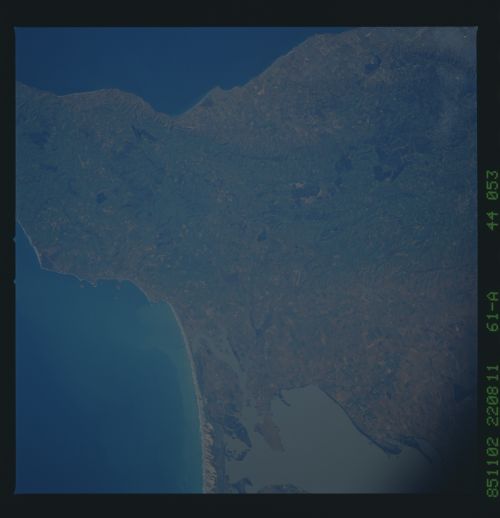
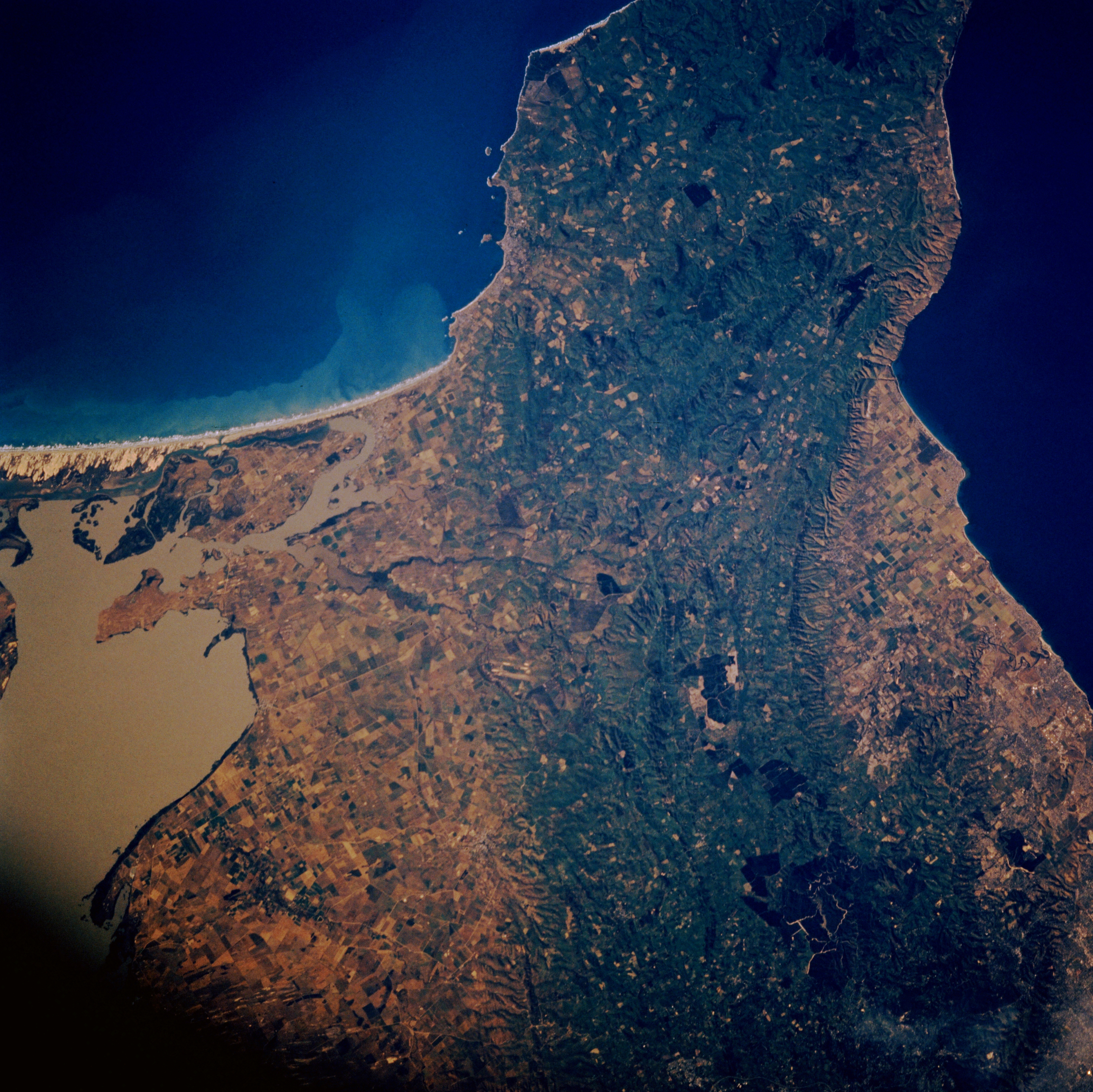
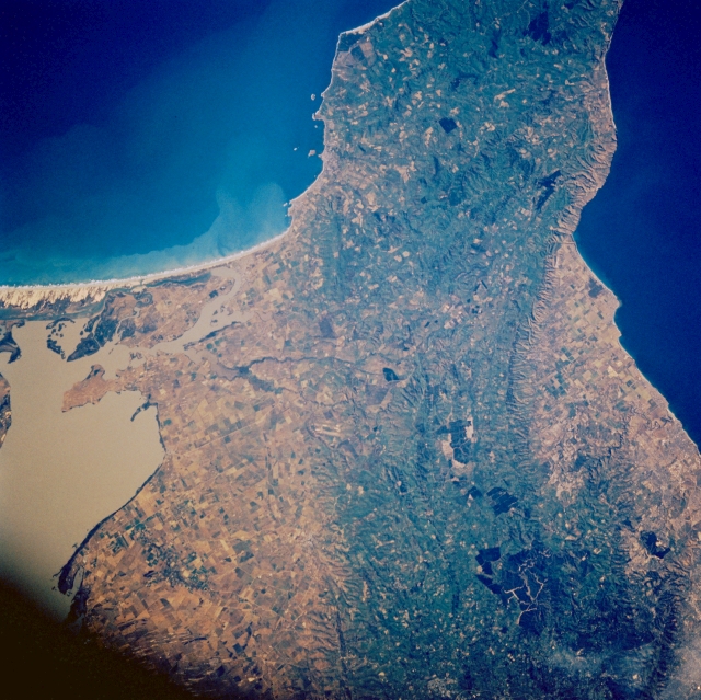
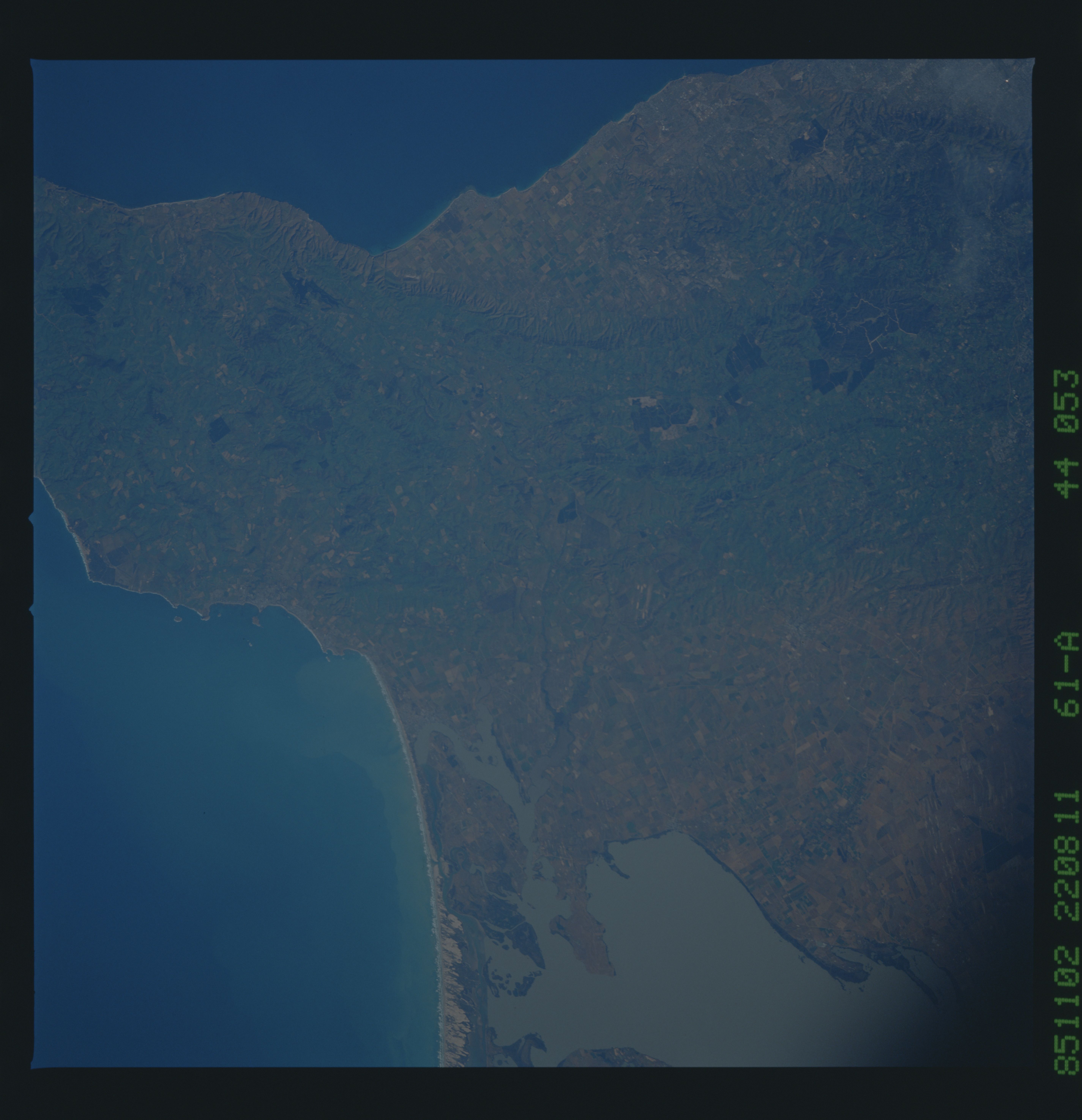
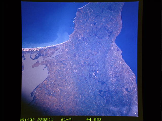
Image Caption: STS61A-44-0053 Fleurieu Peninsula, South Australia, Australia November 1985
The green, forested, low mountains of the Fleurieu Peninsula present an appealing landscape in southeastern South Australia. The gently curving mountains with maximum elevations exceeding 1400 feet (427 meters) above sea level are situated between Adelaide (just off the edge of the scene to the north) and the western extent of the coastal, sandy beaches of Younghusbands Peninsula (to the southeast). This region enjoys a mild Mediterranean climate which supports numerous vineyards. The muddy-looking body of water along the edge of the image is Lake Alexandrina, which connects the Murray River with the Indian Ocean. The dark blue waters of the Gulf of St. Vincent is visible along the opposite (western) edge of the picture.
The green, forested, low mountains of the Fleurieu Peninsula present an appealing landscape in southeastern South Australia. The gently curving mountains with maximum elevations exceeding 1400 feet (427 meters) above sea level are situated between Adelaide (just off the edge of the scene to the north) and the western extent of the coastal, sandy beaches of Younghusbands Peninsula (to the southeast). This region enjoys a mild Mediterranean climate which supports numerous vineyards. The muddy-looking body of water along the edge of the image is Lake Alexandrina, which connects the Murray River with the Indian Ocean. The dark blue waters of the Gulf of St. Vincent is visible along the opposite (western) edge of the picture.
