STS61A-43-78
| NASA Photo ID | STS61A-43-78 |
| Focal Length | 100mm |
| Date taken | 1985.11.02 |
| Time taken | 10:14:18 GMT |
Resolutions offered for this image:
3945 x 3912 pixels 639 x 634 pixels 5700 x 5900 pixels 500 x 518 pixels 640 x 480 pixels
3945 x 3912 pixels 639 x 634 pixels 5700 x 5900 pixels 500 x 518 pixels 640 x 480 pixels

Cloud masks available for this image:
Spacecraft nadir point: 12.1° N, 5.4° W
Photo center point: 16.0° N, 4.0° W
Photo center point by machine learning:
Photo center point: 16.0° N, 4.0° W
Photo center point by machine learning:
Nadir to Photo Center: North
Spacecraft Altitude: 175 nautical miles (324km)
Country or Geographic Name: | MALI |
Features: | NIGER DELTA, L. FAGUIBINE |
| Features Found Using Machine Learning: | |
Cloud Cover Percentage: | 20 (11-25)% |
Sun Elevation Angle: | 51° |
Sun Azimuth: | 133° |
Camera: | Hasselblad |
Focal Length: | 100mm |
Camera Tilt: | 55 degrees |
Format: | 5017: Kodak, natural color positive, Ektachrome, X Professional, ASA 64, standard base |
Film Exposure: | Normal |
| Additional Information | |
| Width | Height | Annotated | Cropped | Purpose | Links |
|---|---|---|---|---|---|
| 3945 pixels | 3912 pixels | No | No | Earth From Space collection | Download Image |
| 639 pixels | 634 pixels | No | No | Earth From Space collection | Download Image |
| 5700 pixels | 5900 pixels | No | No | Download Image | |
| 500 pixels | 518 pixels | No | No | Download Image | |
| 640 pixels | 480 pixels | No | No | Download Image |
Download Packaged File
Download a Google Earth KML for this Image
View photo footprint information
Download a GeoTIFF for this photo
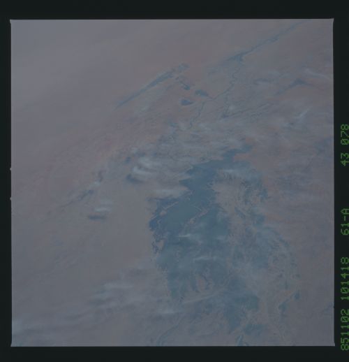
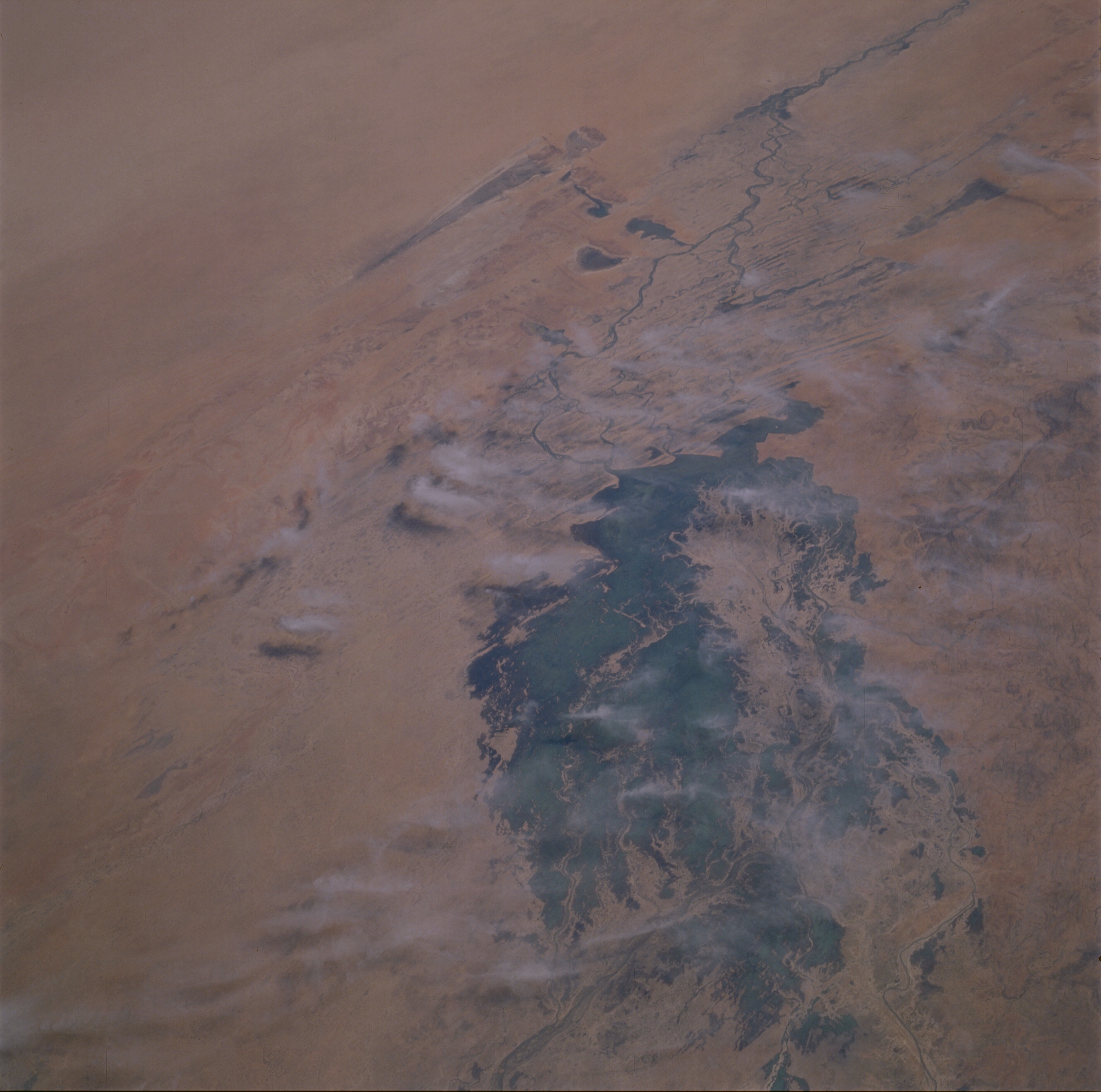
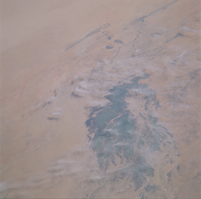
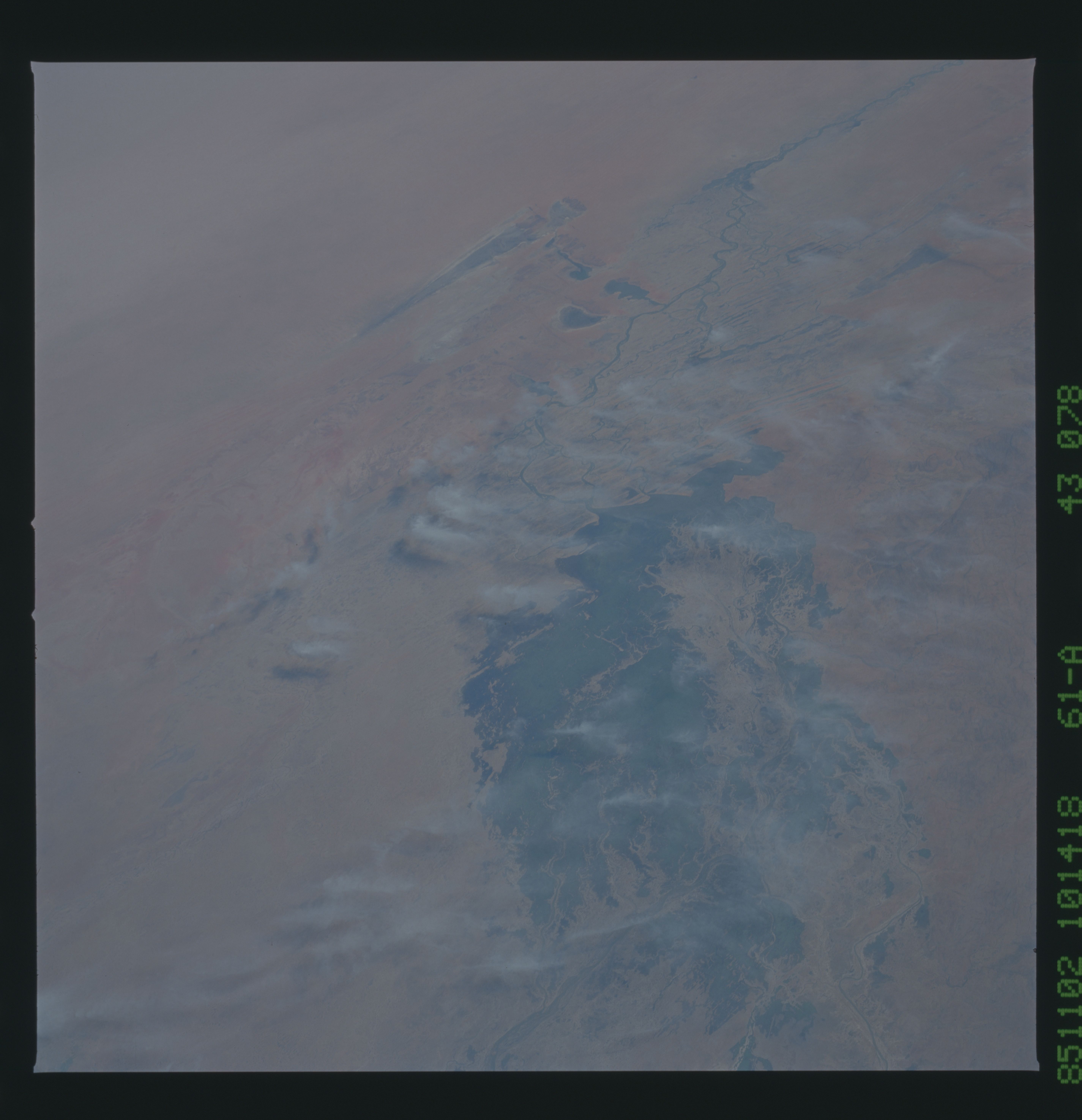
Image Caption: STS61A-43-0078 Inland Delta of the Niger River, Mali October 1985
Most of the area shown in this synoptic, low-oblique photograph was once a large inland lake. During the ice age about 12 000 to 15 000 years ago, more rain fell in north Africa than falls now. As the ice retreated northward and the temperature warmed, the Sahara Desert in north Africa received less rain and became much drier. Over centuries, the conditions that now exist developed. The old lake silt affords fertile, black soils with a relatively high humus content (darker, productive areas). The Inland Delta area of the Niger River in central Mali is a very important agricultural region where large-scale, mechanized cultivation occurs because of effective irrigation practices. Even though devastating droughts have occurred during the last several decades, some ranches exist. This entire region falls climatically into the steppe or semiarid category, normally averaging between 10 and 20 inches (25 and 50 centimeters) of precipitation annually. The region is part of Africa known as the Sahel, a semiarid zone that extends across most of Africa between the southern margin of the arid Sahara Desert and the moist tropical savanna to the south. In this zone, chronic drought and desertification have contributed to famines during the decades from the 1960s through the 1980s. East-west trending, longitudinal sand dunes can be observed along the northeastern meanders of the Niger River as it flows gradually to the east-northeast. Orientation of the sand dunes has routed tributaries into a natural trellis irrigation system within the delta.
Most of the area shown in this synoptic, low-oblique photograph was once a large inland lake. During the ice age about 12 000 to 15 000 years ago, more rain fell in north Africa than falls now. As the ice retreated northward and the temperature warmed, the Sahara Desert in north Africa received less rain and became much drier. Over centuries, the conditions that now exist developed. The old lake silt affords fertile, black soils with a relatively high humus content (darker, productive areas). The Inland Delta area of the Niger River in central Mali is a very important agricultural region where large-scale, mechanized cultivation occurs because of effective irrigation practices. Even though devastating droughts have occurred during the last several decades, some ranches exist. This entire region falls climatically into the steppe or semiarid category, normally averaging between 10 and 20 inches (25 and 50 centimeters) of precipitation annually. The region is part of Africa known as the Sahel, a semiarid zone that extends across most of Africa between the southern margin of the arid Sahara Desert and the moist tropical savanna to the south. In this zone, chronic drought and desertification have contributed to famines during the decades from the 1960s through the 1980s. East-west trending, longitudinal sand dunes can be observed along the northeastern meanders of the Niger River as it flows gradually to the east-northeast. Orientation of the sand dunes has routed tributaries into a natural trellis irrigation system within the delta.
