STS61A-34-23
| NASA Photo ID | STS61A-34-23 |
| Focal Length | 250mm |
| Date taken | 1985.10.31 |
| Time taken | 17:26:26 GMT |
Resolutions offered for this image:
3904 x 3902 pixels 639 x 639 pixels 5700 x 5900 pixels 500 x 518 pixels 640 x 480 pixels
3904 x 3902 pixels 639 x 639 pixels 5700 x 5900 pixels 500 x 518 pixels 640 x 480 pixels
Cloud masks available for this image:
Spacecraft nadir point: 43.8° N, 73.7° W
Photo center point: 44.5° N, 74.0° W
Photo center point by machine learning:
Photo center point: 44.5° N, 74.0° W
Photo center point by machine learning:
Nadir to Photo Center: North
Spacecraft Altitude: 180 nautical miles (333km)
Country or Geographic Name: | USA-NEW YORK |
Features: | ADIRONDACK MOUNTAINS |
| Features Found Using Machine Learning: | |
Cloud Cover Percentage: | 0 (no clouds present) |
Sun Elevation Angle: | 31° |
Sun Azimuth: | 193° |
Camera: | Hasselblad |
Focal Length: | 250mm |
Camera Tilt: | 14 degrees |
Format: | 5017: Kodak, natural color positive, Ektachrome, X Professional, ASA 64, standard base |
Film Exposure: | Normal |
| Additional Information | |
| Width | Height | Annotated | Cropped | Purpose | Links |
|---|---|---|---|---|---|
| 3904 pixels | 3902 pixels | No | No | Earth From Space collection | Download Image |
| 639 pixels | 639 pixels | No | No | Earth From Space collection | Download Image |
| 5700 pixels | 5900 pixels | No | No | Download Image | |
| 500 pixels | 518 pixels | No | No | Download Image | |
| 640 pixels | 480 pixels | No | No | Download Image |
Download Packaged File
Download a Google Earth KML for this Image
View photo footprint information
Download a GeoTIFF for this photo
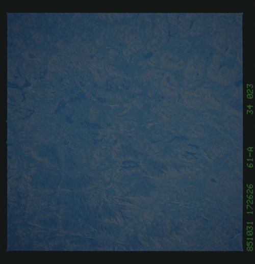
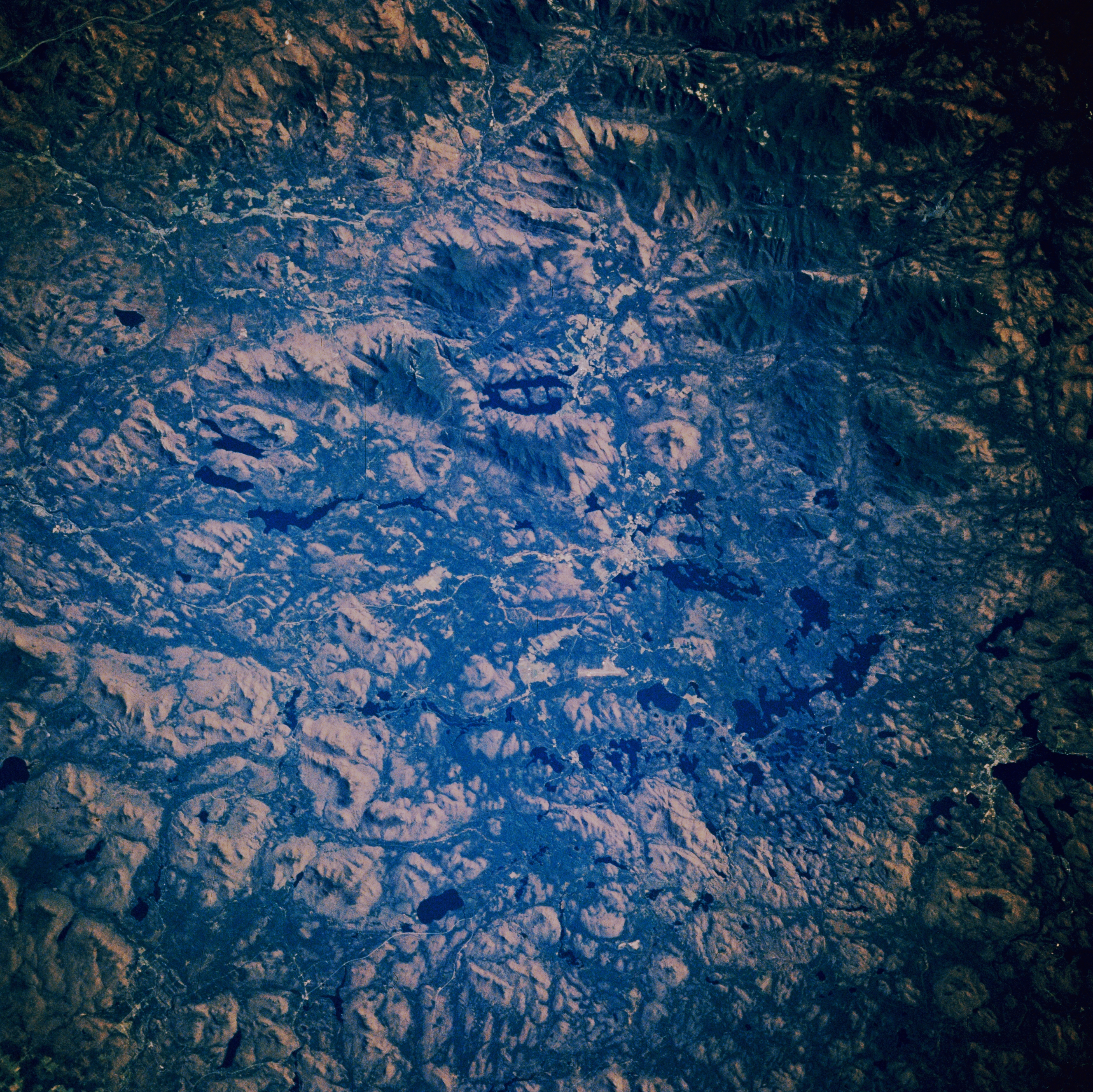
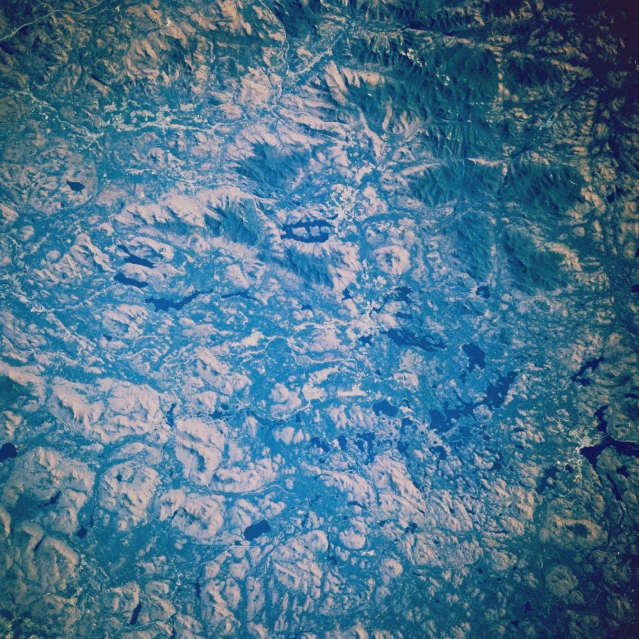
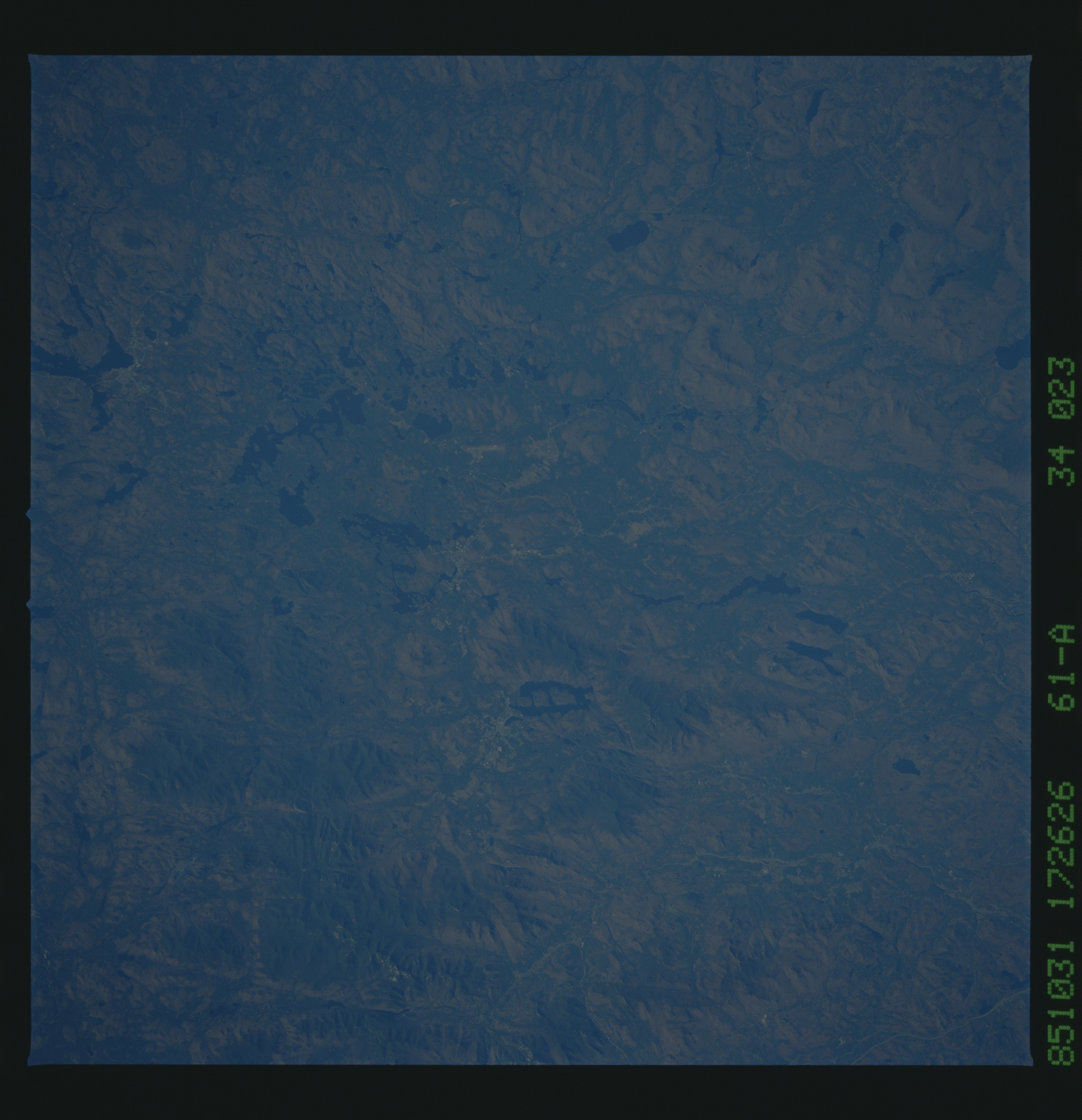
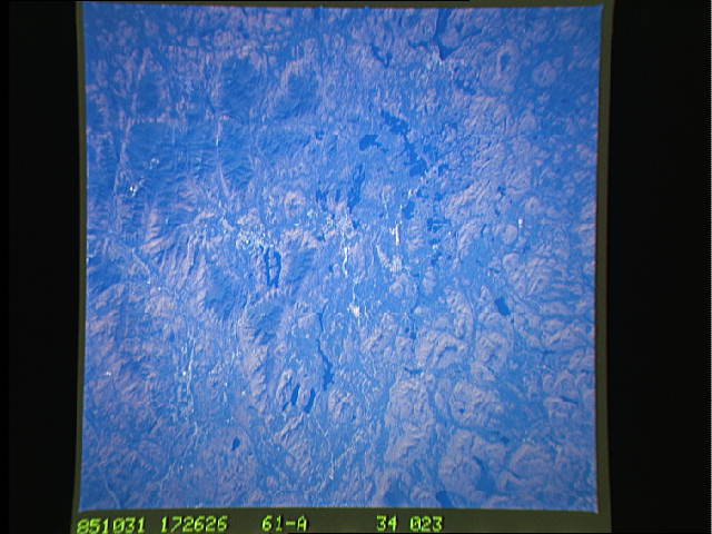
Image Caption: STS61A-34-0023 Adirondack Mountains, Lake Placid, New York November 1985
The peculiar ladder-shaped Lake Placid (just above the center of the image) can be seen in this near-nadir view. Numerous forested hills, valleys, and lakes of the northeastern Adirondack Mountains are also visible. The shape of Lake Placid, as seen on the image, was formed many thousands of years ago by cris-crossing fracture zones, stream erosion, and glaciation. The lake is nearly 5 miles (8 km) long. The uplifted Adirondacks are new mountains, geologically speaking, carved from very old rocks nearly three billion years old. Eroded over the many years and sculptured by glaciers, the Adirondacks continue to rise at about 3 millimeters a year. The highland areas around Lake Placid, site of the 1932 and 1980 Winter Olympic Games, offers spectacular scenery and attracts many thousands of visitors every year.
The peculiar ladder-shaped Lake Placid (just above the center of the image) can be seen in this near-nadir view. Numerous forested hills, valleys, and lakes of the northeastern Adirondack Mountains are also visible. The shape of Lake Placid, as seen on the image, was formed many thousands of years ago by cris-crossing fracture zones, stream erosion, and glaciation. The lake is nearly 5 miles (8 km) long. The uplifted Adirondacks are new mountains, geologically speaking, carved from very old rocks nearly three billion years old. Eroded over the many years and sculptured by glaciers, the Adirondacks continue to rise at about 3 millimeters a year. The highland areas around Lake Placid, site of the 1932 and 1980 Winter Olympic Games, offers spectacular scenery and attracts many thousands of visitors every year.
