STS61A-33-46
| NASA Photo ID | STS61A-33-46 |
| Focal Length | 100mm |
| Date taken | 1985.10.31 |
| Time taken | 17:26:14 GMT |
Resolutions offered for this image:
3936 x 3904 pixels 639 x 634 pixels 5700 x 5900 pixels 500 x 518 pixels 640 x 480 pixels
3936 x 3904 pixels 639 x 634 pixels 5700 x 5900 pixels 500 x 518 pixels 640 x 480 pixels
Cloud masks available for this image:
Spacecraft nadir point: 43.1° N, 74.6° W
Photo center point: 44.0° N, 73.5° W
Photo center point by machine learning:
Photo center point: 44.0° N, 73.5° W
Photo center point by machine learning:
Nadir to Photo Center: Northeast
Spacecraft Altitude: 180 nautical miles (333km)
Country or Geographic Name: | USA-NEW YORK |
Features: | LAKE CHAMPLAIN |
| Features Found Using Machine Learning: | |
Cloud Cover Percentage: | 0 (no clouds present) |
Sun Elevation Angle: | 31° |
Sun Azimuth: | 192° |
Camera: | Hasselblad |
Focal Length: | 100mm |
Camera Tilt: | 25 degrees |
Format: | 5017: Kodak, natural color positive, Ektachrome, X Professional, ASA 64, standard base |
Film Exposure: | Normal |
| Additional Information | |
| Width | Height | Annotated | Cropped | Purpose | Links |
|---|---|---|---|---|---|
| 3936 pixels | 3904 pixels | No | No | Earth From Space collection | Download Image |
| 639 pixels | 634 pixels | No | No | Earth From Space collection | Download Image |
| 5700 pixels | 5900 pixels | No | No | Download Image | |
| 500 pixels | 518 pixels | No | No | Download Image | |
| 640 pixels | 480 pixels | No | No | Download Image |
Download Packaged File
Download a Google Earth KML for this Image
View photo footprint information
Download a GeoTIFF for this photo
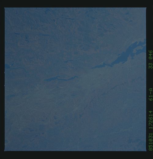
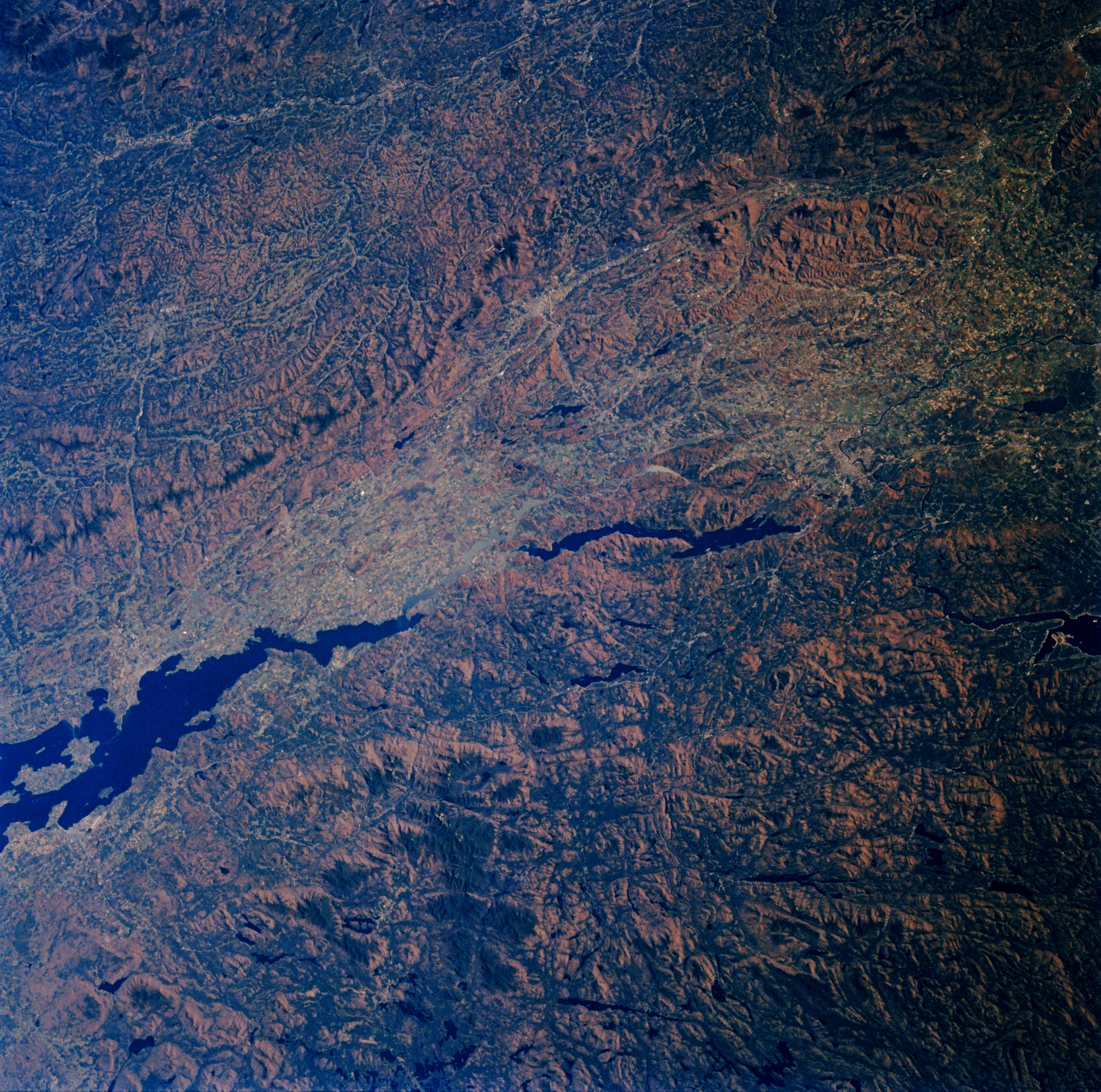
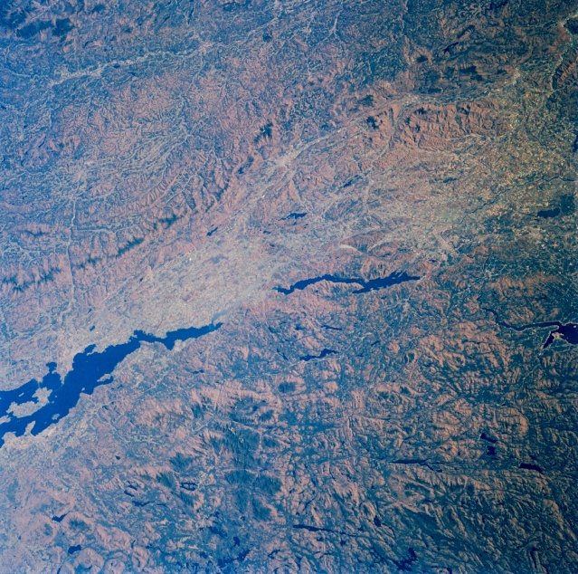
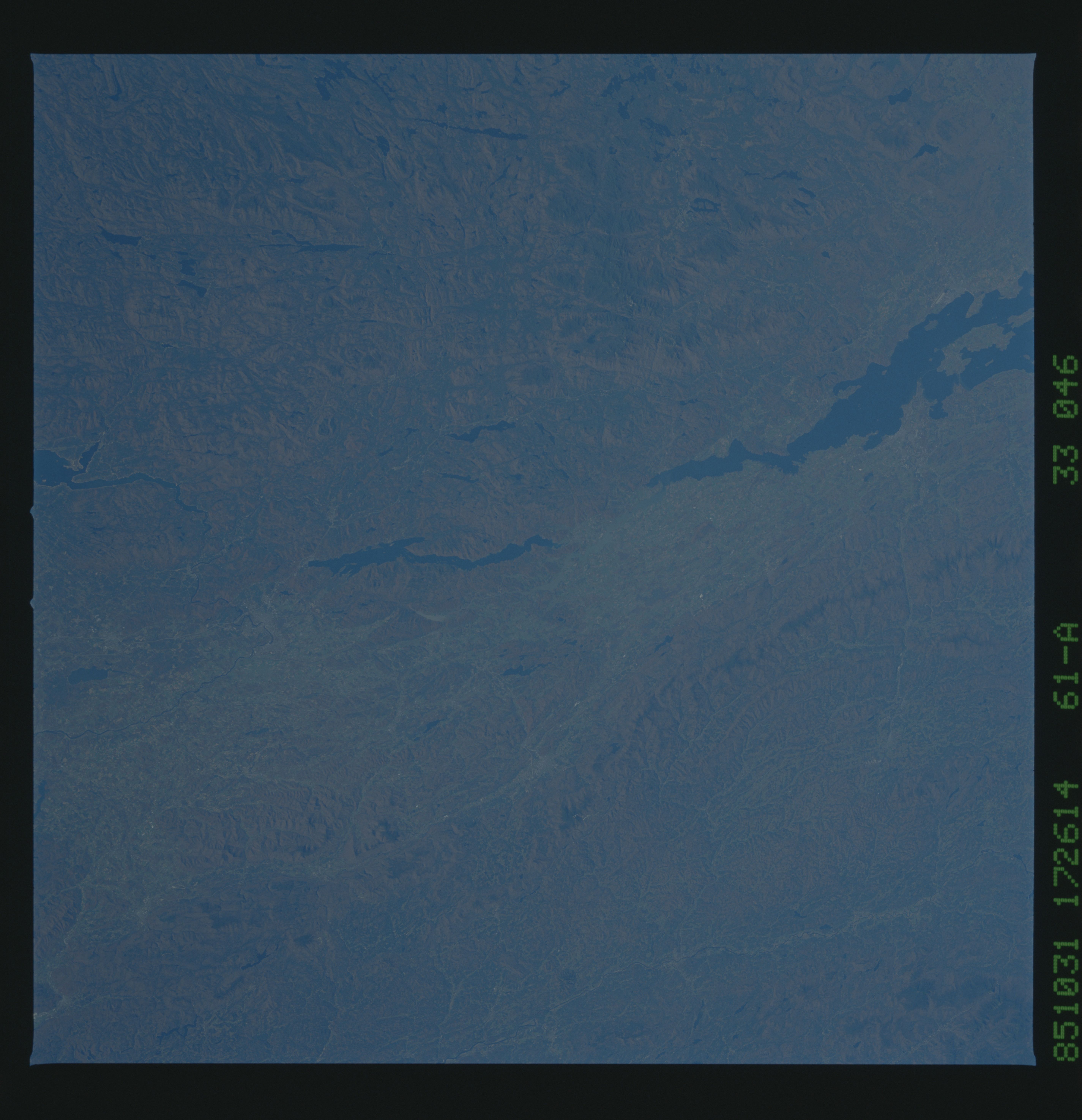
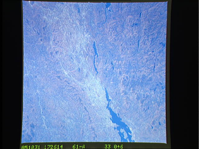
Image Caption: STS61A-33-0046 Adirondack Mountains, Lake Champlain, and Green Mountains, New York and Vermont, U.S.A. November 1985
This east-southeast-looking, low-oblique photograph captures the southern half of Lake Champlain (midway between bottom left and left center) and the Lake Champlain Plain, which separates the Adirondack Mountains (lower half) of New York and the Green Mountains (upper half) of Vermont. Composed of some of the oldest rocks in North America, the Green Mountains of Vermont, a range of the Appalachians and a year-round resort and recreational area, have low, rounded peaks; fertile valleys; and many streams. Lake George, the center of a large resort and recreational region in the foothills of the Adirondacks, is 33 miles (53 kilometers) long and 1 to 3 miles (1 to 5 kilometers) wide. The lake and surrounding area were the location of many battles of the French and Indian War and the American Revolution.
This east-southeast-looking, low-oblique photograph captures the southern half of Lake Champlain (midway between bottom left and left center) and the Lake Champlain Plain, which separates the Adirondack Mountains (lower half) of New York and the Green Mountains (upper half) of Vermont. Composed of some of the oldest rocks in North America, the Green Mountains of Vermont, a range of the Appalachians and a year-round resort and recreational area, have low, rounded peaks; fertile valleys; and many streams. Lake George, the center of a large resort and recreational region in the foothills of the Adirondacks, is 33 miles (53 kilometers) long and 1 to 3 miles (1 to 5 kilometers) wide. The lake and surrounding area were the location of many battles of the French and Indian War and the American Revolution.
