STS61A-32-30
| NASA Photo ID | STS61A-32-30 |
| Focal Length | 250mm |
| Date taken | 1985.10.31 |
| Time taken | 03:36:46 GMT |
Resolutions offered for this image:
4096 x 4096 pixels 640 x 640 pixels 5700 x 5900 pixels 500 x 518 pixels 640 x 480 pixels 520 x 512 pixels
4096 x 4096 pixels 640 x 640 pixels 5700 x 5900 pixels 500 x 518 pixels 640 x 480 pixels 520 x 512 pixels

Cloud masks available for this image:
Spacecraft nadir point: 13.2° N, 107.1° E
Photo center point: 13.5° N, 106.0° E
Photo center point by machine learning:
Photo center point: 13.5° N, 106.0° E
Photo center point by machine learning:
Nadir to Photo Center: West
Spacecraft Altitude: 176 nautical miles (326km)
Country or Geographic Name: | CAMBODIA |
Features: | MEKONG RIVER |
| Features Found Using Machine Learning: | |
Cloud Cover Percentage: | 0 (no clouds present) |
Sun Elevation Angle: | 59° |
Sun Azimuth: | 151° |
Camera: | Hasselblad |
Focal Length: | 250mm |
Camera Tilt: | 21 degrees |
Format: | 5017: Kodak, natural color positive, Ektachrome, X Professional, ASA 64, standard base |
Film Exposure: | Normal |
| Additional Information | |
| Width | Height | Annotated | Cropped | Purpose | Links |
|---|---|---|---|---|---|
| 4096 pixels | 4096 pixels | No | No | Earth From Space collection | Download Image |
| 640 pixels | 640 pixels | No | No | Earth From Space collection | Download Image |
| 5700 pixels | 5900 pixels | No | No | Download Image | |
| 500 pixels | 518 pixels | No | No | Download Image | |
| 640 pixels | 480 pixels | No | No | Download Image | |
| 520 pixels | 512 pixels | Download Image |
Download Packaged File
Download a Google Earth KML for this Image
View photo footprint information
Download a GeoTIFF for this photo
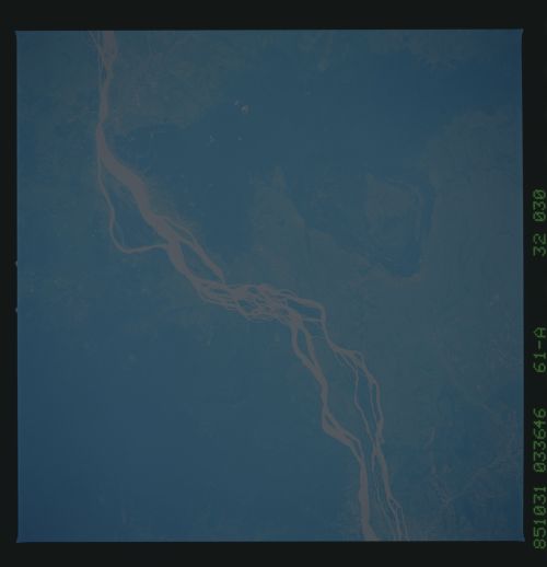
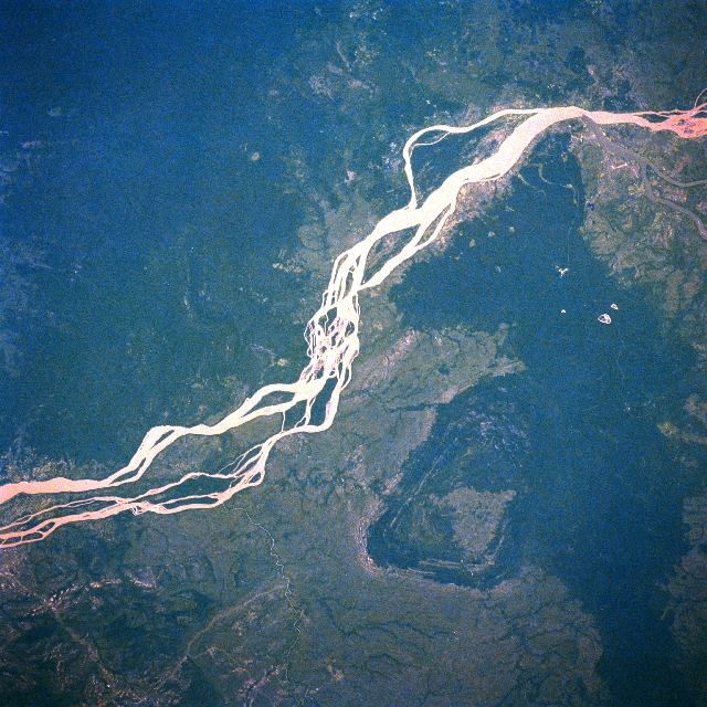
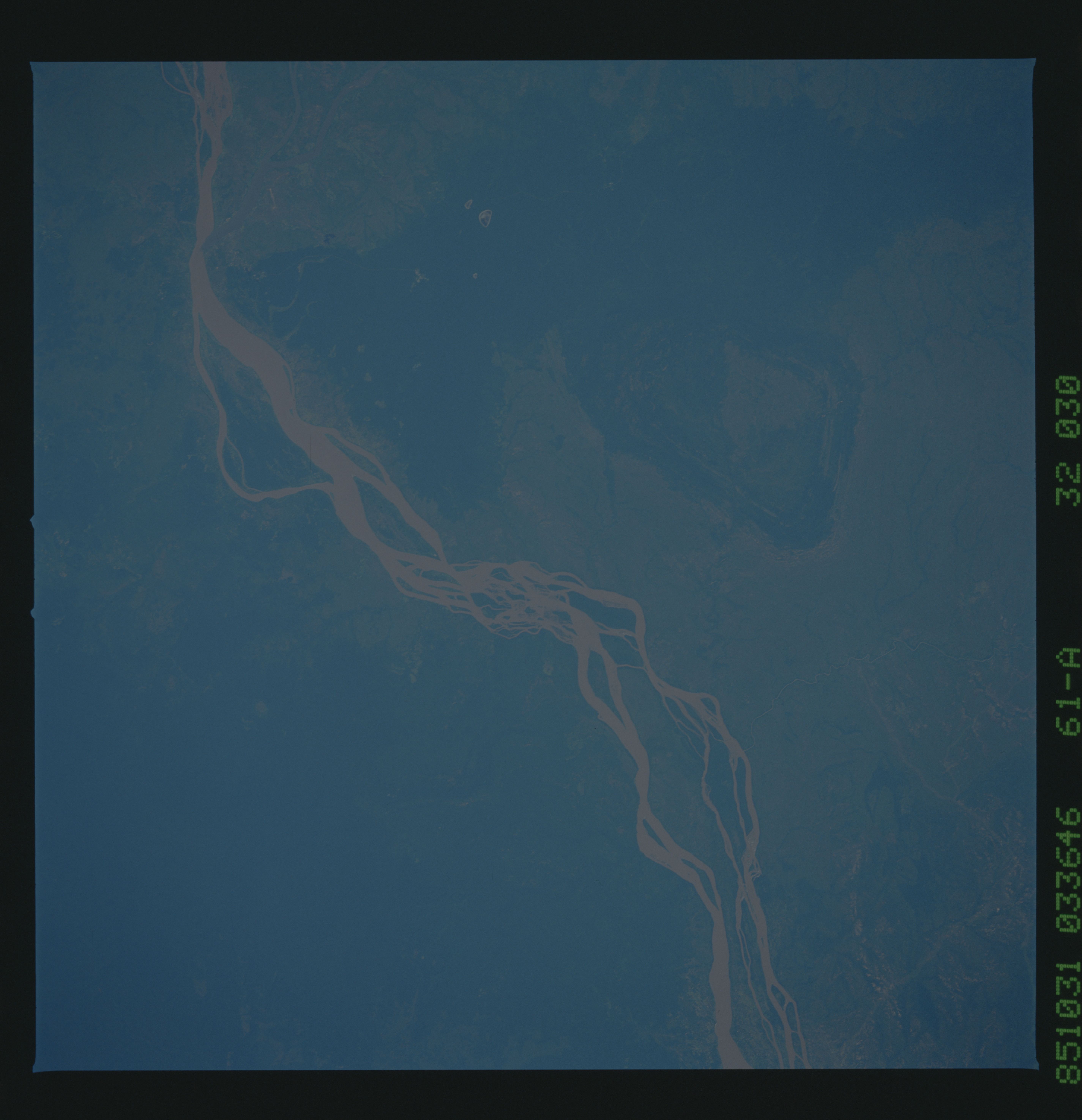
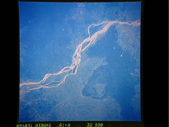
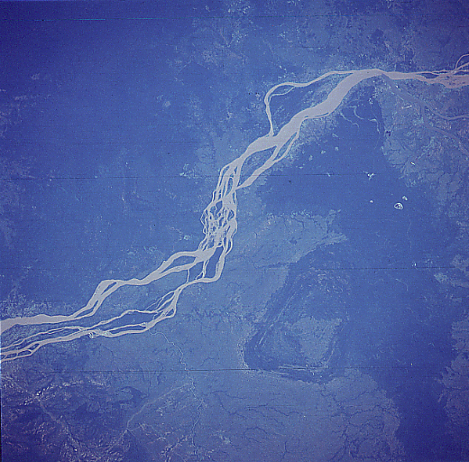
Image Caption: STS61A-32-0030 Mekong River, Cambodia November 1985
The muddy Mekong River with its multiple intersecting stream channels extends southward (upper right to lower left) in this near vertical view of southeast Cambodia. The area covered in this image extends from just north of Kracheh to the Stoeng Treng area (upper right). This section of the Mekong passes largely through undeveloped jungle covered terrain. The dark topography (right center) along the upper east side of the river is a slightly elevated, densely forested landscape. STS61A-32-0029 shows another section of the Mekong River in Cambodia southwest of this scene and immediately northeast of Phnom Penh.
The muddy Mekong River with its multiple intersecting stream channels extends southward (upper right to lower left) in this near vertical view of southeast Cambodia. The area covered in this image extends from just north of Kracheh to the Stoeng Treng area (upper right). This section of the Mekong passes largely through undeveloped jungle covered terrain. The dark topography (right center) along the upper east side of the river is a slightly elevated, densely forested landscape. STS61A-32-0029 shows another section of the Mekong River in Cambodia southwest of this scene and immediately northeast of Phnom Penh.
