STS61A-32-29

| NASA Photo ID | STS61A-32-29 |
| Focal Length | 250mm |
| Date taken | 1985.10.31 |
| Time taken | 03:36:26 GMT |
Resolutions offered for this image:
4096 x 4096 pixels 640 x 640 pixels 5700 x 5900 pixels 500 x 518 pixels 640 x 480 pixels 505 x 514 pixels
4096 x 4096 pixels 640 x 640 pixels 5700 x 5900 pixels 500 x 518 pixels 640 x 480 pixels 505 x 514 pixels


Cloud masks available for this image:
Spacecraft nadir point: 12.1° N, 106.4° E
Photo center point: 12.0° N, 105.5° E
Photo center point by machine learning:
Photo center point: 12.0° N, 105.5° E
Photo center point by machine learning:
Nadir to Photo Center: West
Spacecraft Altitude: 176 nautical miles (326km)
Country or Geographic Name: | CAMBODIA |
Features: | MEKONG RIVER, SUNGLINT |
| Features Found Using Machine Learning: | |
Cloud Cover Percentage: | 5 (1-10)% |
Sun Elevation Angle: | 59° |
Sun Azimuth: | 149° |
Camera: | Hasselblad |
Focal Length: | 250mm |
Camera Tilt: | 17 degrees |
Format: | 5017: Kodak, natural color positive, Ektachrome, X Professional, ASA 64, standard base |
Film Exposure: | Normal |
| Additional Information | |
| Width | Height | Annotated | Cropped | Purpose | Links |
|---|---|---|---|---|---|
| 4096 pixels | 4096 pixels | No | No | Earth From Space collection | Download Image |
| 640 pixels | 640 pixels | No | No | Earth From Space collection | Download Image |
| 5700 pixels | 5900 pixels | No | No | Download Image | |
| 500 pixels | 518 pixels | No | No | Download Image | |
| 640 pixels | 480 pixels | No | No | Download Image | |
| 505 pixels | 514 pixels | Download Image |
Download Packaged File
Download a Google Earth KML for this Image
View photo footprint information
Download a GeoTIFF for this photo
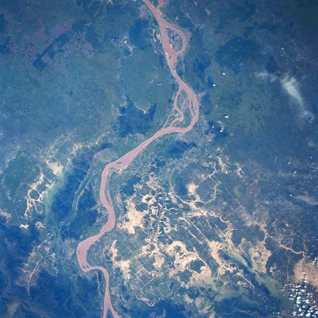
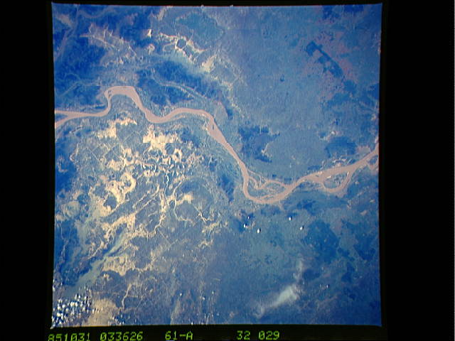
Image Caption: STS61A-32-0029 Mekong River, Cambodia November 1985
A section of the muddy-looking Mekong River meanders through the low-lying, swampy terrain in south central Cambodia. This section of the Mekong drains from the northeast (upper center) to the southwest (lower center). The capital of Cambodia, Phnom Penh, is located along the west bank of the river, a few miles south of the bottom edge of the image. As seen in this image, the torrential rains that come with the wet summer-fall monsoons in this part of southeast Asia taxes the carrying capacity of the Mekong River. The rice fields south of the river reflect a high degree of flooding (numerous light-colored patterns bottom half of the image). The linear, intersecting lines are primarily irrigation canals that crisscross the rice producing landscape. The irregular-shaped, darker landscapes near the main channel of the Mekong are undeveloped, swampy areas, while the angular, dark patterns (upper third) are plantations. STS61A-32-0030 is another image of the Mekong River taken roughly 40 miles (64 km) northeast of this area in Cambodia.
A section of the muddy-looking Mekong River meanders through the low-lying, swampy terrain in south central Cambodia. This section of the Mekong drains from the northeast (upper center) to the southwest (lower center). The capital of Cambodia, Phnom Penh, is located along the west bank of the river, a few miles south of the bottom edge of the image. As seen in this image, the torrential rains that come with the wet summer-fall monsoons in this part of southeast Asia taxes the carrying capacity of the Mekong River. The rice fields south of the river reflect a high degree of flooding (numerous light-colored patterns bottom half of the image). The linear, intersecting lines are primarily irrigation canals that crisscross the rice producing landscape. The irregular-shaped, darker landscapes near the main channel of the Mekong are undeveloped, swampy areas, while the angular, dark patterns (upper third) are plantations. STS61A-32-0030 is another image of the Mekong River taken roughly 40 miles (64 km) northeast of this area in Cambodia.
