STS51I-42-26

| NASA Photo ID | STS51I-42-26 |
| Focal Length | 250mm |
| Date taken | 1985.08.30 |
| Time taken | 06:54:15 GMT |
Resolutions offered for this image:
3904 x 3904 pixels 639 x 639 pixels 5700 x 5900 pixels 500 x 518 pixels 640 x 480 pixels
3904 x 3904 pixels 639 x 639 pixels 5700 x 5900 pixels 500 x 518 pixels 640 x 480 pixels

Cloud masks available for this image:
Spacecraft nadir point: 24.3° S, 114.7° E
Photo center point: 24.5° S, 115.5° E
Photo center point by machine learning:
Photo center point: 24.5° S, 115.5° E
Photo center point by machine learning:
Nadir to Photo Center: East
Spacecraft Altitude: 172 nautical miles (319km)
Country or Geographic Name: | AUSTRALIA-WA |
Features: | LYONS RIVER |
| Features Found Using Machine Learning: | |
Cloud Cover Percentage: | 0 (no clouds present) |
Sun Elevation Angle: | 40° |
Sun Azimuth: | 307° |
Camera: | Hasselblad |
Focal Length: | 250mm |
Camera Tilt: | 16 degrees |
Format: | 5017: Kodak, natural color positive, Ektachrome, X Professional, ASA 64, standard base |
Film Exposure: | Normal |
| Additional Information | |
| Width | Height | Annotated | Cropped | Purpose | Links |
|---|---|---|---|---|---|
| 3904 pixels | 3904 pixels | No | No | Earth From Space collection | Download Image |
| 639 pixels | 639 pixels | No | No | Earth From Space collection | Download Image |
| 5700 pixels | 5900 pixels | No | No | Download Image | |
| 500 pixels | 518 pixels | No | No | Download Image | |
| 640 pixels | 480 pixels | No | No | Download Image |
Download Packaged File
Download a Google Earth KML for this Image
View photo footprint information
Download a GeoTIFF for this photo
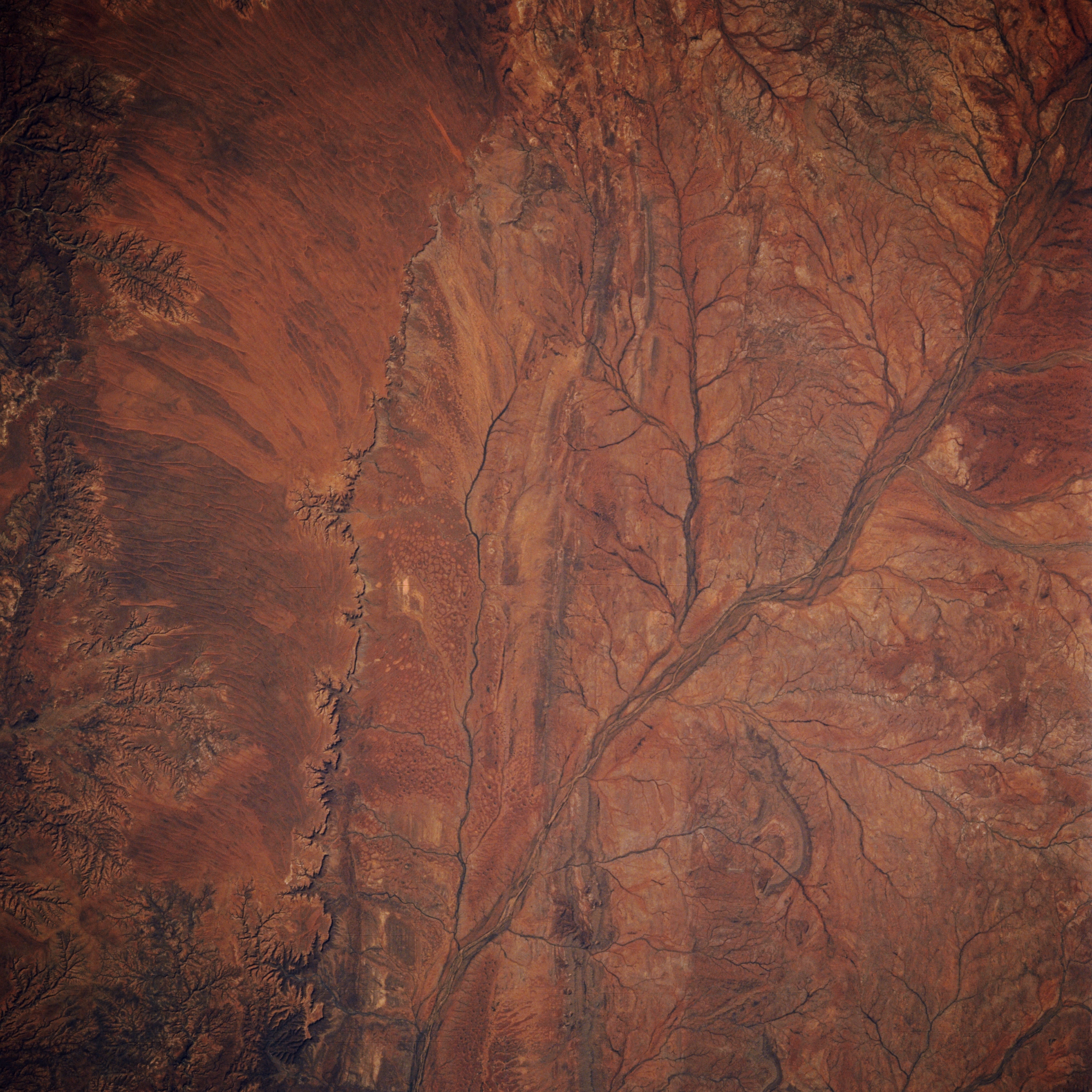
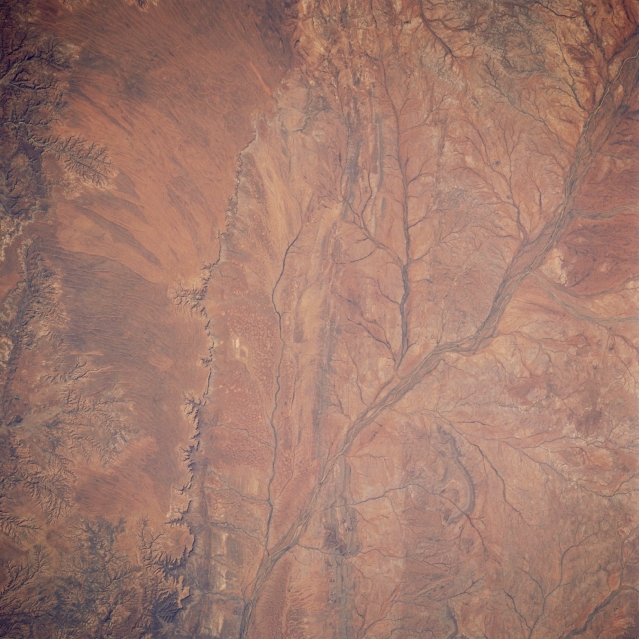
Image Caption: STS51I-42-0026 Lyons River, Western Australia, Australia August 1985
The eastern edge of the Kennedy Range (left side of image) forms the western boundary of this section of the Lyons River in west central Western Australia. In fact, the 1000 foot (305 meter) contour line can be traced along a north-south oriented escarpment (steep faced slope with shadows) in the left third of the image. The multi-braided stream channels of the Lyons River has produced a fairly broad floodplain (upper right to bottom center). Several tributary streams (also oriented generally north-south) drain into the main stream channel of the Lyon River. All of the drainage features are ephemeral in this desert environment.
The eastern edge of the Kennedy Range (left side of image) forms the western boundary of this section of the Lyons River in west central Western Australia. In fact, the 1000 foot (305 meter) contour line can be traced along a north-south oriented escarpment (steep faced slope with shadows) in the left third of the image. The multi-braided stream channels of the Lyons River has produced a fairly broad floodplain (upper right to bottom center). Several tributary streams (also oriented generally north-south) drain into the main stream channel of the Lyon River. All of the drainage features are ephemeral in this desert environment.
