STS51I-39-8
| NASA Photo ID | STS51I-39-8 |
| Focal Length | 250mm |
| Date taken | 1985.09.02 |
| Time taken | 06:32:36 GMT |
Resolutions offered for this image:
5248 x 5248 pixels 640 x 640 pixels 5700 x 5900 pixels 500 x 518 pixels 640 x 480 pixels
5248 x 5248 pixels 640 x 640 pixels 5700 x 5900 pixels 500 x 518 pixels 640 x 480 pixels
Cloud masks available for this image:
Spacecraft nadir point: 3.0° N, 34.1° E
Photo center point: 4.0° N, 36.0° E
Photo center point by machine learning:
Photo center point: 4.0° N, 36.0° E
Photo center point by machine learning:
Nadir to Photo Center: Northeast
Spacecraft Altitude: 219 nautical miles (406km)
Country or Geographic Name: | KENYA |
Features: | LAKE RUDOLF, OMO RIVER |
| Features Found Using Machine Learning: | |
Cloud Cover Percentage: | 0 (no clouds present) |
Sun Elevation Angle: | 42° |
Sun Azimuth: | 82° |
Camera: | Hasselblad |
Focal Length: | 250mm |
Camera Tilt: | 30 degrees |
Format: | 5017: Kodak, natural color positive, Ektachrome, X Professional, ASA 64, standard base |
Film Exposure: | Normal |
| Additional Information | |
| Width | Height | Annotated | Cropped | Purpose | Links |
|---|---|---|---|---|---|
| 5248 pixels | 5248 pixels | No | No | Earth From Space collection | Download Image |
| 640 pixels | 640 pixels | No | No | Earth From Space collection | Download Image |
| 5700 pixels | 5900 pixels | No | No | Download Image | |
| 500 pixels | 518 pixels | No | No | Download Image | |
| 640 pixels | 480 pixels | No | No | Download Image |
Download Packaged File
Download a Google Earth KML for this Image
View photo footprint information
Download a GeoTIFF for this photo
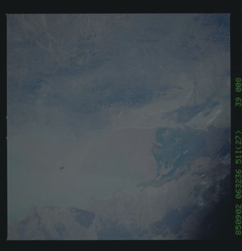
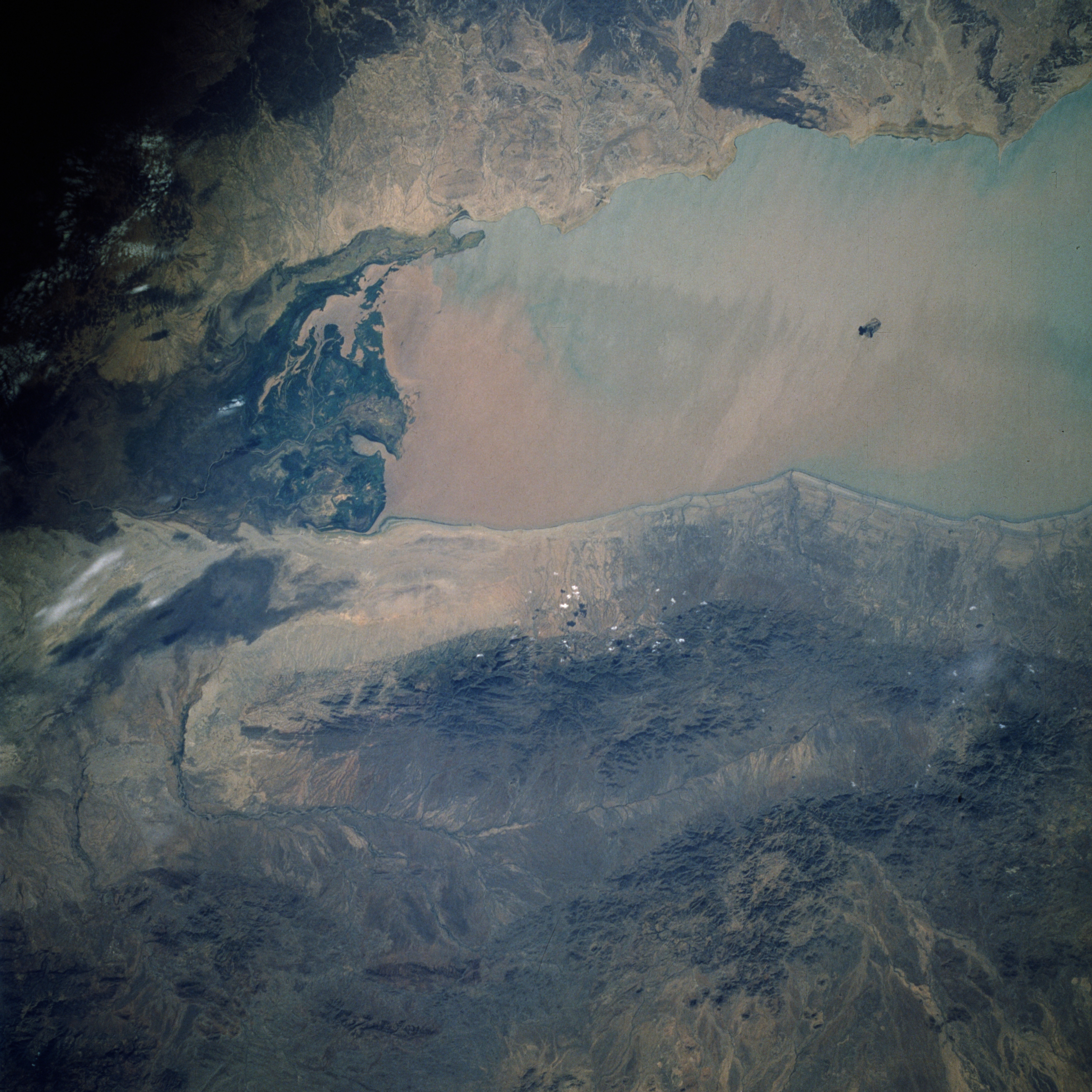
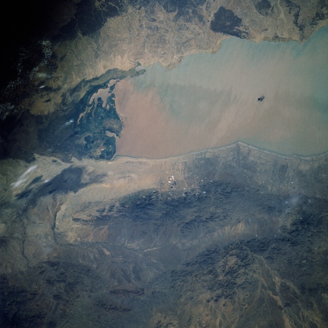
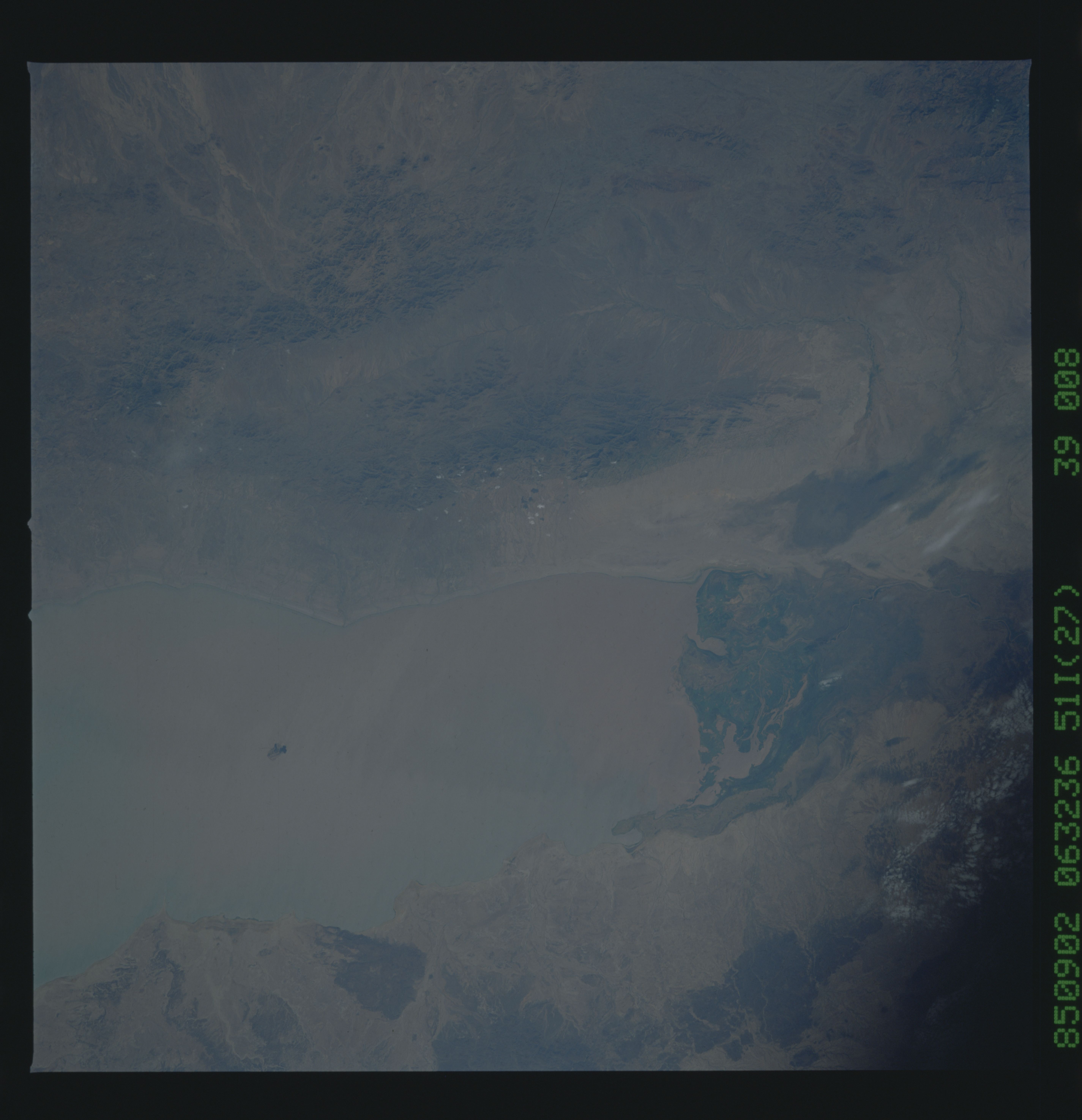
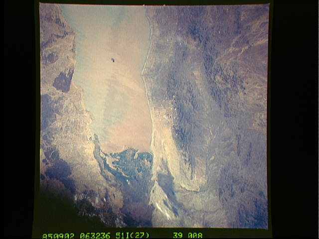
Image Caption: STS51I-39-0008 Omo River Delta and Lake Turkana, Ethiopia and Kenya August 1985
The Omo River Delta, growing and expanding into Lake Turkana (Lake Rudolf) can be seen in this near-vertical photograph as the dark green area at the north end of the lake. A small island, remnant of an old volcanic peak, can be seen in the middle of the lake south of the delta. Before 1950, the Omo River, 400 miles (650 kilometers) long, with headwaters in the Ethiopian Highlands, emptied into the lake with little sedimentation. Lake Turkana, 154 miles (250 kilometers) long and 10 to 20 miles (16 to 32 kilometers) wide, is part of the Great Rift Valley of eastern Africa. Deforestation in the southern Ethiopian Highlands began in earnest in the 1950s and continues today. Since 1960 a delta has been forming and expanding outward into a very deep Lake Rudolf. Even with this influx of fresh water, Lake Rudolf, surrounded on all sides by volcanoes, has no natural outlet; thus, its water is becoming more saline each year. Fish, the staple of the local villagers' diet, are declining in numbers as the lake water becomes more laden with sediment and salt.
The Omo River Delta, growing and expanding into Lake Turkana (Lake Rudolf) can be seen in this near-vertical photograph as the dark green area at the north end of the lake. A small island, remnant of an old volcanic peak, can be seen in the middle of the lake south of the delta. Before 1950, the Omo River, 400 miles (650 kilometers) long, with headwaters in the Ethiopian Highlands, emptied into the lake with little sedimentation. Lake Turkana, 154 miles (250 kilometers) long and 10 to 20 miles (16 to 32 kilometers) wide, is part of the Great Rift Valley of eastern Africa. Deforestation in the southern Ethiopian Highlands began in earnest in the 1950s and continues today. Since 1960 a delta has been forming and expanding outward into a very deep Lake Rudolf. Even with this influx of fresh water, Lake Rudolf, surrounded on all sides by volcanoes, has no natural outlet; thus, its water is becoming more saline each year. Fish, the staple of the local villagers' diet, are declining in numbers as the lake water becomes more laden with sediment and salt.
