STS51G-34-61
| NASA Photo ID | STS51G-34-61 |
| Focal Length | 250mm |
| Date taken | 1985.06.18 |
| Time taken | 17:06:08 GMT |
Resolutions offered for this image:
5700 x 5900 pixels 500 x 518 pixels 640 x 480 pixels 2513 x 2514 pixels 2513 x 2514 pixels 1778 x 1775 pixels 655 x 457 pixels 655 x 457 pixels 768 x 768 pixels
5700 x 5900 pixels 500 x 518 pixels 640 x 480 pixels 2513 x 2514 pixels 2513 x 2514 pixels 1778 x 1775 pixels 655 x 457 pixels 655 x 457 pixels 768 x 768 pixels


Cloud masks available for this image:
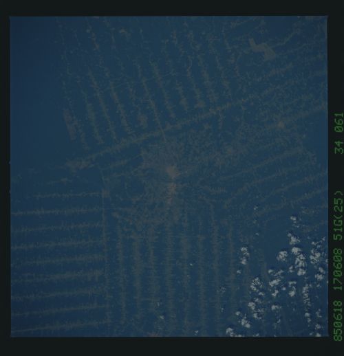
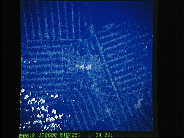
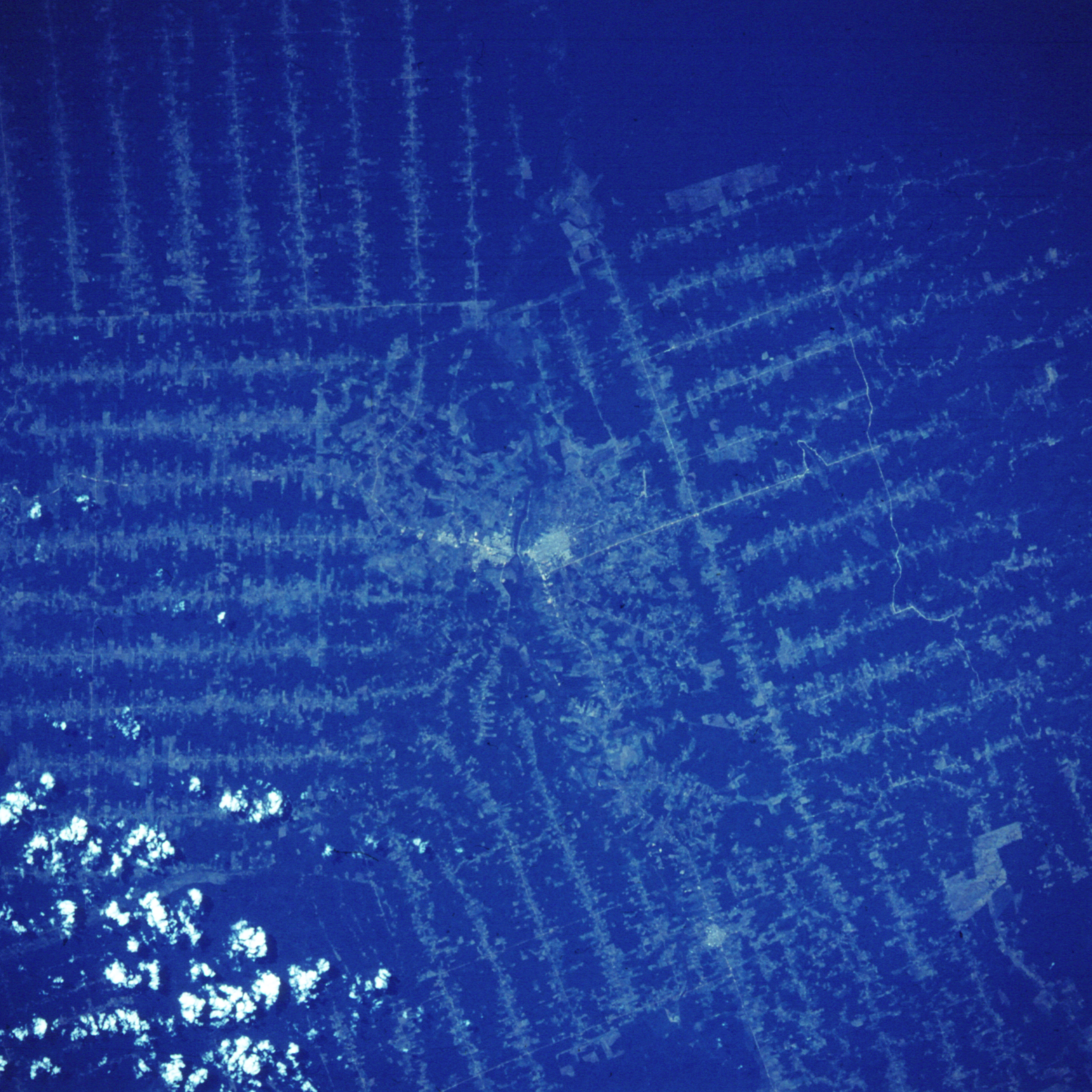
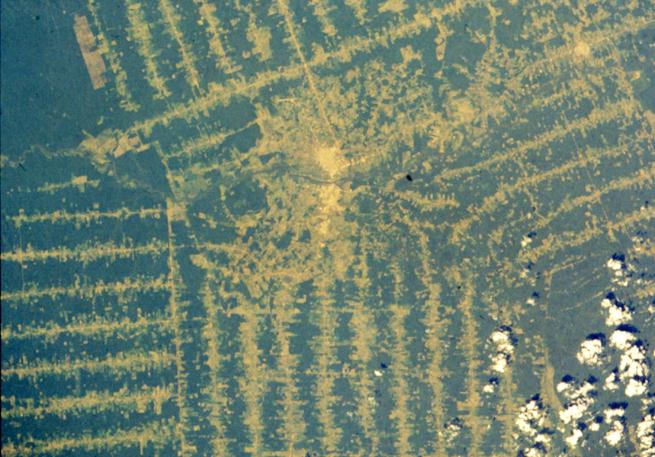
Spacecraft nadir point: 10.3° S, 61.6° W
Photo center point: 11.0° S, 62.0° W
Photo center point by machine learning:
Photo center point: 11.0° S, 62.0° W
Photo center point by machine learning:
Nadir to Photo Center: Southwest
Spacecraft Altitude: 193 nautical miles (357km)
Country or Geographic Name: | BRAZIL |
Features: | DEFORESTATION, RIO JAMARI |
| Features Found Using Machine Learning: | |
Cloud Cover Percentage: | 10 (1-10)% |
Sun Elevation Angle: | 53° |
Sun Azimuth: | 337° |
Camera: | Hasselblad |
Focal Length: | 250mm |
Camera Tilt: | 14 degrees |
Format: | 5017: Kodak, natural color positive, Ektachrome, X Professional, ASA 64, standard base |
Film Exposure: | Under Exposed |
| Additional Information | |
| Width | Height | Annotated | Cropped | Purpose | Links |
|---|---|---|---|---|---|
| 5700 pixels | 5900 pixels | No | No | Download Image | |
| 500 pixels | 518 pixels | No | No | Download Image | |
| 640 pixels | 480 pixels | No | No | Download Image | |
| 2513 pixels | 2514 pixels | Download Image | |||
| 2513 pixels | 2514 pixels | Download Image | |||
| 1778 pixels | 1775 pixels | Download Image | |||
| 655 pixels | 457 pixels | Download Image | |||
| 655 pixels | 457 pixels | Download Image | |||
| 768 pixels | 768 pixels | Download Image |
Download Packaged File
Download a Google Earth KML for this Image
View photo footprint information
Download a GeoTIFF for this photo
Image Caption: Rondonia Brazil clearings, 1985. Compare this view with the 1997 view (NM21-761-76).
