STS51G-34-17
| NASA Photo ID | STS51G-34-17 |
| Focal Length | 100mm |
| Date taken | 1985.06.18 |
| Time taken | 11:01:24 GMT |
Resolutions offered for this image:
5700 x 5900 pixels 500 x 518 pixels 640 x 480 pixels 1284 x 1288 pixels
5700 x 5900 pixels 500 x 518 pixels 640 x 480 pixels 1284 x 1288 pixels


Cloud masks available for this image:
Spacecraft nadir point: 13.5° S, 38.2° E
Photo center point: 10.5° S, 34.5° E
Photo center point by machine learning:
Photo center point: 10.5° S, 34.5° E
Photo center point by machine learning:
Nadir to Photo Center: Northwest
Spacecraft Altitude: 193 nautical miles (357km)
Country or Geographic Name: | MALAWI |
Features: | LAKE NYASA, SMOKE |
| Features Found Using Machine Learning: | |
Cloud Cover Percentage: | 70 (51-75)% |
Sun Elevation Angle: | 46° |
Sun Azimuth: | 327° |
Camera: | Hasselblad |
Focal Length: | 100mm |
Camera Tilt: | High Oblique |
Format: | 5017: Kodak, natural color positive, Ektachrome, X Professional, ASA 64, standard base |
Film Exposure: | Under Exposed |
| Additional Information | |
| Width | Height | Annotated | Cropped | Purpose | Links |
|---|---|---|---|---|---|
| 5700 pixels | 5900 pixels | No | No | Download Image | |
| 500 pixels | 518 pixels | No | No | Download Image | |
| 640 pixels | 480 pixels | No | No | Download Image | |
| 1284 pixels | 1288 pixels | No | No | Download Image |
Download Packaged File
Download a Google Earth KML for this Image
View photo footprint information
Download a GeoTIFF for this photo
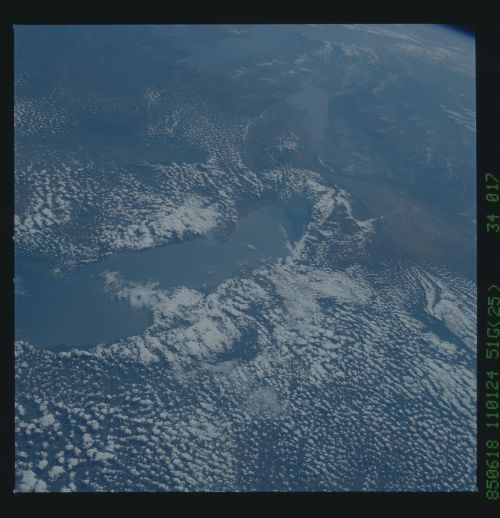
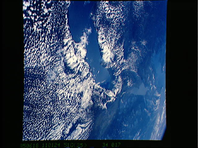
Image Caption: STS51G-34-017 Northern Lake Malawi The northern half of 700- km long
Lake Malawi appears center in this NW-looking view. The broad
alignment of the East African Rift changes from N- S (Lake Malawi) to
NW-SE (Lake Rukwa, top center). Lake Tanganyika appears extreme top.
Malawi lies under cloud on the far side (west side) of Lake Malawi
with Zambia beyond. Tanzania lies in the foreground and along the
right side of the view where bush fires can be seen.
