STS51F-32-24
| NASA Photo ID | STS51F-32-24 |
| Focal Length | 100mm |
| Date taken | 1985.07.30 |
| Time taken | 15:12:04 GMT |

Cloud masks available for this image:
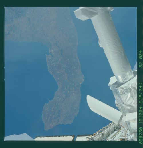
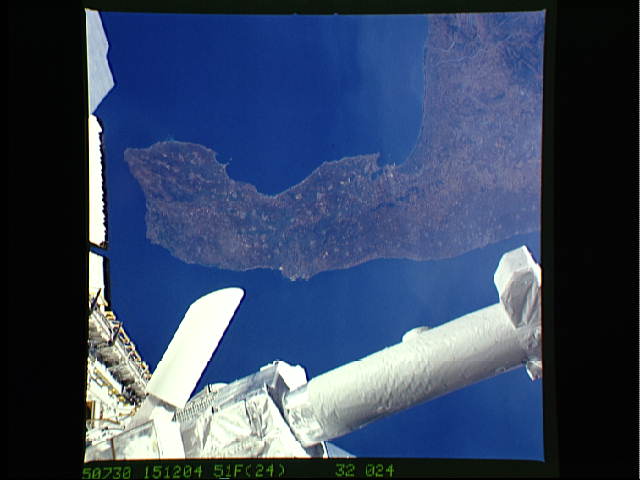
Spacecraft nadir point: 39.1° N, 18.9° E
Photo center point: 40.5° N, 18.0° E
Photo center point by machine learning:
Photo center point: 40.5° N, 18.0° E
Photo center point by machine learning:
Nadir to Photo Center: Northwest
Spacecraft Altitude: 173 nautical miles (320km)
Country or Geographic Name: | ITALY |
Features: | INSTRUMENT POINTING SYS |
| Features Found Using Machine Learning: | |
Cloud Cover Percentage: | 5 (1-10)% |
Sun Elevation Angle: | 30° |
Sun Azimuth: | 269° |
Camera: | Hasselblad |
Focal Length: | 100mm |
Camera Tilt: | 30 degrees |
Format: | 5017: Kodak, natural color positive, Ektachrome, X Professional, ASA 64, standard base |
Film Exposure: | Normal |
| Additional Information | |
| Width | Height | Annotated | Cropped | Purpose | Links |
|---|---|---|---|---|---|
| 5700 pixels | 5900 pixels | No | No | Download Image | |
| 500 pixels | 518 pixels | No | No | Download Image | |
| 640 pixels | 480 pixels | No | No | Download Image |
Download Packaged File
Download a Google Earth KML for this Image
View photo footprint information
Download a GeoTIFF for this photo
Image Caption: This view of the "heel" of the "boot" of Southern Italy (40.5N, 18.0E) shows the rich an varied detail of the Salentina peninsula. This southern promontory, projecting into the Mediterranean Sea, is known for its year round mild climate and agricultural produce. The typical European cluster city and town plan wherein the farming population lives in communities and commutes to the fields can be observed throughout the peninsula.
