STS51D-46-97
| NASA Photo ID | STS51D-46-97 |
| Focal Length | 100mm |
| Date taken | 1985.04.19 |
| Time taken | 06:00:13 GMT |
Resolutions offered for this image:
640 x 480 pixels
640 x 480 pixels
Cloud masks available for this image:
Spacecraft nadir point: 20.8° N, 31.1° E
Photo center point: 28.0° N, 36.0° E
Photo center point by machine learning:
Photo center point: 28.0° N, 36.0° E
Photo center point by machine learning:
Nadir to Photo Center: Northeast
Spacecraft Altitude: 182 nautical miles (337km)
Country or Geographic Name: | SAUDI ARABIA |
Features: | CLOUD FRONT |
| Features Found Using Machine Learning: | |
Cloud Cover Percentage: | 20 (11-25)% |
Sun Elevation Angle: | 33° |
Sun Azimuth: | 90° |
Camera: | Hasselblad |
Focal Length: | 100mm |
Camera Tilt: | High Oblique |
Format: | 5017: Kodak, natural color positive, Ektachrome, X Professional, ASA 64, standard base |
Film Exposure: | Over Exposed |
| Additional Information | |
| Width | Height | Annotated | Cropped | Purpose | Links |
|---|---|---|---|---|---|
| 640 pixels | 480 pixels | No | No | ISD 1 | Download Image |
Download Packaged File
Download a Google Earth KML for this Image
View photo footprint information
Download a GeoTIFF for this photo
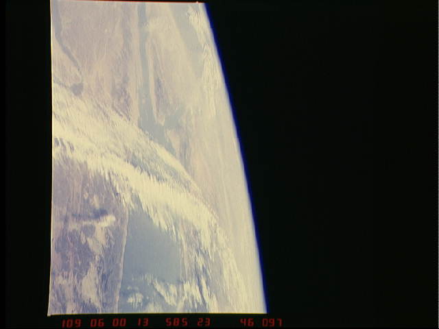
Image Caption: Jet Stream over Red Sea
Here's another example of a jet stream where you can see the
cirrus both parallel and perpendicular to the jet stream
flow over the Red Sea. In this case there is no low or
frontal system associated with it.
Here's another example of a jet stream where you can see the
cirrus both parallel and perpendicular to the jet stream
flow over the Red Sea. In this case there is no low or
frontal system associated with it.
