STS51D-46-22
| NASA Photo ID | STS51D-46-22 |
| Focal Length | 100mm |
| Date taken | 1985.04.18 |
| Time taken | 18:05:51 GMT |
Resolutions offered for this image:
1286 x 1275 pixels 720 x 714 pixels 640 x 480 pixels 1275 x 1286 pixels
1286 x 1275 pixels 720 x 714 pixels 640 x 480 pixels 1275 x 1286 pixels

Cloud masks available for this image:
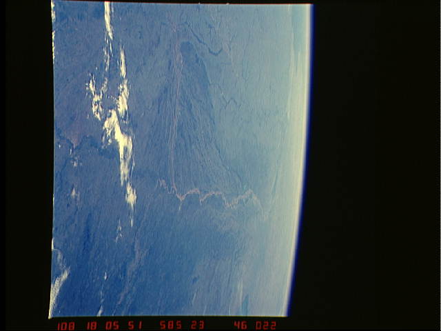
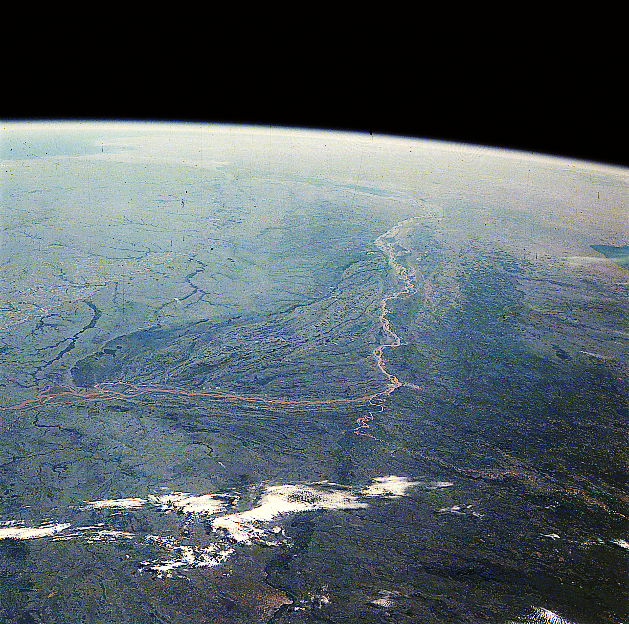
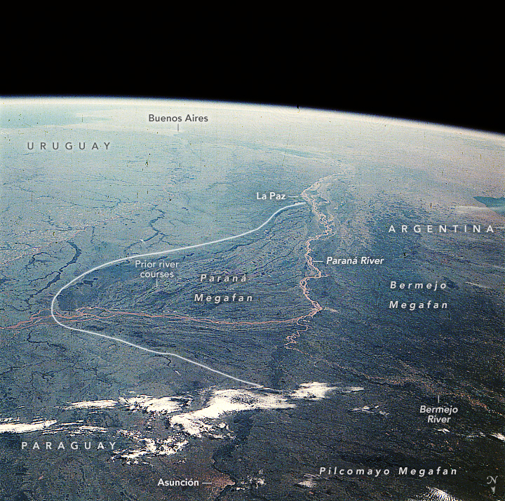
Spacecraft nadir point: 21.2° S, 56.7° W
Photo center point: 28.0° S, 58.0° W
Photo center point by machine learning:
Photo center point: 28.0° S, 58.0° W
Photo center point by machine learning:
Nadir to Photo Center: South
Spacecraft Altitude: 216 nautical miles (400km)
Country or Geographic Name: | ARGENTINA |
Features: | RIO PARANA/RIO PARAGUAY |
| Features Found Using Machine Learning: | |
Cloud Cover Percentage: | 10 (1-10)% |
Sun Elevation Angle: | 43° |
Sun Azimuth: | 309° |
Camera: | Hasselblad |
Focal Length: | 100mm |
Camera Tilt: | High Oblique |
Format: | 5017: Kodak, natural color positive, Ektachrome, X Professional, ASA 64, standard base |
Film Exposure: | Normal |
| Additional Information | |
| Width | Height | Annotated | Cropped | Purpose | Links |
|---|---|---|---|---|---|
| 1286 pixels | 1275 pixels | Yes | Yes | Download Image | |
| 720 pixels | 714 pixels | Yes | Yes | Download Image | |
| 640 pixels | 480 pixels | No | No | ISD 1 | Download Image |
| 1275 pixels | 1286 pixels | No | No | Download Image |
Download Packaged File
Download a Google Earth KML for this Image
View photo footprint information
Download a GeoTIFF for this photo
Image Caption: none
