STS51D-45-63
| NASA Photo ID | STS51D-45-63 |
| Focal Length | 250mm |
| Date taken | 1985.04.17 |
| Time taken | 05:11:13 GMT |
Resolutions offered for this image:
640 x 480 pixels 3663 x 2971 pixels 3663 x 2971 pixels 960 x 779 pixels
640 x 480 pixels 3663 x 2971 pixels 3663 x 2971 pixels 960 x 779 pixels


Cloud masks available for this image:
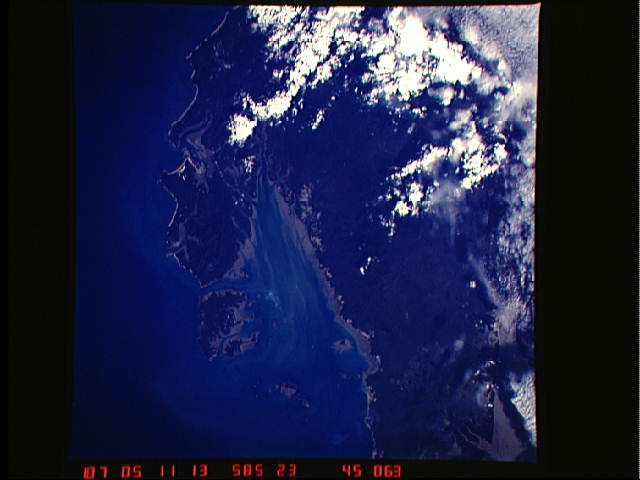
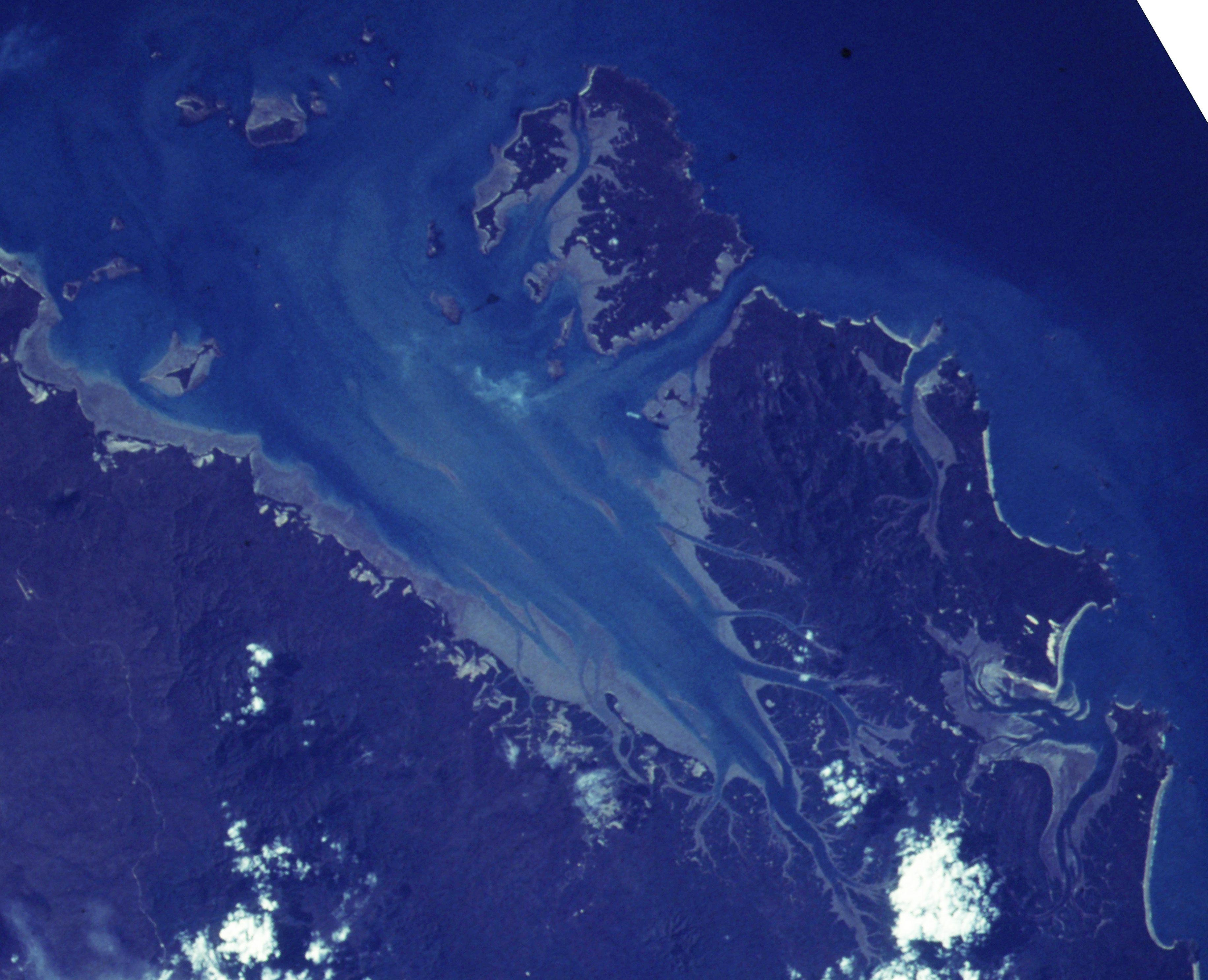
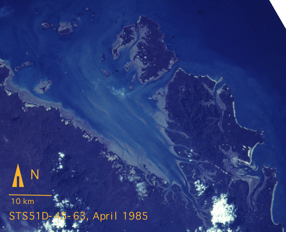
Spacecraft nadir point: 21.6° S, 150.5° E
Photo center point: 22.5° S, 150.5° E
Photo center point by machine learning:
Photo center point: 22.5° S, 150.5° E
Photo center point by machine learning:
Nadir to Photo Center: South
Spacecraft Altitude: 225 nautical miles (417km)
Country or Geographic Name: | AUSTRALIA-Q |
Features: | SHOALWATER BAY/COASTLINE |
| Features Found Using Machine Learning: | |
Cloud Cover Percentage: | 20 (11-25)% |
Sun Elevation Angle: | 32° |
Sun Azimuth: | 298° |
Camera: | Hasselblad |
Focal Length: | 250mm |
Camera Tilt: | 13 degrees |
Format: | 5017: Kodak, natural color positive, Ektachrome, X Professional, ASA 64, standard base |
Film Exposure: | Normal |
| Additional Information | |
| Width | Height | Annotated | Cropped | Purpose | Links |
|---|---|---|---|---|---|
| 640 pixels | 480 pixels | No | No | ISD 1 | Download Image |
| 3663 pixels | 2971 pixels | Download Image | |||
| 3663 pixels | 2971 pixels | Download Image | |||
| 960 pixels | 779 pixels | Yes | No | Download Image |
Download Packaged File
Download a Google Earth KML for this Image
View photo footprint information
Download a GeoTIFF for this photo
Image Caption: none
