STS51D-41-3
| NASA Photo ID | STS51D-41-3 |
| Focal Length | 250mm |
| Date taken | 1985.04.18 |
| Time taken | 10:19:21 GMT |
Resolutions offered for this image:
640 x 480 pixels 4927 x 5054 pixels 1942 x 1958 pixels 2618 x 2563 pixels 909 x 1181 pixels 4096 x 4096 pixels 540 x 702 pixels
640 x 480 pixels 4927 x 5054 pixels 1942 x 1958 pixels 2618 x 2563 pixels 909 x 1181 pixels 4096 x 4096 pixels 540 x 702 pixels

Cloud masks available for this image:
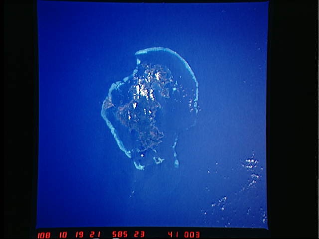
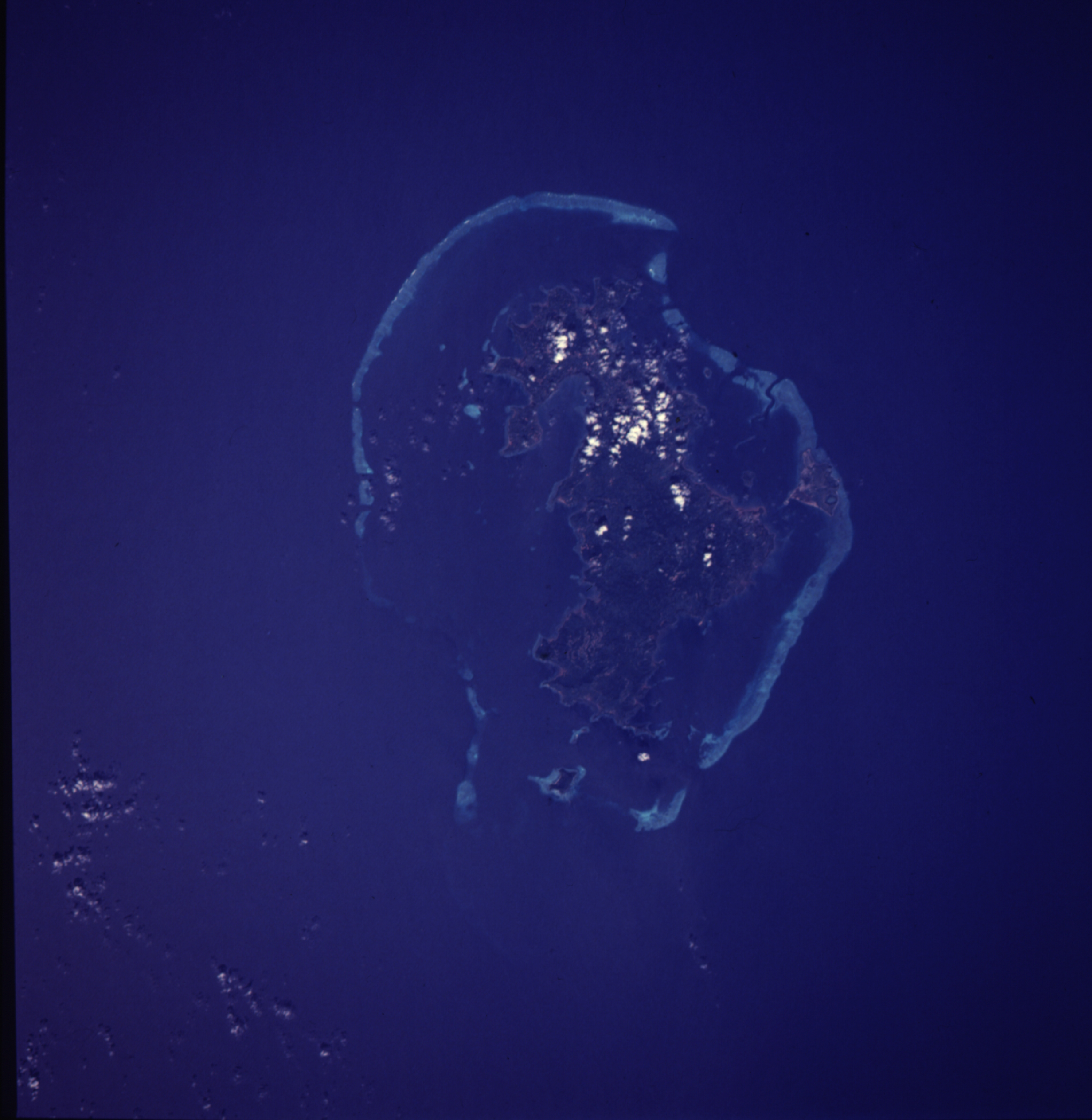
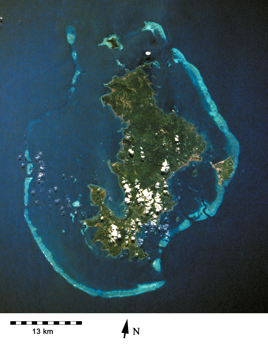
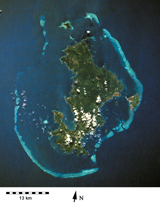
Spacecraft nadir point: 14.1° S, 44.6° E
Photo center point: 13.0° S, 45.0° E
Photo center point by machine learning:
Photo center point: 13.0° S, 45.0° E
Photo center point by machine learning:
Nadir to Photo Center: North
Spacecraft Altitude: 206 nautical miles (382km)
Country or Geographic Name: | COMOROS |
Features: | MAYOTTE/MOZAMBIQUE CHAN |
| Features Found Using Machine Learning: | |
Cloud Cover Percentage: | 5 (1-10)% |
Sun Elevation Angle: | 58° |
Sun Azimuth: | 320° |
Camera: | Hasselblad |
Focal Length: | 250mm |
Camera Tilt: | 19 degrees |
Format: | 5017: Kodak, natural color positive, Ektachrome, X Professional, ASA 64, standard base |
Film Exposure: | Normal |
| Additional Information | |
| Width | Height | Annotated | Cropped | Purpose | Links |
|---|---|---|---|---|---|
| 640 pixels | 480 pixels | No | No | ISD 1 | Download Image |
| 4927 pixels | 5054 pixels | ReefBase pilot | Download Image | ||
| 1942 pixels | 1958 pixels | No | Yes | ReefBase 1 | Download Image |
| 2618 pixels | 2563 pixels | No | ReefBase 1 | Download Image | |
| 909 pixels | 1181 pixels | Yes | Yes | Publisher Request | Download Image |
| 4096 pixels | 4096 pixels | No | No | Download Image | |
| 540 pixels | 702 pixels | Yes | Yes | Publisher Request | Download Image |
Download Packaged File
Download a Google Earth KML for this Image
View photo footprint information
Download a GeoTIFF for this photo
Image Caption: Mayotte has a number of fringing reefs and is almost completely encircled by its barrier reef [STS51D-41-3, 1985].
