STS51C-38-31
| NASA Photo ID | STS51C-38-31 |
| Focal Length | 100mm |
| Date taken | 1985.01.27 |
| Time taken | 14:39:36 GMT |
Resolutions offered for this image:
5152 x 5152 pixels 639 x 639 pixels 6830 x 4937 pixels 500 x 361 pixels 640 x 480 pixels
5152 x 5152 pixels 639 x 639 pixels 6830 x 4937 pixels 500 x 361 pixels 640 x 480 pixels

Cloud masks available for this image:
Spacecraft nadir point: 12.0° N, 90.5° W
Photo center point: 15.0° N, 91.5° W
Photo center point by machine learning:
Photo center point: 15.0° N, 91.5° W
Photo center point by machine learning:
Nadir to Photo Center: North
Spacecraft Altitude: 202 nautical miles (374km)
Country or Geographic Name: | GUATEMALA |
Features: | QUEZALTENANGO |
| Features Found Using Machine Learning: | |
Cloud Cover Percentage: | 30 (26-50)% |
Sun Elevation Angle: | 28° |
Sun Azimuth: | 119° |
Camera: | Hasselblad |
Focal Length: | 100mm |
Camera Tilt: | 43 degrees |
Format: | 5017: Kodak, natural color positive, Ektachrome, X Professional, ASA 64, standard base |
Film Exposure: | Normal |
| Additional Information | |
| Width | Height | Annotated | Cropped | Purpose | Links |
|---|---|---|---|---|---|
| 5152 pixels | 5152 pixels | No | No | Earth From Space collection | Download Image |
| 639 pixels | 639 pixels | No | No | Earth From Space collection | Download Image |
| 6830 pixels | 4937 pixels | No | No | Download Image | |
| 500 pixels | 361 pixels | No | No | Download Image | |
| 640 pixels | 480 pixels | No | No | Download Image |
Download Packaged File
Download a Google Earth KML for this Image
View photo footprint information
Download a GeoTIFF for this photo
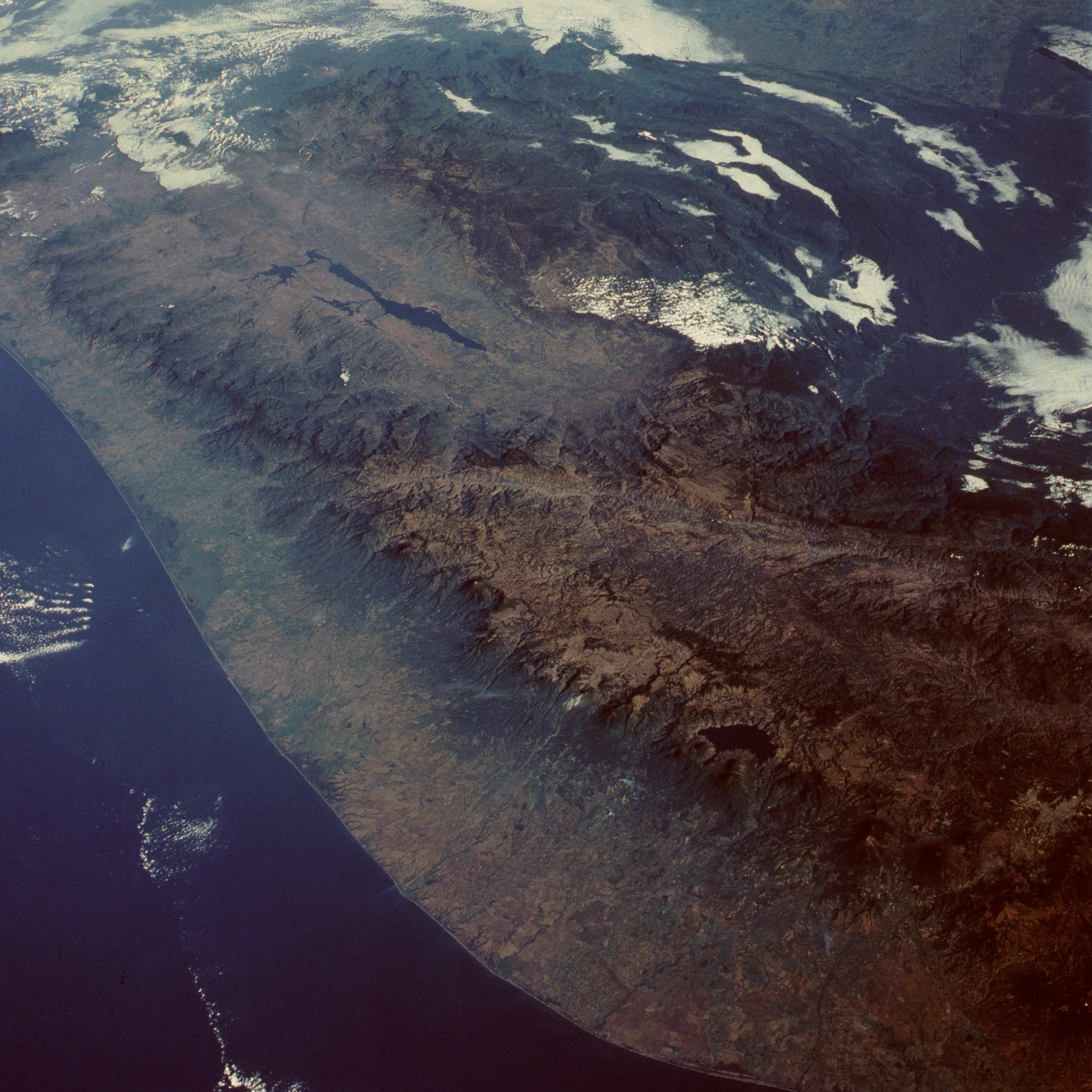
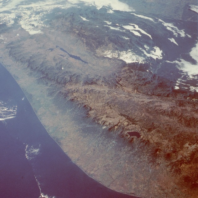
Image Caption: STS51C-038-0031 Sierra Madre, Guatemala January 1985
This low-oblique photograph produces an almost 3-dimensional quality for viewing the Pacific coast of southern Mexico and western Guatemala. The narrow coastal plain lies in marked contrast to the rugged Sierra Madre and Sierra de los Cuchumatanes of western Guatemala. A pronounced chain of volcanoes parallels the Pacific coast along the western edge of the mountainous terrain. Two neighboring volcanoes, Agua and Fuego, are visible near the southeastern edge of the photograph. More easterly Agua Volcano exceeds 12 330 feet (3760 meters) and erupted in 1541, almost completely burying the village of Cuidad Vieja. During recent years, Fuego Volcano [summit of 12 310 feet (3752 meters)] has emitted smoke and steam but has not caused great destruction. The outline of the capital, Guatemala City, is barely discernible just east of these two volcanoes. Deep blue Lake Atitlán, 35 miles (57 kilometers) west of Guatemala City, has a surface elevation of 5125 feet (1560 meters) above sea level, and further northwest, elongated Angostura Reservoir is visible in southern Mexico. A major unidentified east-west fault line extends across northwest Guatemala through a small part of southern Mexico.
This low-oblique photograph produces an almost 3-dimensional quality for viewing the Pacific coast of southern Mexico and western Guatemala. The narrow coastal plain lies in marked contrast to the rugged Sierra Madre and Sierra de los Cuchumatanes of western Guatemala. A pronounced chain of volcanoes parallels the Pacific coast along the western edge of the mountainous terrain. Two neighboring volcanoes, Agua and Fuego, are visible near the southeastern edge of the photograph. More easterly Agua Volcano exceeds 12 330 feet (3760 meters) and erupted in 1541, almost completely burying the village of Cuidad Vieja. During recent years, Fuego Volcano [summit of 12 310 feet (3752 meters)] has emitted smoke and steam but has not caused great destruction. The outline of the capital, Guatemala City, is barely discernible just east of these two volcanoes. Deep blue Lake Atitlán, 35 miles (57 kilometers) west of Guatemala City, has a surface elevation of 5125 feet (1560 meters) above sea level, and further northwest, elongated Angostura Reservoir is visible in southern Mexico. A major unidentified east-west fault line extends across northwest Guatemala through a small part of southern Mexico.
