STS51B-52-37
| NASA Photo ID | STS51B-52-37 |
| Focal Length | 250mm |
| Date taken | 1985.05.02 |
| Time taken | 17:22:34 GMT |
Resolutions offered for this image:
3869 x 3904 pixels 634 x 639 pixels 5700 x 5900 pixels 500 x 518 pixels
3869 x 3904 pixels 634 x 639 pixels 5700 x 5900 pixels 500 x 518 pixels

Cloud masks available for this image:
Spacecraft nadir point: 32.8° N, 112.0° W
Photo center point: 33.5° N, 111.0° W
Photo center point by machine learning:
Photo center point: 33.5° N, 111.0° W
Photo center point by machine learning:
Nadir to Photo Center: Northeast
Spacecraft Altitude: 192 nautical miles (356km)
Country or Geographic Name: | USA-ARIZONA |
Features: | THEODORE ROOSEVELT LAKE |
| Features Found Using Machine Learning: | |
Cloud Cover Percentage: | 0 (no clouds present) |
Sun Elevation Angle: | 57° |
Sun Azimuth: | 114° |
Camera: | Hasselblad |
Focal Length: | 250mm |
Camera Tilt: | 21 degrees |
Format: | 5017: Kodak, natural color positive, Ektachrome, X Professional, ASA 64, standard base |
Film Exposure: | Normal |
| Additional Information | |
| Width | Height | Annotated | Cropped | Purpose | Links |
|---|---|---|---|---|---|
| 3869 pixels | 3904 pixels | No | No | Earth From Space collection | Download Image |
| 634 pixels | 639 pixels | No | No | Earth From Space collection | Download Image |
| 5700 pixels | 5900 pixels | No | No | Download Image | |
| 500 pixels | 518 pixels | No | No | Download Image |
Download Packaged File
Download a Google Earth KML for this Image
View photo footprint information
Download a GeoTIFF for this photo
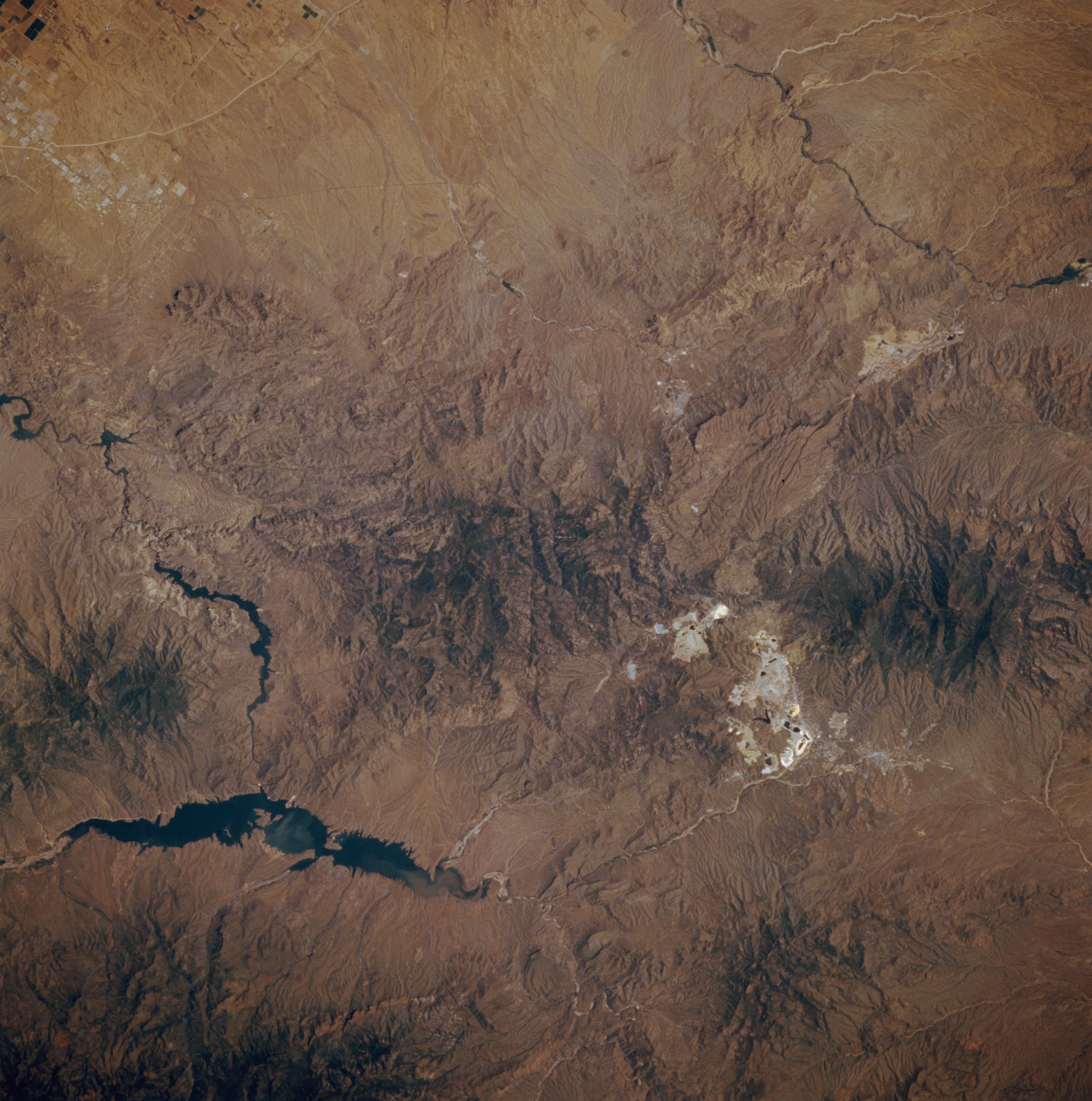
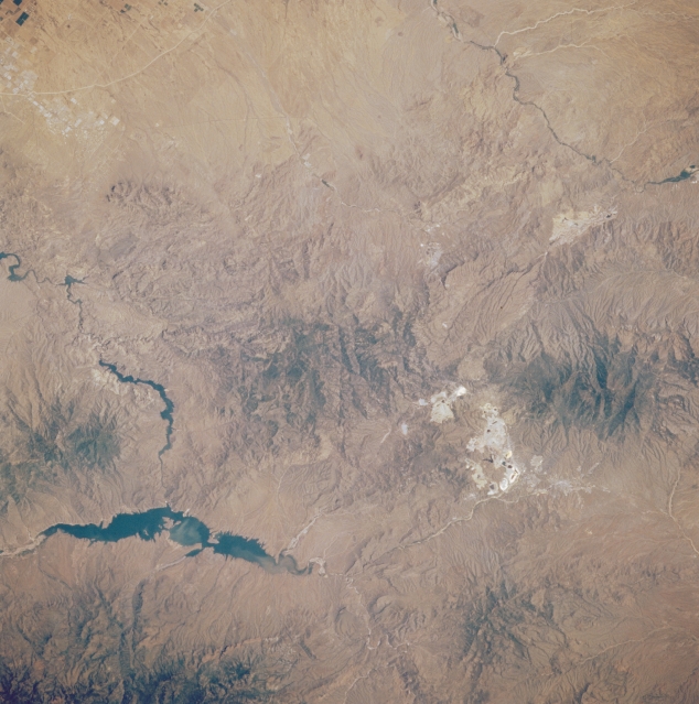
Image Caption: STS51B-052-0037 Theodore Roosevelt Lake, Arizona, U.S.A. May 1985
Several small dams create a series of lakes in the Salt River as it twists westward toward Phoenix. Long, dark Theodore Roosevelt Lake is located roughly 60 miles (97 kilometers) east of Phoenix. Most of the forested Mazatzal and Mesca Mountains are part of the Tonto National Forest and Superstition Wilderness. The highly reflective areas in the Mesca Mountains near the city of Globe show extensive mining operations for silver, gold, asbestos, manganese, vanadium, and tungsten, but the mineral mined most often is copper. A small section of the Gila River is visible in the upper left corner of the photograph.
Several small dams create a series of lakes in the Salt River as it twists westward toward Phoenix. Long, dark Theodore Roosevelt Lake is located roughly 60 miles (97 kilometers) east of Phoenix. Most of the forested Mazatzal and Mesca Mountains are part of the Tonto National Forest and Superstition Wilderness. The highly reflective areas in the Mesca Mountains near the city of Globe show extensive mining operations for silver, gold, asbestos, manganese, vanadium, and tungsten, but the mineral mined most often is copper. A small section of the Gila River is visible in the upper left corner of the photograph.
