STS51B-43-40
| NASA Photo ID | STS51B-43-40 |
| Focal Length | 100mm |
| Date taken | 1985.05.04 |
| Time taken | 15:12:27 GMT |
Cloud masks available for this image:
Spacecraft nadir point: 42.0° N, 78.8° W
Photo center point: 43.0° N, 77.5° W
Photo center point by machine learning:
Photo center point: 43.0° N, 77.5° W
Photo center point by machine learning:
Nadir to Photo Center: Northeast
Spacecraft Altitude: 193 nautical miles (357km)
Country or Geographic Name: | USA-NEW YORK |
Features: | FINGER LAKES, ROCHESTER |
| Features Found Using Machine Learning: | |
Cloud Cover Percentage: | 10 (1-10)% |
Sun Elevation Angle: | 53° |
Sun Azimuth: | 126° |
Camera: | Hasselblad |
Focal Length: | 100mm |
Camera Tilt: | 27 degrees |
Format: | 5017: Kodak, natural color positive, Ektachrome, X Professional, ASA 64, standard base |
Film Exposure: | Normal |
| Additional Information | |
| Width | Height | Annotated | Cropped | Purpose | Links |
|---|---|---|---|---|---|
| 5700 pixels | 5900 pixels | No | No | Download Image | |
| 500 pixels | 518 pixels | No | No | Download Image |
Download Packaged File
Download a Google Earth KML for this Image
View photo footprint information
Download a GeoTIFF for this photo
Image Caption:
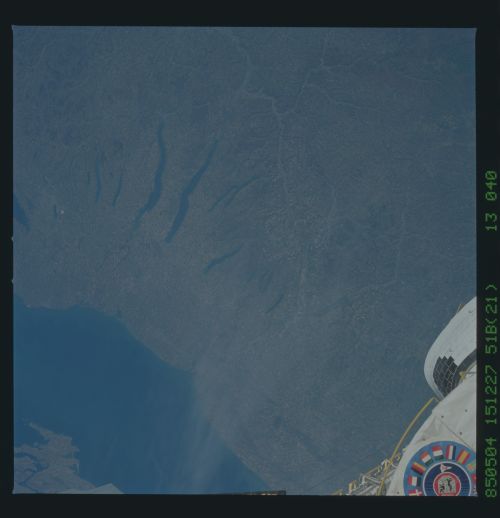
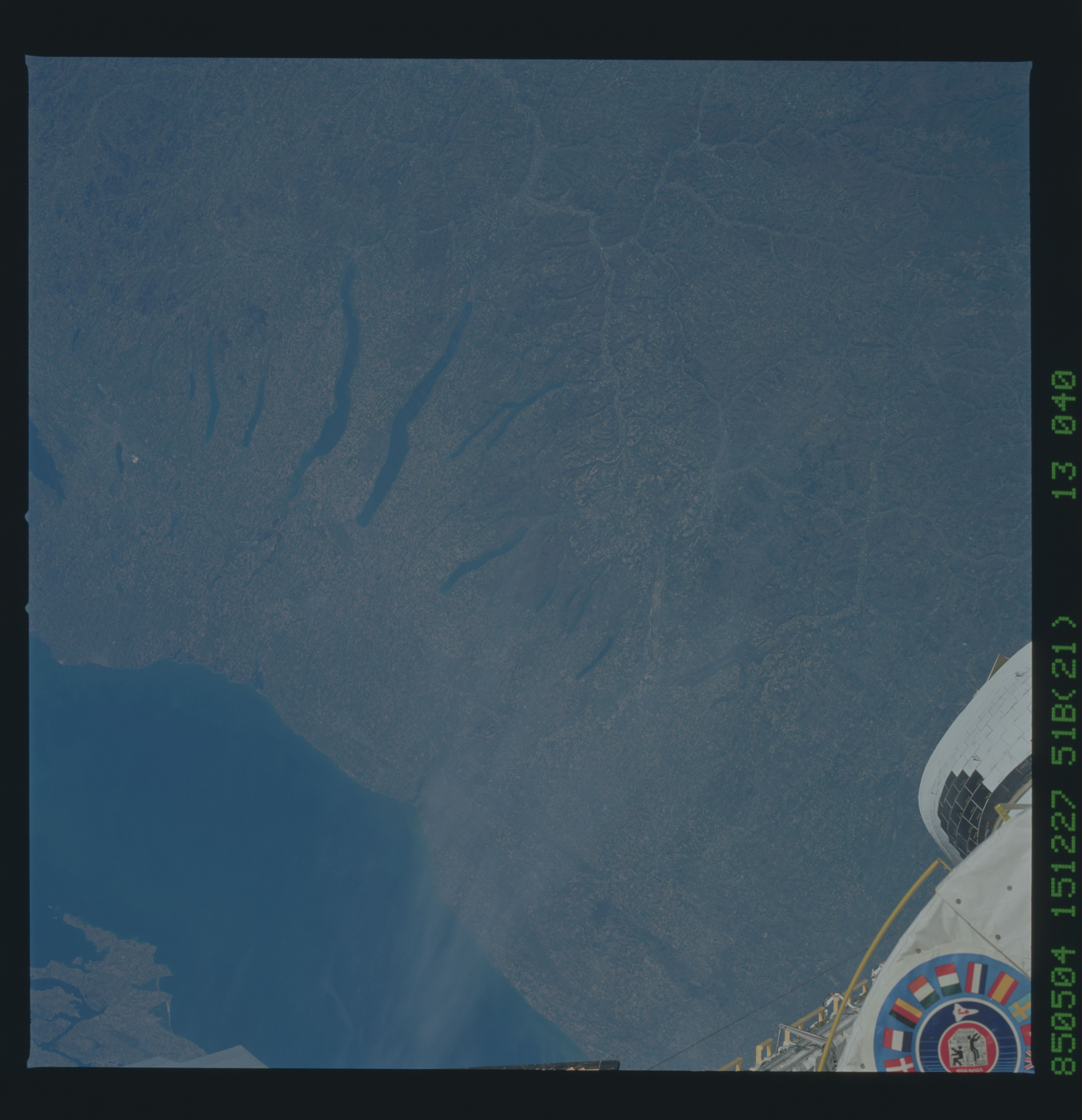
Upstate New York
The largely rural expanse of upstate New York is 200 miles from
New York City. This view shows the Finger Lakes (1), Lake On-
tario (2), and the city of Rochester (3). The coastal plain
along the Great Lakes is heavily cultivated, but further south
around the Finger Lakes, the region is too hilly to support any-
thing but dairy farms. (STS51B-43- 040)
