STS51B-38-95
| NASA Photo ID | STS51B-38-95 |
| Focal Length | 250mm |
| Date taken | 1985.__.__ |
| Time taken | GMT |
Resolutions offered for this image:
3881 x 3904 pixels 636 x 639 pixels 5700 x 5900 pixels 500 x 518 pixels
3881 x 3904 pixels 636 x 639 pixels 5700 x 5900 pixels 500 x 518 pixels
Cloud masks available for this image:
Spacecraft nadir point:
Photo center point: 46.0° N, 119.5° W
Photo center point by machine learning:
Photo center point: 46.0° N, 119.5° W
Photo center point by machine learning:
Nadir to Photo Center:
Spacecraft Altitude: nautical miles (0km)
Country or Geographic Name: | USA-WASHINGTON |
Features: | COLUMBIA RIVER |
| Features Found Using Machine Learning: | |
Cloud Cover Percentage: | 5 (1-10)% |
Sun Elevation Angle: | ° |
Sun Azimuth: | ° |
Camera: | Hasselblad |
Focal Length: | 250mm |
Camera Tilt: | Near Vertical |
Format: | 5017: Kodak, natural color positive, Ektachrome, X Professional, ASA 64, standard base |
Film Exposure: | Normal |
| Additional Information | |
| Width | Height | Annotated | Cropped | Purpose | Links |
|---|---|---|---|---|---|
| 3881 pixels | 3904 pixels | No | No | Earth From Space collection | Download Image |
| 636 pixels | 639 pixels | No | No | Earth From Space collection | Download Image |
| 5700 pixels | 5900 pixels | No | No | Download Image | |
| 500 pixels | 518 pixels | No | No | Download Image |
Download Packaged File
Download a Google Earth KML for this Image
View photo footprint information
Download a GeoTIFF for this photo
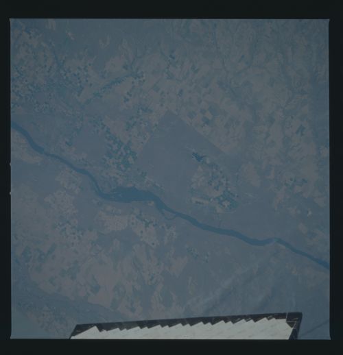
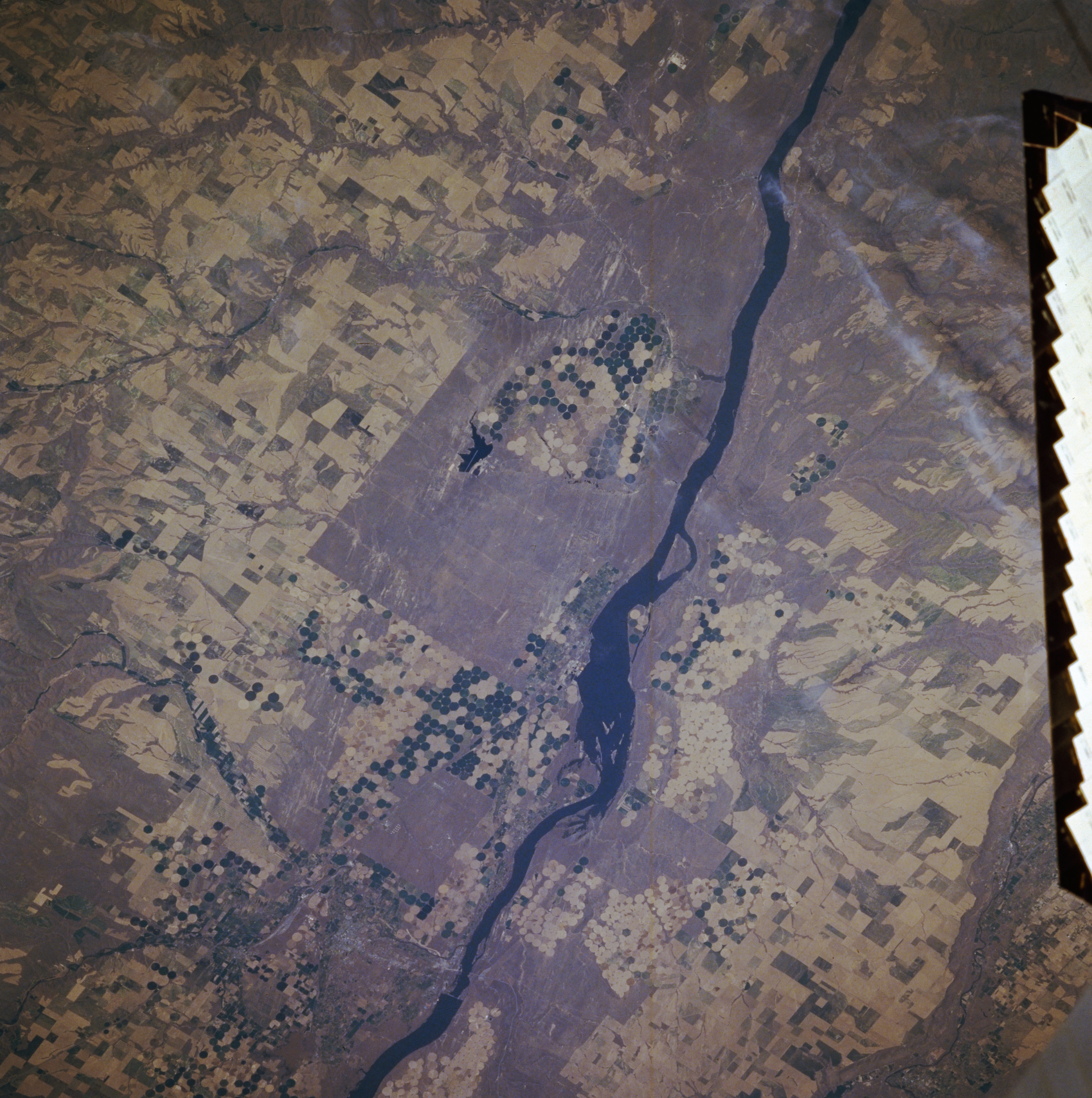
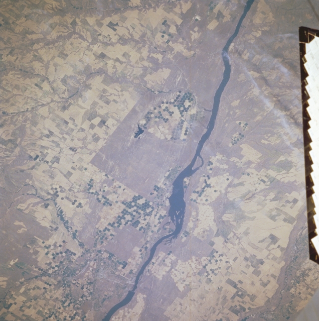
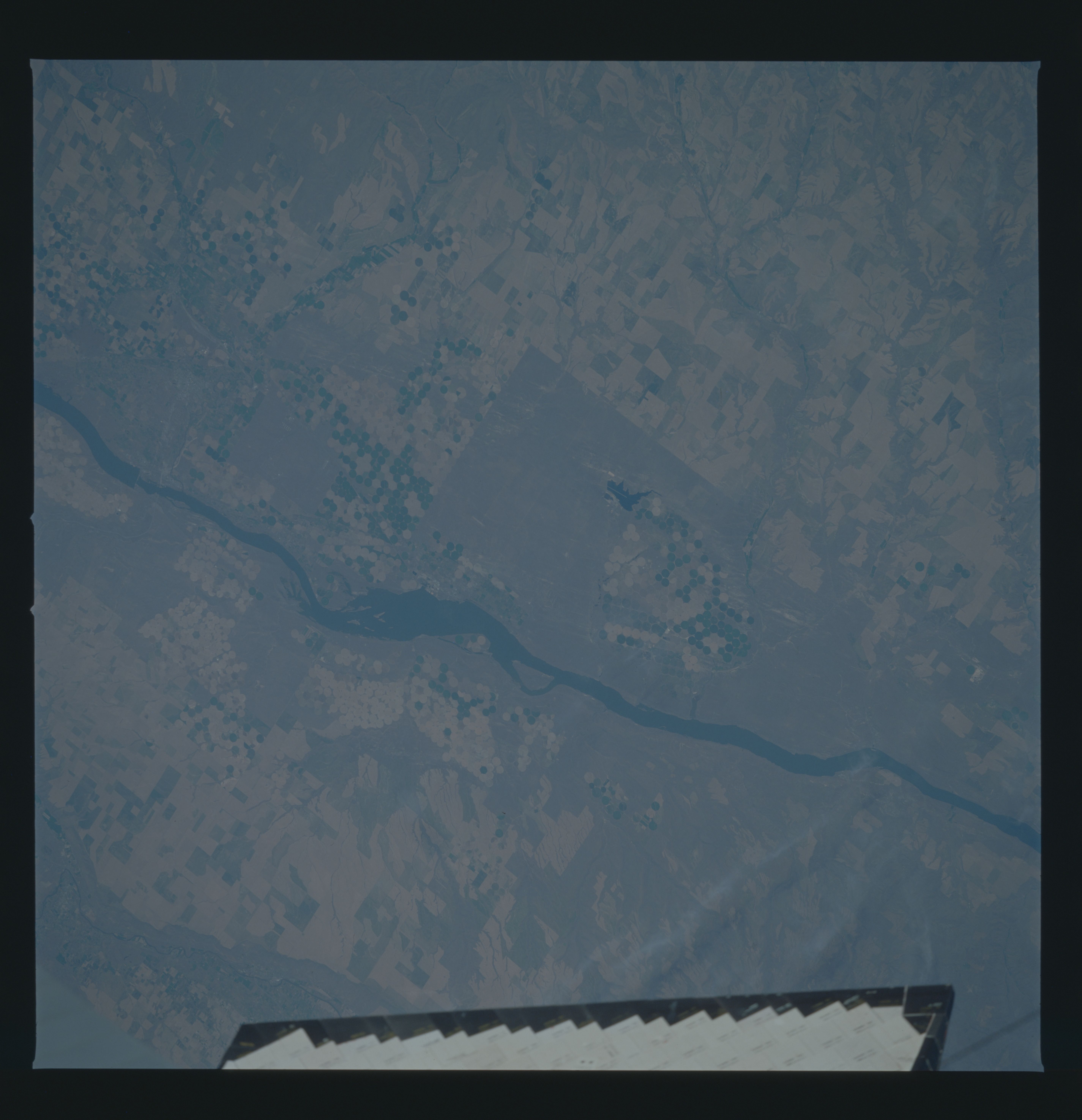
Image Caption: STS51B-038-0095 Columbia River, Oregon and Washington, U.S.A. May 1985
This west-southwest-looking, low-oblique photograph shows the Columbia River near Boardman, Oregon. Near the bottom center of the photograph, the McNary Dam is visible. Scattered agricultural field patterns, including circular pivot irrigation fields, are seen. In this rolling terrain of the Columbia Plateau, the Columbia River has scoured a gorge that deepens from 150 to 300 feet (30 to 91 meters) as the river makes its way westward (toward the upper right of photograph).
This west-southwest-looking, low-oblique photograph shows the Columbia River near Boardman, Oregon. Near the bottom center of the photograph, the McNary Dam is visible. Scattered agricultural field patterns, including circular pivot irrigation fields, are seen. In this rolling terrain of the Columbia Plateau, the Columbia River has scoured a gorge that deepens from 150 to 300 feet (30 to 91 meters) as the river makes its way westward (toward the upper right of photograph).
