STS51B-35-96
| NASA Photo ID | STS51B-35-96 |
| Focal Length | 100mm |
| Date taken | 1985.05.01 |
| Time taken | 18:32:14 GMT |
Resolutions offered for this image:
3904 x 3904 pixels 639 x 639 pixels 5700 x 5900 pixels 500 x 518 pixels
3904 x 3904 pixels 639 x 639 pixels 5700 x 5900 pixels 500 x 518 pixels
Cloud masks available for this image:
Spacecraft nadir point: 41.3° N, 114.2° W
Photo center point: 41.0° N, 113.0° W
Photo center point by machine learning:
Photo center point: 41.0° N, 113.0° W
Photo center point by machine learning:
Nadir to Photo Center: East
Spacecraft Altitude: 194 nautical miles (359km)
Country or Geographic Name: | USA-UTAH |
Features: | GREAT SALT LAKE |
| Features Found Using Machine Learning: | |
Cloud Cover Percentage: | 10 (1-10)% |
Sun Elevation Angle: | 60° |
Sun Azimuth: | 148° |
Camera: | Hasselblad |
Focal Length: | 100mm |
Camera Tilt: | 21 degrees |
Format: | 5017: Kodak, natural color positive, Ektachrome, X Professional, ASA 64, standard base |
Film Exposure: | Normal |
| Additional Information | |
| Width | Height | Annotated | Cropped | Purpose | Links |
|---|---|---|---|---|---|
| 3904 pixels | 3904 pixels | No | No | Earth From Space collection | Download Image |
| 639 pixels | 639 pixels | No | No | Earth From Space collection | Download Image |
| 5700 pixels | 5900 pixels | No | No | Download Image | |
| 500 pixels | 518 pixels | No | No | Download Image |
Download Packaged File
Download a Google Earth KML for this Image
View photo footprint information
Download a GeoTIFF for this photo
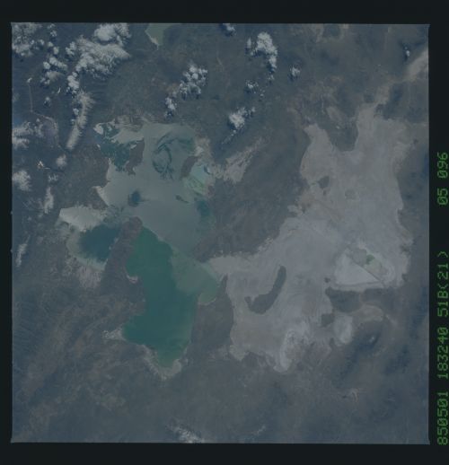
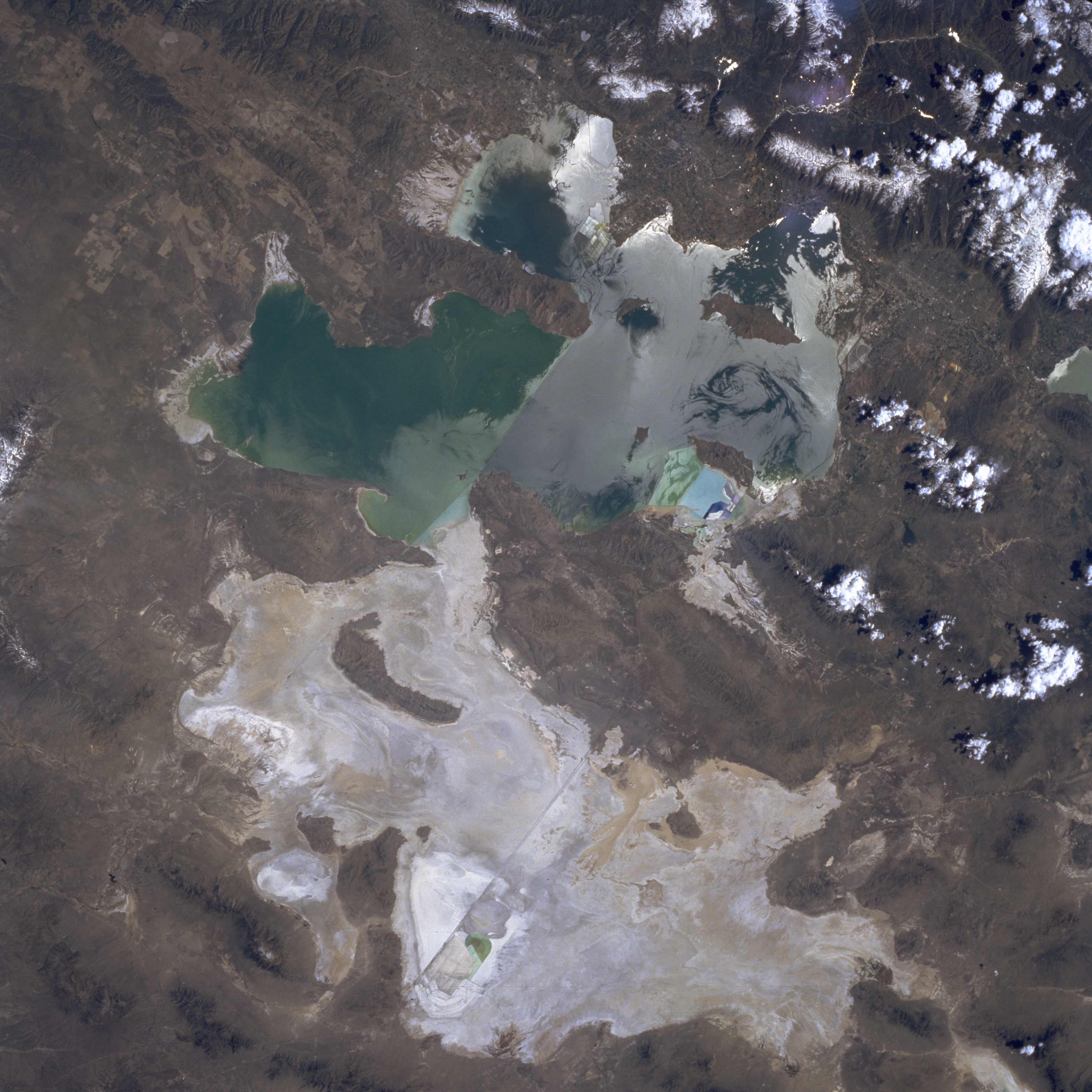
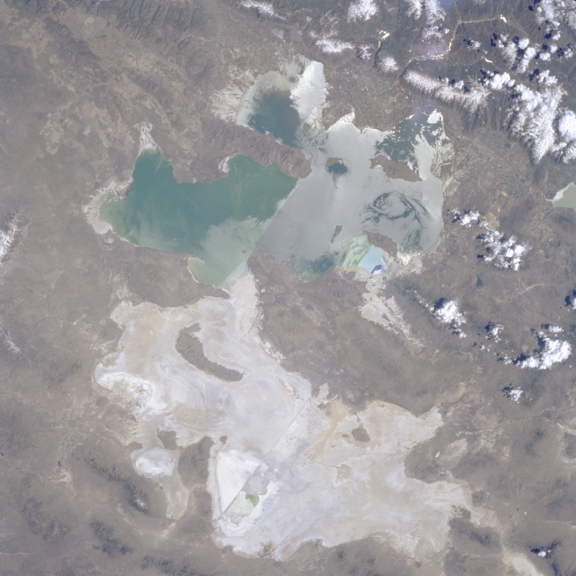
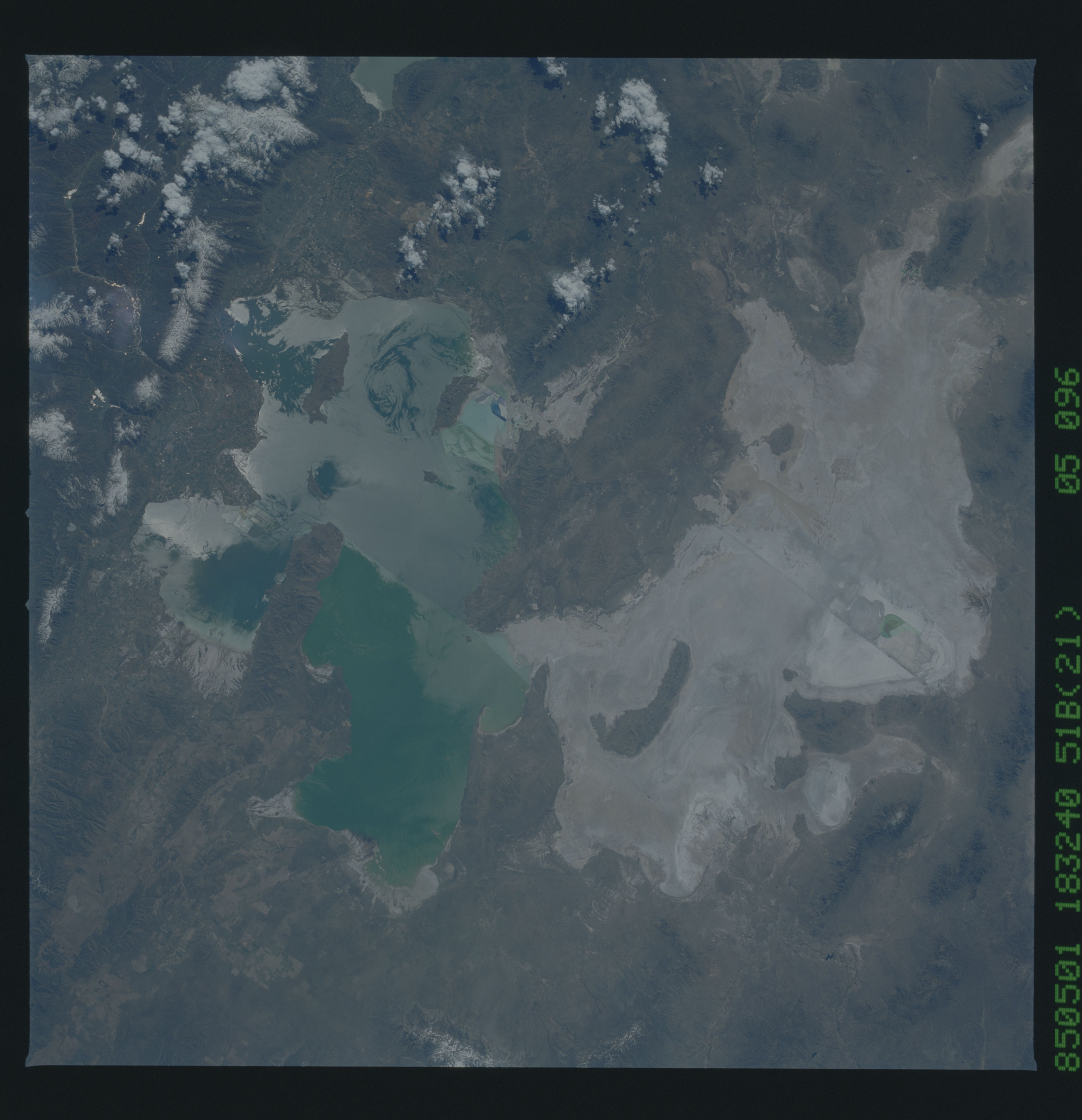
Image Caption: STS51B-035-0096 Great Salt Lake, Great Salt Lake Desert, Utah, U.S.A. May 1985
The Great Salt Lake, the largest inland body of saltwater in the Western Hemisphere, is featured in this northeast-looking, low-oblique photograph. Visible are a railroad causeway separating the two halves of the lake, the white former floor of prehistoric Lake Bonneville spanning more than half of the photograph, scattered clouds, and snow at the higher elevations of the Wasatch Range. The lake's water level varies seasonally and yearly. This photograph shows water levels higher than normal (see STS-074-111-018 from November 1995 to detect a difference in water level). Color variation in the lake is caused by higher concentrations of salt in the northern portion.
The Great Salt Lake, the largest inland body of saltwater in the Western Hemisphere, is featured in this northeast-looking, low-oblique photograph. Visible are a railroad causeway separating the two halves of the lake, the white former floor of prehistoric Lake Bonneville spanning more than half of the photograph, scattered clouds, and snow at the higher elevations of the Wasatch Range. The lake's water level varies seasonally and yearly. This photograph shows water levels higher than normal (see STS-074-111-018 from November 1995 to detect a difference in water level). Color variation in the lake is caused by higher concentrations of salt in the northern portion.
