STS51B-146-122
| NASA Photo ID | STS51B-146-122 |
| Focal Length | 250mm |
| Date taken | 1985.__.__ |
| Time taken | GMT |

Cloud masks available for this image:
Spacecraft nadir point:
Photo center point: 41.3° N, 112.3° W
Photo center point by machine learning:
Photo center point: 41.3° N, 112.3° W
Photo center point by machine learning:
Nadir to Photo Center:
Spacecraft Altitude: nautical miles (0km)
Country or Geographic Name: | USA-UTAH |
Features: | GR. SALT LAKE, SALT LK CT |
| Features Found Using Machine Learning: | |
Cloud Cover Percentage: | 10 (1-10)% |
Sun Elevation Angle: | ° |
Sun Azimuth: | ° |
Camera: | Linhof |
Focal Length: | 250mm |
Camera Tilt: | Low Oblique |
Format: | 5017: Kodak, natural color positive, Ektachrome, X Professional, ASA 64, standard base |
Film Exposure: | Normal |
| Additional Information | |
| Width | Height | Annotated | Cropped | Purpose | Links |
|---|---|---|---|---|---|
| 5184 pixels | 4096 pixels | No | No | Earth From Space collection | Download Image |
| 640 pixels | 505 pixels | No | No | Earth From Space collection | Download Image |
| 640 pixels | 480 pixels | No | No | ISD 1 | Download Image |
Download Packaged File
Download a Google Earth KML for this Image
View photo footprint information
Download a GeoTIFF for this photo
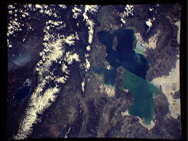
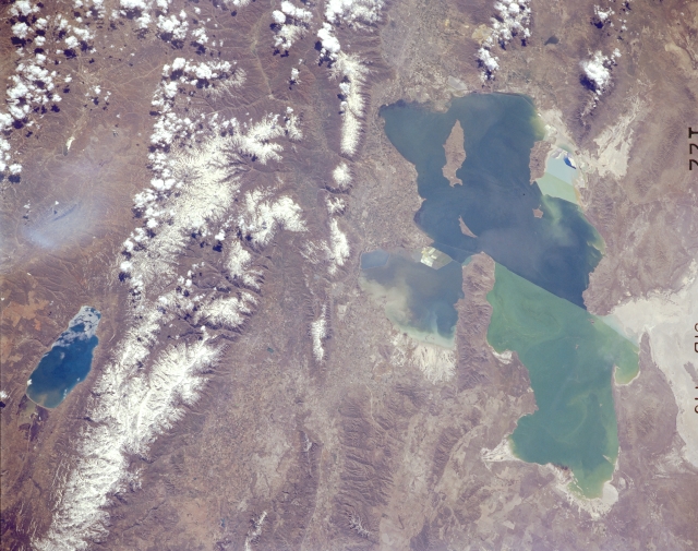
Image Caption: STS51B-146-0122 Bear Lake, Great Salt Lake, and Bear River Range, Utah and Idaho, U.S.A. May 1985
The Great Salt Lake, the largest salt lake in North America, is apparent in this south-southwest-looking, low-oblique photograph. A railway causeway bisects the lake--easily distinguishing the greenish, shallower, saltier north portion of the lake from the bluer, south end. Dark blue Bear Lake, 20 miles (32 kilometers) long and 7 miles (11 kilometers) wide, lies east of the snow-covered Bear River Range. The snowcapped peaks of the Wasatch Range (top center) are visible, with Salt Lake City barely discernible to the west. The whitish eastern portion of the Great Salt Lake Desert appears in the right center of the photograph.
The Great Salt Lake, the largest salt lake in North America, is apparent in this south-southwest-looking, low-oblique photograph. A railway causeway bisects the lake--easily distinguishing the greenish, shallower, saltier north portion of the lake from the bluer, south end. Dark blue Bear Lake, 20 miles (32 kilometers) long and 7 miles (11 kilometers) wide, lies east of the snow-covered Bear River Range. The snowcapped peaks of the Wasatch Range (top center) are visible, with Salt Lake City barely discernible to the west. The whitish eastern portion of the Great Salt Lake Desert appears in the right center of the photograph.
