STS51B-146-119
| NASA Photo ID | STS51B-146-119 |
| Focal Length | 250mm |
| Date taken | 1985.__.__ |
| Time taken | GMT |
Cloud masks available for this image:
Spacecraft nadir point:
Photo center point: 41.2° N, 112.8° W
Photo center point by machine learning:
Photo center point: 41.2° N, 112.8° W
Photo center point by machine learning:
Nadir to Photo Center:
Spacecraft Altitude: nautical miles (0km)
Country or Geographic Name: | USA-UTAH |
Features: | GR. SALT LAKE, EDDY |
| Features Found Using Machine Learning: | |
Cloud Cover Percentage: | 0 (no clouds present) |
Sun Elevation Angle: | ° |
Sun Azimuth: | ° |
Camera: | Linhof |
Focal Length: | 250mm |
Camera Tilt: | Low Oblique |
Format: | 5017: Kodak, natural color positive, Ektachrome, X Professional, ASA 64, standard base |
Film Exposure: | Normal |
| Additional Information | |
| Width | Height | Annotated | Cropped | Purpose | Links |
|---|---|---|---|---|---|
| 5184 pixels | 4096 pixels | No | No | Earth From Space collection | Download Image |
| 640 pixels | 505 pixels | No | No | Earth From Space collection | Download Image |
| 640 pixels | 480 pixels | No | No | ISD 1 | Download Image |
Download Packaged File
Download a Google Earth KML for this Image
View photo footprint information
Download a GeoTIFF for this photo
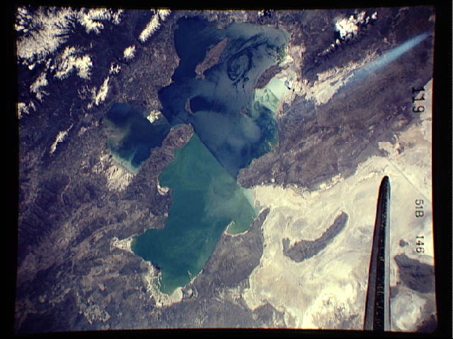
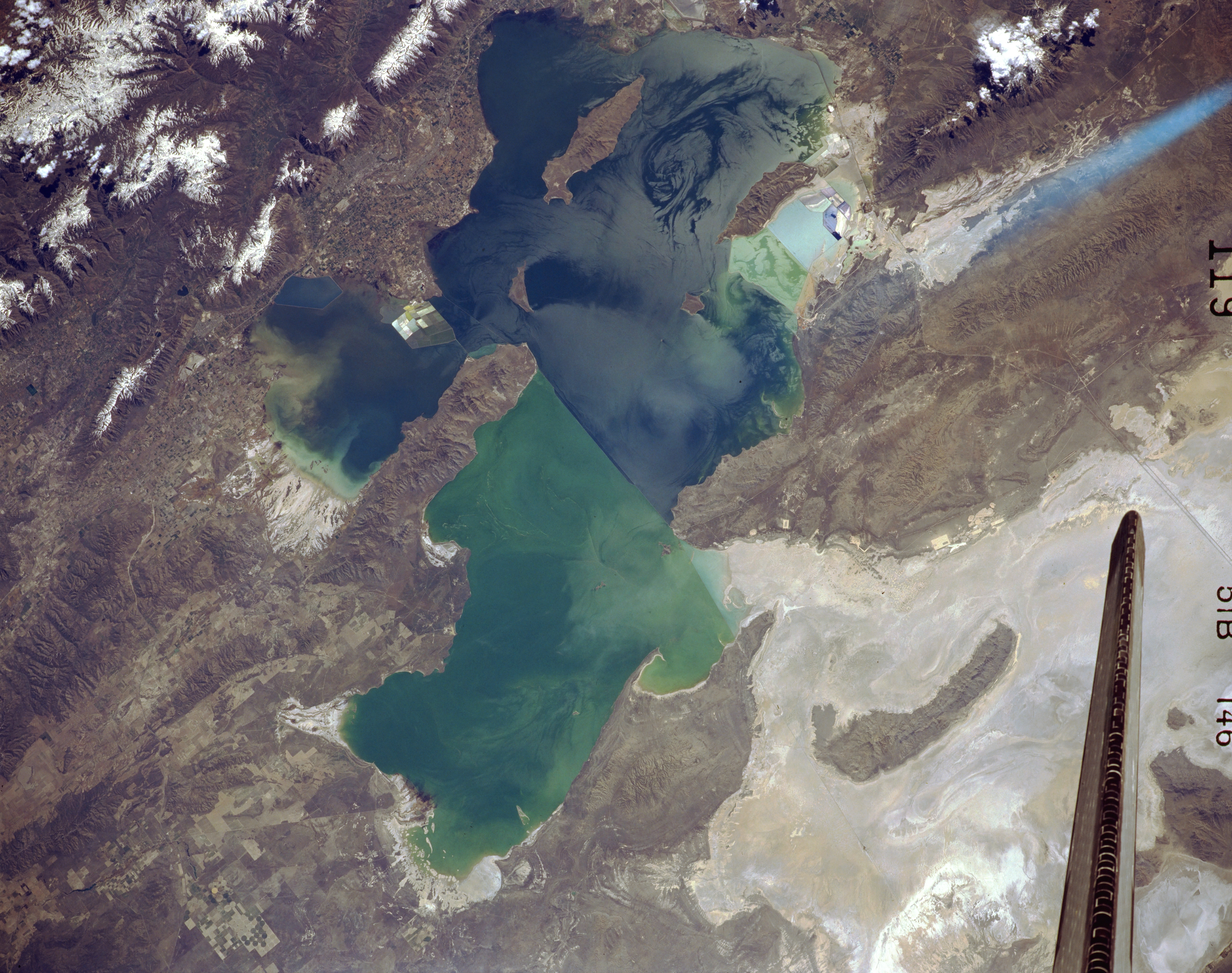
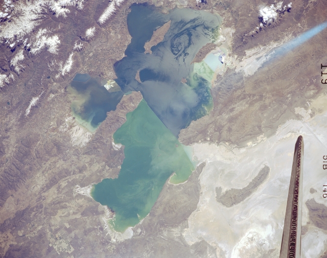
Image Caption: STS51B-146-0119 Great Salt Lake, Utah, U.S.A. May 1985
The Great Salt Lake, the largest salt lake in North America, is featured in this spectacular, south-southeast-looking, low-oblique photograph. The lake is a remnant of a much larger prehistoric lake that covered portions of present-day Idaho, Nevada, and Utah 12 000 years ago. Dependent on precipitation, the Great Salt Lake fluctuates in size seasonally and yearly. This photograph shows a water level higher than usual because of above-normal precipitation in preceding years. A railway causeway bisects the lake--the northern, greenish half with a higher concentration of salt is much shallower than the bluish southern half. Visible counterclockwise from the upper left corner are the snowcapped Wasatch Range; center-pivot irrigation fields; and the Great Salt Lake Desert, once the floor of ancient Lake Bonneville.
The Great Salt Lake, the largest salt lake in North America, is featured in this spectacular, south-southeast-looking, low-oblique photograph. The lake is a remnant of a much larger prehistoric lake that covered portions of present-day Idaho, Nevada, and Utah 12 000 years ago. Dependent on precipitation, the Great Salt Lake fluctuates in size seasonally and yearly. This photograph shows a water level higher than usual because of above-normal precipitation in preceding years. A railway causeway bisects the lake--the northern, greenish half with a higher concentration of salt is much shallower than the bluish southern half. Visible counterclockwise from the upper left corner are the snowcapped Wasatch Range; center-pivot irrigation fields; and the Great Salt Lake Desert, once the floor of ancient Lake Bonneville.
