STS51A-45-27
| NASA Photo ID | STS51A-45-27 |
| Focal Length | 250mm |
| Date taken | 1984.11.__ |
| Time taken | GMT |
Resolutions offered for this image:
4078 x 4078 pixels 639 x 639 pixels 5700 x 5900 pixels 483 x 500 pixels 640 x 480 pixels 648 x 640 pixels
4078 x 4078 pixels 639 x 639 pixels 5700 x 5900 pixels 483 x 500 pixels 640 x 480 pixels 648 x 640 pixels

Cloud masks available for this image:
Spacecraft nadir point:
Photo center point: 16.5° N, 86.5° W
Photo center point by machine learning:
Photo center point: 16.5° N, 86.5° W
Photo center point by machine learning:
Nadir to Photo Center:
Spacecraft Altitude: nautical miles (0km)
Country or Geographic Name: | HONDURAS |
Features: | ISLA DE ROATAN |
| Features Found Using Machine Learning: | |
Cloud Cover Percentage: | 10 (1-10)% |
Sun Elevation Angle: | ° |
Sun Azimuth: | ° |
Camera: | Hasselblad |
Focal Length: | 250mm |
Camera Tilt: | Low Oblique |
Format: | 6017: Kodak Ektachrome 64, 220 Roll Format |
Film Exposure: | Normal |
| Additional Information | |
| Width | Height | Annotated | Cropped | Purpose | Links |
|---|---|---|---|---|---|
| 4078 pixels | 4078 pixels | No | No | Earth From Space collection | Download Image |
| 639 pixels | 639 pixels | No | No | Earth From Space collection | Download Image |
| 5700 pixels | 5900 pixels | No | No | Download Image | |
| 483 pixels | 500 pixels | No | No | Download Image | |
| 640 pixels | 480 pixels | No | No | Download Image | |
| 648 pixels | 640 pixels | No | No | Download Image |
Download Packaged File
Download a Google Earth KML for this Image
View photo footprint information
Download a GeoTIFF for this photo
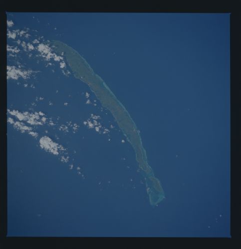
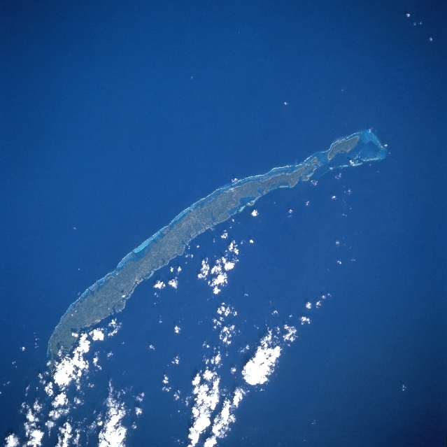
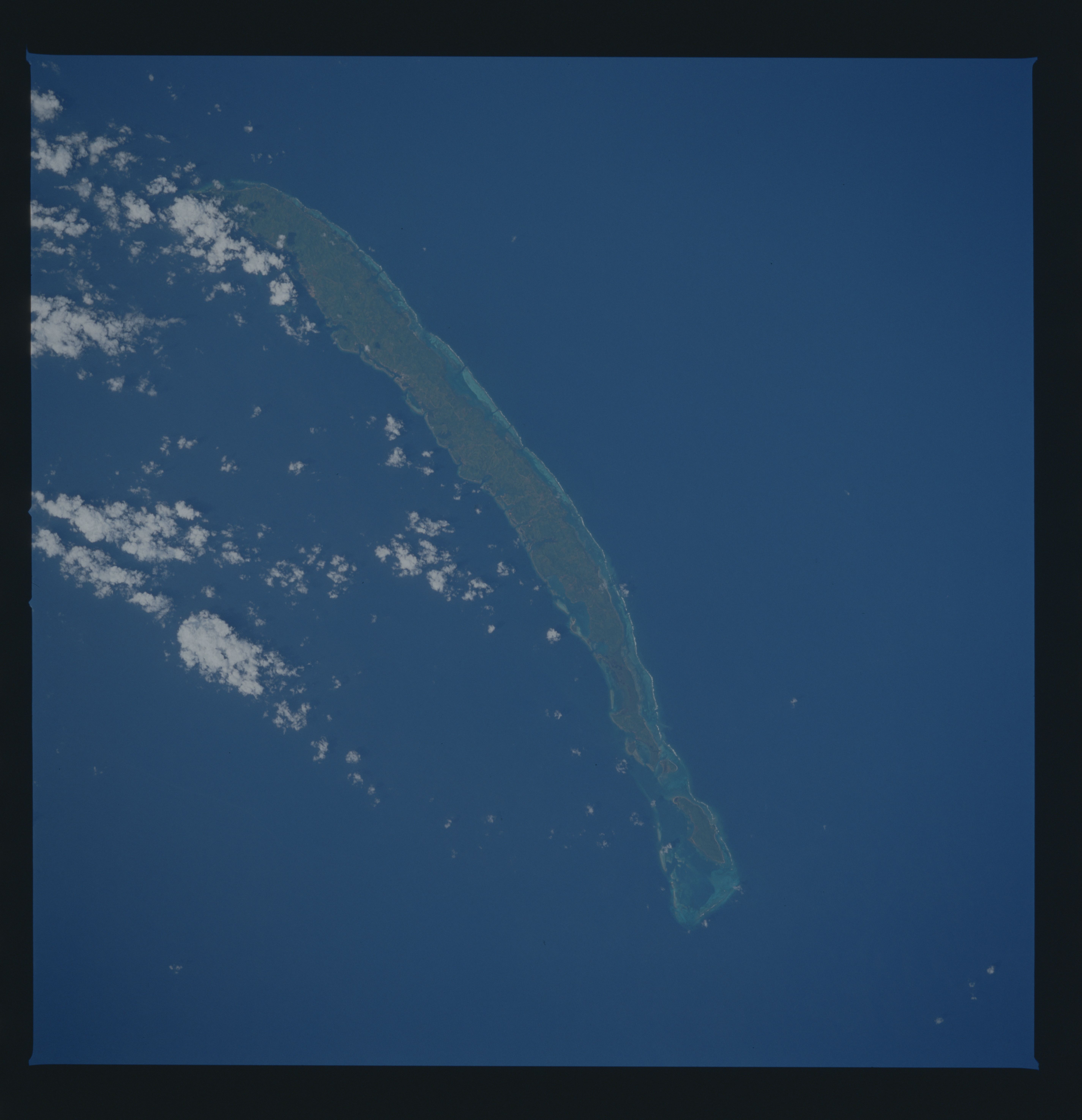
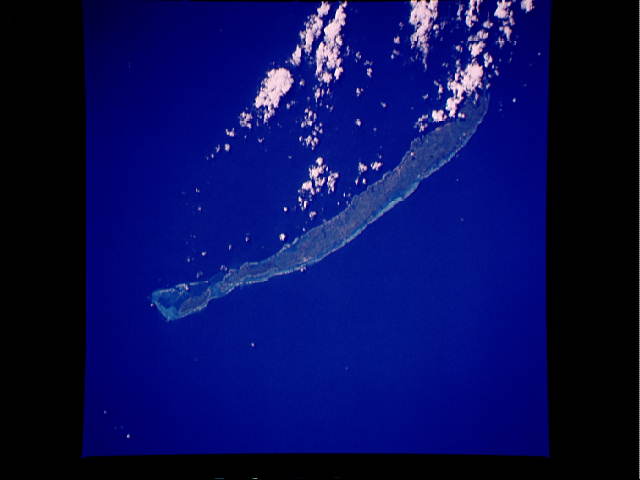
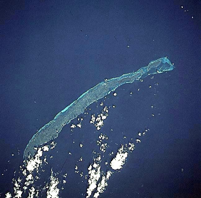
Image Caption: STS51A-45-0027 Roatan Island, Honduras November 1984
The largest of the Bay Islands, the hilly, reef-fringed island of Roatan can be seen in this north-northeast-looking view. Roatan island is 40 miles (64 km) long and less than 4 miles (6 km) wide. Roatan and the rest of the Bay Islands rests on the Bonacca Ridge about 40 miles (64 km) off the northern coast of Honduras. The ridge was formed as a result of an enormous crack along the Caribbean Sea floor. Lava from the earth's mantle welled up through the crack, forming the Caribbean Plate, which buckled and created Bonacca Ridge and the Bay Islands, including Roatan. Until the fall of 1998, Roatan was a vacation resort area known for its great diving and trophy fishing. In the fall of 1998, Hurricane Mitch, a category five hurricane with winds gusting to over 150 miles per hour (243 km per hour), struck the island. The storm stalled over the island before finally moving on to the northern Honduran mainland. The island was devastated by extremely high winds and high waves. Repairs to the devastated island are presently ongoing, and tourists are returning.
The largest of the Bay Islands, the hilly, reef-fringed island of Roatan can be seen in this north-northeast-looking view. Roatan island is 40 miles (64 km) long and less than 4 miles (6 km) wide. Roatan and the rest of the Bay Islands rests on the Bonacca Ridge about 40 miles (64 km) off the northern coast of Honduras. The ridge was formed as a result of an enormous crack along the Caribbean Sea floor. Lava from the earth's mantle welled up through the crack, forming the Caribbean Plate, which buckled and created Bonacca Ridge and the Bay Islands, including Roatan. Until the fall of 1998, Roatan was a vacation resort area known for its great diving and trophy fishing. In the fall of 1998, Hurricane Mitch, a category five hurricane with winds gusting to over 150 miles per hour (243 km per hour), struck the island. The storm stalled over the island before finally moving on to the northern Honduran mainland. The island was devastated by extremely high winds and high waves. Repairs to the devastated island are presently ongoing, and tourists are returning.
